For reasons now lost in time, the Postmaster General's Department, in its day responsible for all postal, telegraph and telephony services in Australia, constructed a trail along this spur to lay telecommunications cables, which can still be seen exposed in places. But to where? There's nothing out there but trees, rocks and the Patonga Creek estuary. So, um, did the Postmaster General just like the view and use it as his retreat?
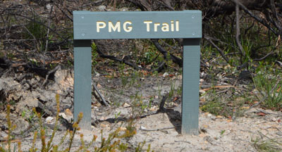
Begin your journey at the cleared area on the northern side of Patonga Drive where the Great North Walk crosses the road. Follow the GNW signs to the trackhead waypoint and go straight ahead along the signposted PMG Trail. Be prepared for a steep descent in places (and an equally steep climb on the way out), and bring plenty of water and sun protection as there's little shade along the track.
At the end of the trail, continue west over the rocky outcrop and along a cleared walking track to the end of the spur where glimpses of Patonga Creek open up. Close to GZ is a rock platform with a clear view south over the creek. From there, go down to the right onto the broad ledge below to reach the cache.
The cache is located inside Brisbane Water National Park and is hidden with permission. It can be easily accessed without disturbing the vegetation, but take care on any loose rock, particularly close to edges.
The National Parks and Wildlife Service allows only an information card, logbook, pencil and sharpener in the container, so no swag or trackables please!
Brisbane Water National Park, created in 1959, extends along the northern side of the Hawkesbury River from Mooney Mooney to Umina, encompassing 12,000 hectares of mainly open forest and woodland. Hawkesbury sandstone is a Triassic sedimentary quartzose rock laid down from Antarctic sands some 200 million years ago and uplifted to form a plateau, with deep valleys then eroded by running water. At the end of the last ice age, rising seawater flooded some of these valleys, forming saltwater estuaries such as Patonga Creek. Wind erosion has also attacked weaknesses in the rock, forming alcoves and honeycombing on exposed faces throughout the park.
The Great North Walk between Sydney and Newcastle traverses the full north-south extent of the park from Patonga to Somersby. It was established as part of the 1988 bicentenary and is maintained by the NSW Department of Industry's Crown Lands section.
Other important information about the National Park is here:
Footnote: Further research has revealed that the two old cables were the original 2 x 24-pair trunk between Sydney and Maitland, although why they chose this route rather than following the road or rail corridor across the Hawkesbury remains a mystery.
Congratulations to the barefoot seaeagles1997, the retreat's first guest.