
FRANCAIS
LA VIA DOMITIA AU FIL DES SIÈCLES
 Près d'un siècle avant César l'implantation de Rome dans le Midi méditerranéen français
s'est enracinée grâce à la première voie romaine construite hors d'Italie. Cet axe, parcourant
le Val de Durance devient au Moyen Âge un boulevard d'édifices romans, avec les cathédrales de
six diocèses: Embrun, Gap, Sisteron-Forcalquier, Apt, Cavaillon et enfin Arles. S'y ajoutent
des monastères et prieurés importants, tels Boscodon, Ganagobie, Salagon, Montmajour.
Cet itinéraire a permis une double pérégrination, Italiens et Provencaux cheminant vers
Compostelle, mais aussi Espagnols, Languedociens et Provencaux allant à Rome, diversité
d'origines et de destinations.
Le couloir durancien joua aussi un rôle stratégique en fonction de la fluctuation des
frontières, fortifications de Sisteron, Mont-Dauphin et Briançon.
L'itinéraire décrit içi est fidèle à la publication de la fédération française de randonnée,
il s'agit d'un chemin du XXIème siècle, il est donc un compromis entre un chemin "Jacquaire"
et "Romieu" historique.
Depuis décembre 1998, les chemins de Saint Jacques de Compostelle en France sont inscrits
au patrimoine mondial de l'UNESCO. Cette reconnaissance a pu être obtenue grace aux efforts
de l'État, la Fédération francaise de randonnée pédestre et la société française des Amis
de de Saint-Jacques-de-Compostelle.
LA SÉRIE
Je poursuis à partir d'ici la série des chemins de Saint Jacques de Compostelle débuté
il a maintenant plusieurs années. Elle suit une partie du tracé exact du chemin sur le
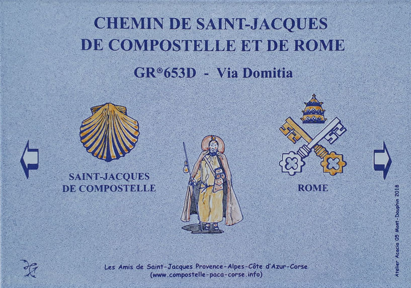
sentier de grande randonnée GR653D empruntant la Via Domitia reliant la frontière Italienne
à la voie d'Arles.
Sur cette partie elle vous permettra de traverser le centre historique de Gap en passant par
les lieux les plus représentatifs de la ville.
Compte tenu du trajet de la série beaucoup de caches se trouvent en ville et donc en des
lieux très fréquentés, soyez discret et remettez bien les caches telle que vous les avez
trouvées. Autant que possible j'ai essayé de les écarter quelques peu des coins les plus
exposés.
Pensez à prendre un stylo la plupart des caches n'en possédant pas.
LA CACHE
Poursuivez en suivant le marquage rouge et blanc en direction de Pic Ponson.
Faites attention il n'y a pas de place de stationnement.
ENGLISH
THE VIA DOMITIA THROUGHOUT THE CENTURIES
Nearly a century before Caesar the establishment of Rome in the Mediterranean
French Midi took root thanks to the first Roman road built outside Italy.
This axis, traversing the Val de Durance becomes in the Middle Ages a boulevard
of Romanesque buildings, with the cathedrals of six dioceses: Embrun, Gap,
Sisteron-Forcalquier, Apt, Cavaillon and finally Arles.
To this are added important monasteries and priory such as Boscodon, Ganagobie,
Salagon, Montmajour.
This route has allowed a double pilgrimage, Italians and Provencals moving towards
Compostela, but also Spanish, Languedoc and Provencal going to Rome, diversity of
origins and destinations.
The durancial corridor also played a strategic role according to the fluctuation of
borders, fortifications of Sisteron, Mont-Dauphin and Briançon.
The route described here is faithful to the publication of the French Federation of
hiking, it is a path of the XXI century, so it is a compromise between a path "Jacquaire"
and "Romieu" history.
Since December 1998, the roads of Saint Jacques de Compostela in France are listed as
UNESCO World Heritage.
This recognition was obtained thanks to the efforts of the State, the French Hiking
Federation and the French Society of the Friends of Saint-Jacques-de-Compostelle.
SERIES
I continue from here the series of paths of Saint Jacques de Compostela started now
several years ago. It follows part of the exact route of the path on the GR653D
long-distance footpath along the Via Domitia linking the Italian border to the Arles way.
To stay on the track follow the red and white markings.
On this part it will allow you to cross the historic center of Gap through the most
representative places of the city.
Given the route of the series many caches are in town and therefore in busy places, be
discreet and put the caches well as you found them. As much as possible I tried to remove
some of the most exposed corners.
Remember to take a pen most caches do not have.
THE HIDING-PLACE
Continue following the red and white markings towards Pic Ponson.
Be careful there is no parking space.