|
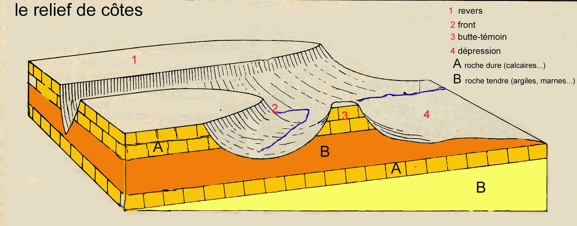
An outlier is an area of younger rock surrounded by older rocks. It can be an isolated hill formed by the erosion of sedimentary layers protected by a harder layer at the top of the hill. In a cuesta zone, the outlier is isolated from the plateau of the same geological origin. In French they are called "buttes-temoins", witness-buttes, as they provide evidence of past geological layers in the area.
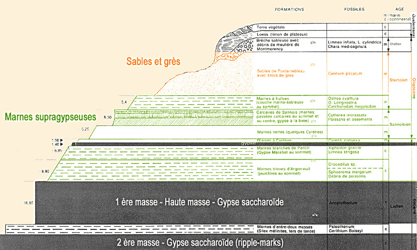
The Paris Basin began its formation with sedimentary deposits until the Cretaceous with marine episodes leading to the formation of limestone rocks. In the Paleocene, folds were created under the influence of the formation of the Alps. During the Eocene, seas invaded several times the area, with deposits creating layers of limestone, clay, sand and gypsum. During the Oligocene, the upper layers were formed, notably oyster marls, Fontainebleau sands and sandstones and Montmorency millstones during the Rupelian or Stampian (from 33.9 Million years to 28.1 Million years), corresponding to the platform of Beauce south-west of Paris. These layers now remain at the top of the outliers around Paris, in Parisis in particular, which are therefore called Stampian hills.
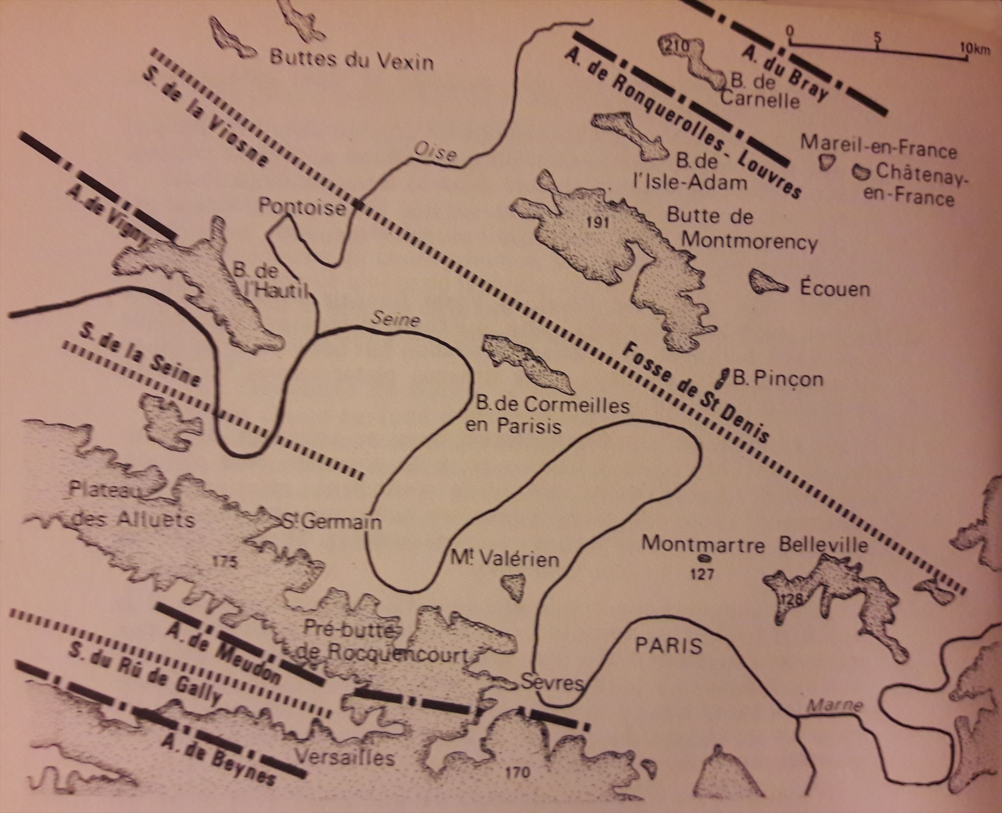
These isolated outliers are still sometimes covered by forests but were also used for their strategic interest (fortifications of Mont Valérien, castle at Ecouen), symbolic interest (basilic of Montmartre) or economic interest with the frequent gypsum quarries to produce the high quality Paris plaster Plaster (Buttes-Chaumont on the Belleville hill, Montmartre, Cormeilles-en-Parisis, Hautil). They generally have an Armorican orientation (north-west / south-east) as the ridge that extends to the southwest on the wooded heights of Rocquencourt, Marly and Saint-Germain-en-Laye that could create some isolated outlier in a far future.
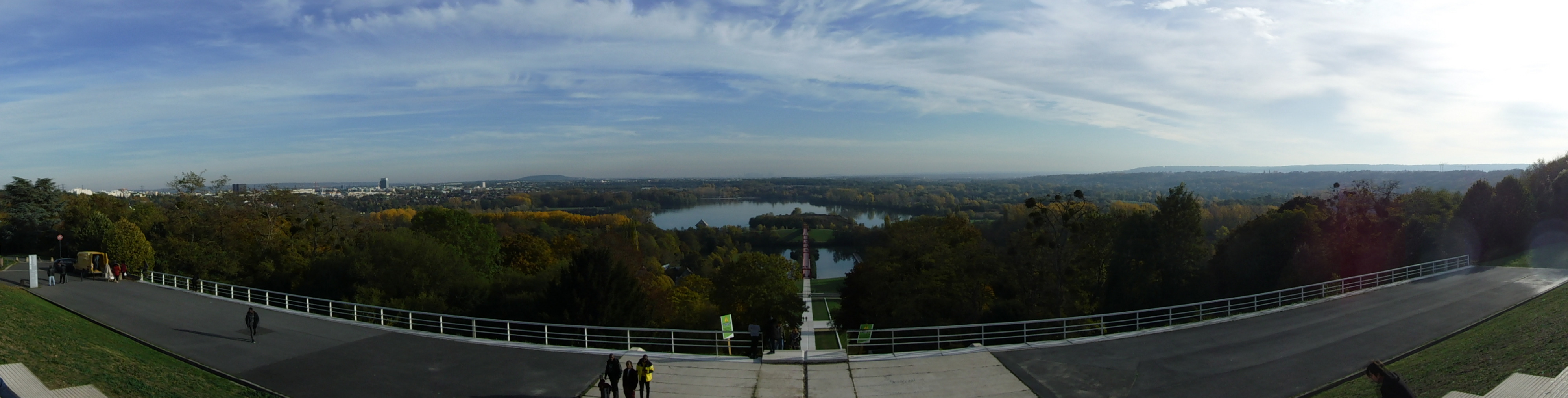
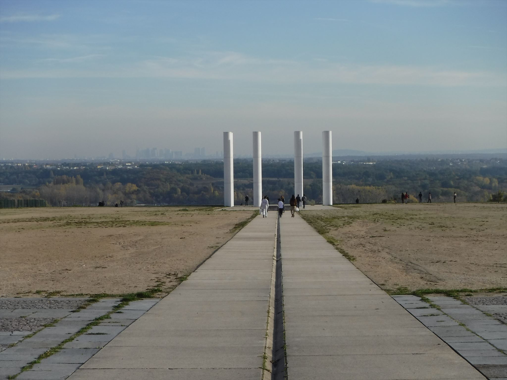
The location of the cache is located on the edge of the French Vexin plateau: the panorama allows you to discover the loops of the river Oise in the foreground and those of the river Seine in the background and of course some isolated outliers on the horizon as well as the artificial skyline of the district of La Défense. Located in the once "new city" of Cergy-Pontoise, this perspective has also been highlighted by the Axe Majeur, an urban artistitic project that extends over several kilometers and includes 12 stations, the location of the cache being the Esplanade of Paris, the third station, which ends in twelve white columns.
Validation of the earthcache
To validate this cache, observe this fine landscape and answer the following questions :
- Depending on weather conditions and local visibility, indicate which isolated outliers are visible from right (south) to left (north).
- Give the name of the isolated outlier aligned with the rightmost column (146 degrees azimuth).
- According to you, what is the main erosion factor involved in the formation of these isolated hills?
- At your feet is a semicircular pavement from the Louvre. Describe the appearance of the stones. What kind of rock do you think this is?
- At which level of the isolated outliers can this type of rock be found (base, middle, summit) be found? Why?
Please log this earthcache as "Found it" and send your answers by mail (user profile or message center). You will be contacted in case of problems.
As a bonus, any picture of your geocaching experience will be very much appreciated. Thank you for your interest in this earthcache!
|