Baía dos GOLFINHoS!
Este Geocache compõe a Geoarte Baía dos GOLFINHoS! Representada por 120 pontos no mapa de SC numa parceria entre GDFernandes e R&BSerras. Este projeto representa o que o Geocaching nos proporciona, muito além do desafio da busca do container em si… permite viagens a lugares novos, descobertas de cenários espetaculares e surgimento de novas amizades…
This Geocache makes up the Geoarte Bay of Dolphins! Represented by 120 points on the map of SC in a partnership between GDFernandes and R & BSerras. This project represents what Geocaching gives us, far beyond the challenge of finding the container itself ... allows trips to new places, discoveries of spectacular scenery and the emergence of new friends ...

|
|
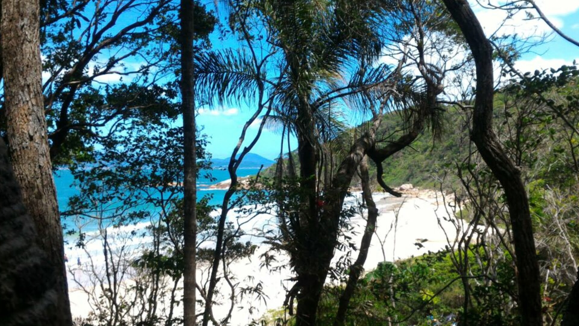
Divirta-se ao navegar pelos caminhos desta GeoArte tal qual GOLFINHoS! se exibindo entre um mergulho e outro nas buscas por Florianópolis e Governador Celso Ramos!
Have fun while navigating the paths of this Geoarte just like dolphins exhibiting between a dive and another in the searches for Florianópolis and Governador Celso Ramos!
Conte-nos se avistar GOLFINHoS! 
|
O geocache NÃO está nas coordenadas listadas!
|
|
.
IMPORTANTE:
Quase lá! Almost there! - D2.5/T2.5 Pequeno -
Waypoint (estacionamento/ parking) - S 27 20.946 w 48 32.647
Waypoint (entrada trilha inicial, caminho do meio/ trailhead, middle way) - S 27 20.955 w 48 32.506
Waypoint (Quase lá! Almost there!) - s 27 21.004 w 48 32.128
O acesso à trilha (e portanto ao cache) só é possível caminhando...
Você pode estacionar no recuo da rodovia ou ir até o estacionamento (pago) mais adiante.
Comece sua breve caminhada subindo a partir do waypoint ESTACIONAMENTO até a trifurcação no topo do morro.
Escolha o caminho do meio (ENTRADA DA TRILHA) seguindo em direção à descida.
Este geocache está bem próximo à praia. Mas antes de chegar na areia, vire à esquerda!
Após uns 35 metros, no começo da curva, saia da trilha à esquerda (por 5 metros) em direção à geozone.
Pequeno cache com espaço apenas para logbook, portanto traga sua caneta.
CUIDADO COM MUGGLES.
POR FAVOR AJUDE A MANTER ESTE ESPAÇO LIMPO.
CUIDADO PARA NÃO PERDER A CAMUFLAGEM.
FECHE BEM PARA MANTER A VEDAÇÃO.
DEVOLVA DA MESMA MANEIRA.
SEJA DISCRETO.
The access to the trail (and so to the cache) is only possible walking...
You may park on the highway retreat or go to the parking lot (payed) a few meters away.
Start your short walk, going up from the PARKING waypoint until the trifurcation up on the hill.
Choose the correct way, the middle one (TRAILHEAD) heading toward to the middle track and downhill.
This geocache is very close to the beach. But before you reach the white sand, turn to the left. .
About 35 meters ahead, in the beginning of the curve go out the trail to the left heading to the geozone.
It´s a small cache with space only for logbook.
Bring your pen.
BEWARE WITH MUGGLES.
BE CAREFUL, DON´T LET IT FALL WHEN RETURNING IT TO SPOT.
PLEASE HELP KEEPING THIS AREA CLEAN.
Aproveite para conhecer a belíssima Praia do Sissial e procurar este geocache nesta região da cidade de Governador Celso Ramos.
Conte-nos se avistar GOLFINHoS!
OH O!.SoN Fo LO.GOI