The aim is to look at the sandstones to the north of Pease Bay and to understand the environment in which they were deposited.
This site is a Scottish Natural Heritage SSSI. Please do not damage the rocks in any way. There is free public access to the beach and rocks at all times. Permission has been granted by the owners of the holiday park for use of the car park.
You will need to visit at low tide In order to view the rocks and walk around the headland safely (Pease Bay weather and tides)
From the car park, walk through the holiday park to the beach. Once on the beach, turn left and walk north-west towards the headland
Background: These rocks are Devonian sedimentary sandstones deposited by rivers about 360 million years ago on a continent which lay in arid latitudes between 15º - 20º south of the equator. Although they were originally deposited horizontally, Earth movements have subsequently tilted them towards the east.
Question 1: estimate the degree of dip or tilt (the angle from the horizontal) towards the east.
Look closely at these rocks. You will see that they are red in colour and made of sand grains. The red colour comes from iron which was washed through the spaces between the sand grains and was deposited. Some of the grains are sand size but some are smaller. All these rocks were deposited by rivers in various stages of flow.
N55º 55.939 W002º 20.155 Here you can see cross-bedding
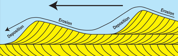
Questions 2. In what direction do you think the current was flowing here? Was it right to left or left to right?
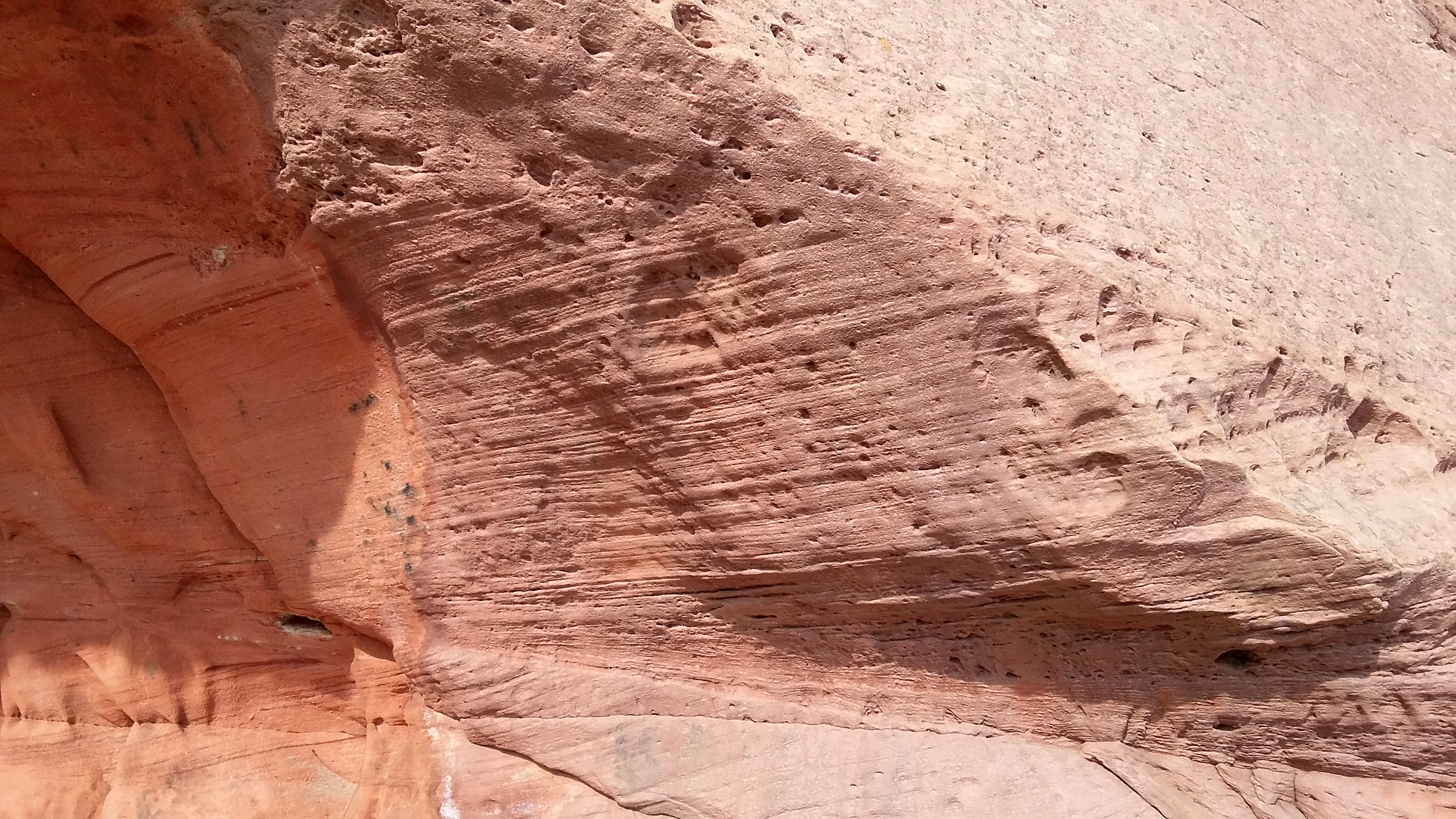
N55º 55.949 W002º 20.149 You will also notice an area of striped, red and white rocks. The grains in the rocks here are smaller indicating that there was little current in the water; they may represent shallow temporary lake conditions. The white stripes may be caused by microbial action in the temporary lakes. There are circular white spots in the rocks too which also may indicate microbial action. The conditions lasted for a long time and were constantly repeated as there are a lot of 'stripes'.
Questions 3: estimate the average thickness of the stripes
Now walk around the headland to N55º 56.087 W002º 20.248.
Here you can see many blocks of knobbly red sandstone. If you look at the cliff face you can see the origins of these blocks in a layer. This layer represents an ancient soil surface. You could have walked on this about 360 million years ago! In the very arid, conditions, there was strong evaporation which drew calcium carbonate to the surface where it was deposited to form these hard bands, known as calcrete.
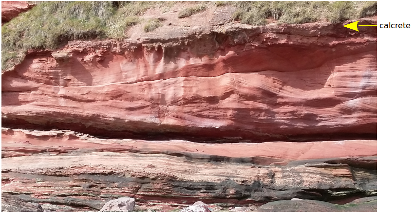
Question 4: where in the world would you go to see modern calcrete?
You may be wondering about the black boulders visible on the beach e,g, at N55º 56.086 W002º 20.250 They are made of fine-grained igneous rock and have been eroded from nearby early Devonian intrusions of magma.
Questions 5: estimate the average size of these boulders
Please email your answers to me, JurassicEdie or send them through the Message Centre