Pays de La Châtaigneraie Traditional Geocache
-
Difficulty:
-

-
Terrain:
-

Size:  (micro)
Please note Use of geocaching.com services is subject to the terms and conditions
in our disclaimer.
LE TERRITOIRE EN QUELQUES CHIFFRES Etablissement public de coopération intercommunale rassemblant 16 071 habitants des 18 communes du Pays de La Châtaigneraie, la Communauté de Communes du Pays de La Châtaigneraie assure les missions d'intérêt général que lui ont confiées les communes pour le service de la population de son territoire.
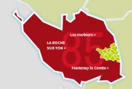
FICHE D’IDENTITÉ : Situation générale : Est Vendée Superficie : 336.68 km² Les 18 Communes membres : Communes Population totale (hab.)
Extrapolée en 2016 (Source INSEE) Superficie en m² (HA.)
ANTIGNY 1077 2217
BAZOGES EN PAREDS 1195 3383
BREUIL BARRET 674 1494
CEZAIS 315 1222
LA CHAPELLE AUX LYS 256 1056
LA CHATAIGNERAIE 2662 794
CHEFFOIS 1001 1863
LOGE FOUGEREUSE 378 1037
MARILLET 112 425
MENOMBLET 641 2095
MOUILLERON SAINT GERMAIN 1907 2805
SAINT HILAIRE DE VOUST 662 1890
SAINT MAURICE DES NOUES 685 2142
SAINT MAURICE LE GIRARD 616 1142
SAINT PIERRE DU CHEMIN 1377 2965
SAINT SULPICE EN PAREDS 426 1333
LA TARDIERE 1338 2048
THOUARSAIS BOUILDROUX 749 1737
TOTAL 16 071 31 648
Population : 15673 habitants (population légale) soit 50hab/km²
Chef-lieu du Canton : La Châtaigneraie

Additional Hints
(Decrypt)
Cnezvf yrf nhgerf onzobhf bhierm ovra yrf lrhk znvf ar pnffre evra.