[Chinese]在地球史上侏罗纪末到古近纪初的这段时间,在中国区域范围内发生了广泛的地壳运动,被称为燕山造山运动。这期间地壳因为受到强有力的挤压,褶皱隆起,成为绵亘的花岗岩山脉。
花岗岩的语源是拉丁文的granum,它是岩浆岩的一种,是地球深部的岩浆在上升过程中,未来得及抵达地表就冷却凝固而形成的岩石。在冷却过程中,岩石发生收缩,内部发育出节理,这些节理就是山峰雄奇的秘密。
花岗岩非常坚硬,不易风化和溶解,因此不可能形成溶洞。但雨水沿花岗岩体内断裂带冲刷,会加剧岩石表面比较脆弱地方的侵蚀 。
密云地区的山脉经历了漫长的地质历史,在形成于1.9亿至0.8亿年前的碳酸盐岩层面上,有各种各样复杂的地质标志:在燕山运动的不同阶段形成的各种岩层,大型的山前断裂,几乎垂直的断层,巨大的圆顶山,以及燕山造山运动所特有形成的背斜和单斜构造。而密集的断层和节理,又把岩石切割成许多块。
在北京的密云地区,由于燕山造山运动而形成的地质景观、美丽如画的自然风光以及良好的生态环境比比皆是。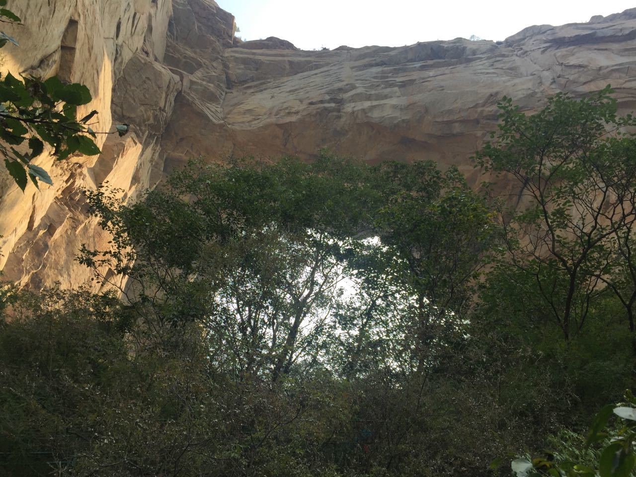
天门洞位于密云天门山景区东山顶部海拔660米的位置,南北向贯通。天门山景区的山峰都是以花岗岩为主,但是花岗岩是一种不会被水侵蚀的岩石,因此它并不会像石灰岩地区那样形成喀斯特地貌。那么,天门洞是怎么在花岗岩地区形成的呢?
我们从不同的方面来探寻这个形成过程。
首先,受北京地区燕山造山运动的影响,密云地区的花岗岩被抬升到地表后,受到阳光、风、雨、动物、植物等外力的侵蚀。北京地处暖温带半湿润季风气候,冬季寒冷干旱,夏季炎热多雨,日温差和年温差大,因而风化强烈,花岗岩容易形成崩塌。
其次,据地质学家研究证明,自1亿2千万年前,由燕山造山运动引起的地壳隆起强度和幅度较大,致使山峰的各种构造层、亚构造层剥蚀殆尽,而后期又经历了长期的不断上隆和新构造层的叠加,造成了山峰岩石的松动。岩石节理持续发育,在流水和风的作用下,节理裂隙不断扩大,岩石发生崩塌,而顶部岩石相对稳定,保留下来,逐渐形成洞穴。洞穴慢慢扩大加深,终于贯通,形成了非常少见的“天门洞”景观。
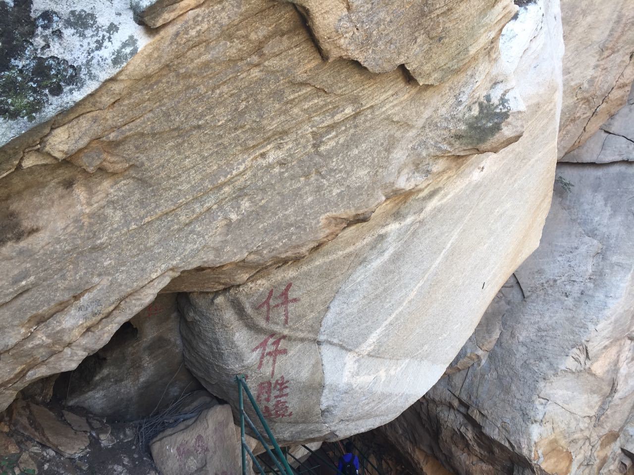
站在天门洞内,仔细观察两侧和顶部的岩石,会发现有一些岩石的节理裂隙发育的非常明显,就像要马上崩塌一样。但是,近几十年来,并没有发生过岩石崩塌现象。你还可以看见,因为形成过程中混入了不同的矿物质,某些花岗岩石块会呈现出不同的颜色。
每天清晨阳光从天门射出,一年四季位置不同,形成壮观的“日出天门”景观;月圆的前后2天,月亮仿佛一面银镜悬挂于天门中间,称为之“天门悬月”,此两奇特景象全国罕见。
路线:
公交路线:东直门(980、987)—密云鼓楼站下车,转乘去石城方向的汽车到一瀑牌楼往里500米天门山风景区
自驾车:三元桥沿京顺路—京密路—密云水库方向西行——一瀑牌楼往里500米天门山风景区。
你的任务:
为了登记这个地理宝藏,你必须要进入景区并且进行一段爬山路程,但并不困难。进入景区的门票是30元人民币。你可以先log,然后将以下几个问题的答案发到我的邮箱里,以确保您的log是真实有效的。如果在两个星期内没有收到你的邮件,我将会删除您的log。
1.估算一下,天门洞的高度和宽度;
2.根据天门洞内两侧和顶部岩石的节理来分析,你认为需要多长时间天门洞会全部坍塌?
3.你认为这块岩石为什么会出现两种颜色?
[English]In the history of the earth, from the end of Jurassic to the Paleogene, a wide range of crustal movement occurred in China, known as the Yanshan movement. Because the earth's crust during strong extrusion, fold uplift of the granite to become mountains。
Granite etymology is the Latin ‘granum’, it is a kind of magmatite, deep earth magma during ascent, and the future is reaching the surface of the cooling and the formation of rocks. In the cooling process, the occurrence of rock contraction, internal development of joints, these joints is the secret of magnificent mountain.
Granite is very hard and difficult to weathering and dissolve, so it is impossible to form karst caves. But the erosion of the rainwater along the fracture zone of granite will aggravate the erosion of the relatively weak surface of the rock.
Miyun mountains experienced a long geological history, formed in 190 million to 80 million years ago in the carbonate level, there are a variety of complex geological mark: various rocks formed in different stage of the Yanshan movement, the piedmont fault of the large, nearly vertical fault, huge dome mountain, and Yanshan movement the unique formation of anticline and monocline. And dense faults and joints cut rocks into chunks.
In Miyun area, as a result of the formation of the Yanshan mountain building geological landscape everywhere。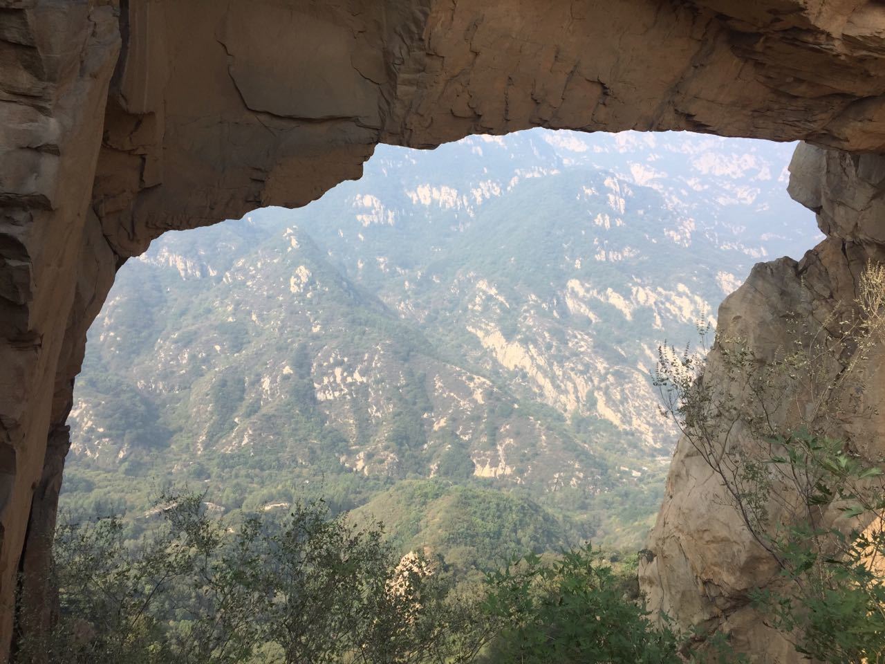
Tianmen cave is located at the top of Dongshan mountain in Miyun Tianmenshan, 660 meters above sea level. The peaks of the Tianmenshan scenic area are dominated by granite, but granite is a rock that is not eroded by water, so it does not form the Karst landform as the limestone region. So, how did the Tianmen cave come into being in the granite area?
We explore this process in different ways.
First,Influenced by the Yanshan movement in Beijing area, the granite in Miyun area was uplifted to the earth's surface and eroded by external forces such as sunlight, wind, rain, animals and plants. Beijing is located in the warm temperate semi humid monsoon climate. It is cold and dry in winter, hot and rainy in summer, large in daily temperature difference and annual temperature difference. Therefore, granite is prone to collapse because of strong weathering.
Second,according to geologists, since 120 million years ago, caused by the Yanshan movement of crustal uplift and strength greatly, resulting in a variety of structural layers, the peaks of the sub tectonic layer eroded, and later experienced a long-term continuous uplift and new tectonic layer superposition caused mountain rock loose. Rock joints develop continuously. Under the action of flowing water and wind, the joints and fissures expand constantly, rock collapses, while the top rocks are relatively stable and retain, and gradually form caves. Caves gradually expand, deepen, and finally through, forming a very rare "Tianmen cave" landscape.
Standing in the cave of Tianmen, carefully observing the rocks on both sides and top, it will be found that some rock joints and fissures developed very clearly, just like to collapse immediately. However, there has been no rock collapse in recent decades. As you can see, some of the granite stones come in different colors because of the different minerals that are formed during the process.
Every morning the sun from Tianmen injection, the seasons of the year in different locations, forming a spectacular "sunrise Tianmen" landscape; 2 days before and after the full moon, the moon like a silver mirror hanging in Tianmen cave, known as the "Tianmen month suspension", the two national rare spectacle.
Route:
Bus routes: Dongzhimen (980, 987) - Miyun Gulou station, ride to the direction of the car to a rock arch to 500 meters waterfall in Tianmenshan Scenic Area
By car: Sanyuanqiao Jingshunlu along - Beijing Road - Miyun reservoir to the westbound direction -- a waterfall 500 meters inside the archway Tianmenshan scenic area.
Your task:
In order to register this geographical treasure, you have to go into the scenic spot and go on a mountain trip, but it's not difficult. There is an entrance fee of around $30 CNY to access this cache. You can first log, and then send the answers to the following questions to my mailbox, to ensure your log is true and effective. If you don't receive your email within two weeks, I'll delete your log.
1. Estimate the height and width of Tianmen cave?
2. According to the joint analysis of the rock on both sides and top of Tianmen cave, how long do you think the Tianmen cave will collapse?
3. Why do you think there are two colors in this rock?