Hvannadalshnúkur - fire and ice EarthCache
Hvannadalshnúkur - fire and ice
-
Difficulty:
-

-
Terrain:
-

Size:  (other)
Please note Use of geocaching.com services is subject to the terms and conditions
in our disclaimer.
Attention: this is a very long climb on a demanding mountain. Please only climb it if you have the experience or a professional guide, the required equipment for climbing a glacier and enough fitness to do so! You should also have good weather conditions. The tour involves 2000 meters of height on one day, half of it along glacier!
If you feel ready to climb, you will be rewarded with marvellous views!
Hvannadalshnúkur
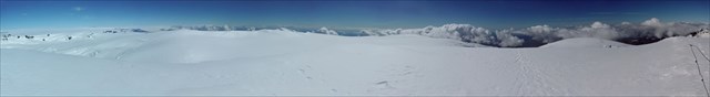
Endless glaciers
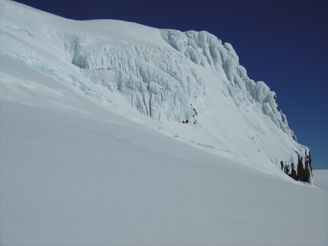
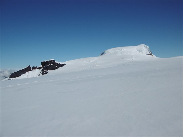
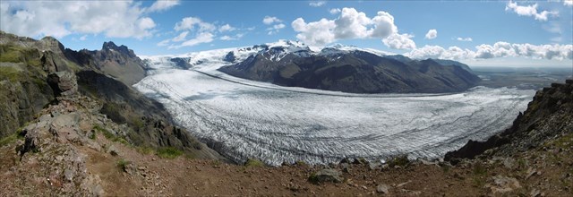
Hvannadalshnúkur is the highes peak in Iceland. It belongs to the glacier called Öræfajökull which itself is part of Vatnajökull. Although it is only 2110m high, the terrain is similar to the Alpine peaks of 4000m and more. It is not possible to find such a huge area of glacier (14 km²) somewhere else in Europe. The summit is a very special place because you have a good view over the endless fields of ice. Be prepared for some marvellous views!
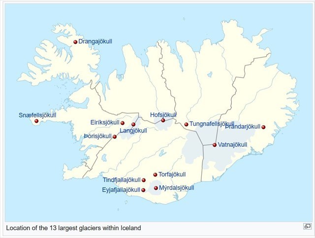
The following map from Wikipedia displays Iceland's main glaciers:
Hot inside
Öræfajökull is not only a glacier but also a volcano. It's an interesting mixture of fire and ice, which is typical here in Iceland. It is the largest active volcano in the country with 285 km³. Hvannadalshnúkur lies on the summit crater's north-western rim. A caldera with 5km in length and 550m deep, all covered by ice ...
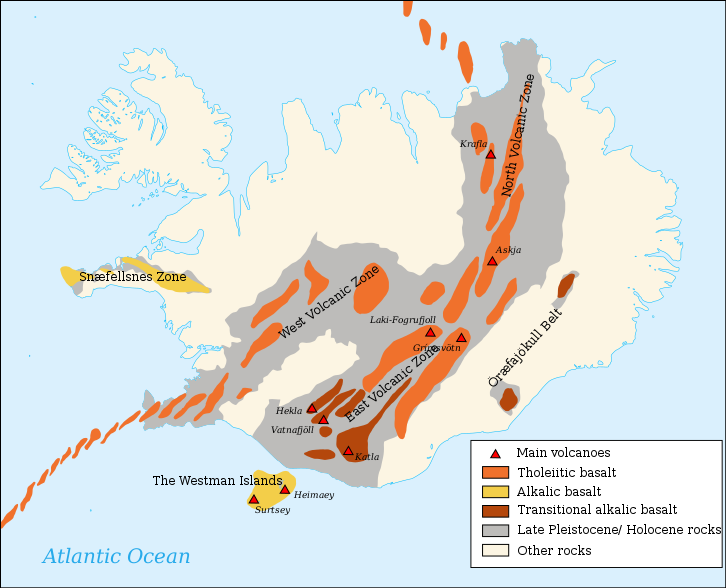
The following map from Wikipedia shows the active volcanoes in Iceland:
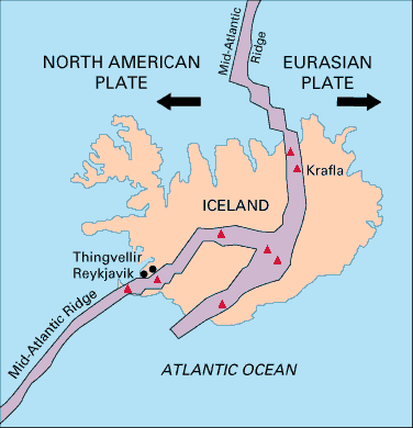
This map from Wikipedia shows the Mid-Atlantic Ridge:
Fire and ice
"A subglacial volcano, also known as a glaciovolcano, is a volcanic form produced by subglacial eruptions or eruptions beneath the surface of a glacier or ice sheet which is then melted into a lake by the rising lava. Today they are most common in Iceland and Antarctica.
During the eruption, the heat of the lava from the subglacial volcano melts the overlying ice. The water quickly cools the lava, resulting in pillow lava shapes similar to those of underwater volcanoes. When the pillow lavas break off and roll down the volcano slopes, pillow breccia, tuff breccia, and hyaloclastite form. The meltwater may be released from below the ice as happened in Iceland in 1996 when the Grímsvötn caldera erupted, melting 3 km3 of ice and giving rise to a large glacial lake outburst flood.
The shape of subglacial volcanoes tends to be quite characteristic and unusual, with a flattened top and steep sides supported against collapse by the pressure of the surrounding ice and meltwater. If the volcano eventually melts completely through the ice layer, then horizontal lava flows are deposited, and the top of the volcano assumes a nearly level form. However, if significant amounts of lava are later erupted subaerially, then the volcano may assume a more conventional shape." (Source: Wikipedia)
To log this earthcache
you have to send me the answers to the following questions:
1. Look at the maps above. Do you see a correlation between volcanos, glaciers and the Mid-Atlantic Ridge? Also explain with your own words the reason for your observation.
2. Depending on your route, what was the height when you left the rocks and entered the glacier? Please also add the coordinates where you reached the glacier. Would you find a glacier at that height somewhere else in Europe / in the world? Why / why not?
3. How many crevices did you pass on your way to the summit? In which direction did they go? What do you think could be the reason for it (hint: think of the hot stuff described above)?
4. On the plateau below the summit you can see a lot of crevices (you probably won't pass them but walk all around them). They have a specific form. What do they look like? Describe the form and how you think it correlates with the direction of the lava flow.
5. Based on the description above, describe the shape of the volcano that you can observe from the header coordinates.
6. Optional: I would be happy if you can add some nice pictures of your trip!
Have a great and safe climb! :)
Additional Hints
(No hints available.)