THOS - Jättabergets hemlighet Traditional Geocache
THOS - Jättabergets hemlighet
-
Difficulty:
-

-
Terrain:
-

Size:  (large)
Please note Use of geocaching.com services is subject to the terms and conditions
in our disclaimer.
THOS - The Heart Of Sweden

THOS - Jättabergets hemlighet
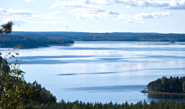
Skåle ligger vid Tisarens östra spets, ett säreget natur- och kulturlandskap, med lämningar efter bl a gruvverksamhet och en fornborg.
Skåle är den enda platsen i Hallsbergs kommun där man säkerligen vet att bergsbruk har bedrivits ända sedan medeltiden. En hytta har funnits på platsen, Skålehyttan (Skordohytto enligt uppgift från år 1507). Kanske var denna hytta en föregångare till Skogaholms bruk. Hyttan vid Skåle finns dock inte med på 1600- talets kartmaterial, utan lades sannolikt ned redan på 1500-talet. Gruvan tillhörde Skogaholms bruk och malmen togs till masugnen i Östra Å. Nya gruvhål upptogs i Skåle under 1700-talet. I sänkan nedanför Skåleklint har ett småskaligt jordbruk bedrivits. En gård i Skåle (Skårte) upptas i jordeboken år 1554. På 1800-talets kartor finns även ett torp, Skålestugan. Jordbruket vid Skåle gård pågick fram till 1960-talet.
1979 bildades naturreservatet Skåle med syftet att bevara områdets naturvärden och odlingslandskap, samt öka områdets tillgänglighet för allmänheten. Kring sänkan reser sig väldiga bergshöjder. Skåleklint i nordost är det högsta berget, ca 195 meter över havet. Jättaberget i sydväst ligger på en höjd av ca 165 meter över havet. På Jättaberget ligger resterna av en fornborg, troligen uppförd någon gång under yngre järnålder. I själva borgen finns idag en timrad jaktstuga från 1931, uppförd av en godsägare i Skyllberg. Nedanför fornborgen kan man finna Jättaporten, där det sägs att Jätten Skalle bodde och detta var hans ingång.

THOS - The Mystery of The Giant’s Hill
Skåle is located at the eastern tip of Tisaren, a special natural and cultural landscape, with remains of for example mining activities and an ancient castle.
Skåle is the only place in the municipality of Hallsberg, where you certainly know that mountain farming has been carried out since the Middle Ages. A foundry has been found on the site, Skålehyttan (Skordohytto, as reported from year 1507). Perhaps this cabin was a precursor to Skogaholm's factory. The foundry at Skåle is not included in the 16th century map material, but is likely to be builded in the 16th century. The mine belonged to Skogaholm's factory and the ore was taken to the blast furnace in East Å. New mining holes were occupied in Skåle during the 1700s. Small-scale farming has been carried out in the lower part of Skåleklint. A farm in Skåle (Skårte) is recorded in the soil book in 1554. In the 19th century maps there is also a cottage, Skålestugan. Farming at Skåle farm continued until the 1960s.
In 1979 the Skåle Nature Reserve was formed with the aim of preserving the area's natural values and cultivation landscapes, as well as increasing the accessibility of the area to the public. Around the valley there are vast mountain heights. Skåleklint, in the northeast, is the highest mountain, about 195 meters above sea level. “Jättaberget” (“The Giant’s hill”) in the southwest is at an altitude of about 165 meters above sea level. On The Giant’s hill, in the western part of the area, there are remains of an ancient castle, probably built sometime during the younger Iron Age. In the castle there is today a timbered hunting lodge from 1931, built by a landowner in Skyllberg. Below the ancient castle you can find The Giant’s Gate, where it is said that the giant “Skull” lived and this was his entrance.

Additional Hints
(No hints available.)