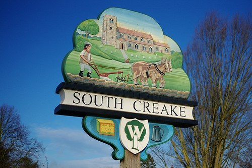
South Creake is a village in Norfolk, tucked into the valley of the little river Burn. Its heart is the Green and playing field beside the river and the B1355 road, where both run towards the Area of Outstanding Natural Beauty along the North Norfolk Coast.
The most visible sign of the earliest human occupation is the Iron Age hilltop fort on Bloodgate Hill. Archaeologists attribute its construction to one of the local warrior tribes during the three or four hundred years prior to the Roman invasion in AD 43. The sheer scale of the original earthworks indicates the importance of the settlement above the valley of the River Burn (which at the time of the Domesday Survey in 1086 was impressive enough to support a watermill at neighbouring North Creake). A large number of flint tools have been discovered in village fields, along with fragments of pottery, Roman coins and a Saxon trade weight, all testifying to a continuous history of occupation and trade.
If anybody would like to expand this series please do. I would just ask that you let Smokeypugs know first so they can keep track of the Village Sign numbers and names to avoid duplication.