
Le chaos du Chéran
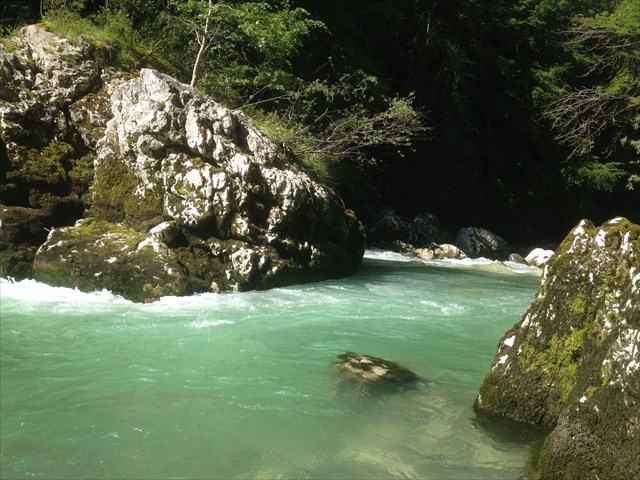
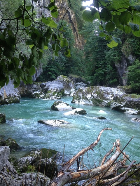
Le chaos du Chéran est une curiosité géologique, vous allez faire face à un canyon qui sort du massif des Bauges. Des parois lisses y ont été tranchées, mais comment expliquer de telles entailles...
Cette anomalie géologique est cachée sous les dépôts de pente. Le massif des Bauges est poussé, ce qui l’oblige à se déverser sur l’Avant Pays Savoyard(le front de chevauchement subalpin). Le soulèvement alpin est toujours actif, la Terre continue de trembler. Ici, le Massif du Mont Blanc repousse les Bauges vers l’Ouest.
C’est pour cela, que je vous invite à vous rendre aux coordonnées afin de découvrir un panneau. Il vous permettra de répondre aux questions pour pouvoir valider cette EarthCache !!!
1.Sur quelle hauteur, les parois ont-elles été tranchées par l’eau du Chéran ?
2.Comment expliquer une telle entaille au fond d’une vallée large au dessus ?
3.Combien compter vous de phases de creusement ?
4.Par quoi la molasse, roche récente est-elle recouverte ?
5.Par qui le Massif des Bauges est-il poussé ?
6.Le Massif du Mont-Blanc continue de se soulever. Mais de combien par an ?
7.Une photo du chaos…(Optionnelle).
Loguez cette cache "Found it" et envoyez-moi vos propositions de réponses soit via mon profil, soit via la messagerie geocaching.com (Message Center), et je vous contacterai en cas de problème.
 The chaos of Chéran
The chaos of Chéran is a geological curiosity, you will face a canyon that leaves the Bauges massif. Smooth walls have been cut, but how to explain such nicks ...
This hidden geological anomaly is hidden beneath the slope deposits. The massif des Bauges is pushed what forces it, which obliges him to pour on the Avant Pays Savoyard (front of subalpine overlap). Alpine uprising is still active, the Earth continues to tremble. Here, the Massif du Mont Blanc pushes the Bauges towards the West.
It is for this reason that I invite you to go to the coordinates in order to discover a sign. It will allow you to answer the questions in order to be able to validate this EarthCache !!!
1.At what height, were the walls cut by the Chéran water?
2. How to explain such a notch at the bottom of a wide valley above?
3. How much counting you from digging phases?
4. By what is the molasse, recent rock covered?
5. By whom is the Massif des Bauges pushed?
6. The Mont-Blanc Massif continues to rise. But how many per year?
7. A picture of the chaos ... (Optional).
Log in this "Found it" cache and send me your suggestions for answers either via my profile or via the geocaching.com message center, and I will contact you if there is a problem.