Før du begir det ut på løpa Knubben Rundt så har jeg et par praktiske opplysninger. Det beste er nok å parkere på Ven skole (flerbrukshus) og gå hele runden til du kommer tilbake til skolen. Det går ann å kjøre opp til Sætra mot en vei avgift men det går ikke ann å kjøre rundt. Man kan kjøre helt frem til Knubben Rundt #08 men der er det stopp. Hvis man tar løpa motsatt vei så er veien svært dårlig. Her vil jeg ikke anbefale å kjøre opp hvis man ikke har en traktor. Selve turen ta ca 2-3 timer. Det kan være lurt å bruke tursko da man må forsere et myr område men det går ann med joggesko hvis man hopper litt. En annen ting er at man vil miste mobildekningen på enkelte plasser så det kan være lurt å lagre liste over alle cachene.
På første post Knubben Rundt #01 har jeg plassert en Mystery cache. Cachen befinner seg ikke på de oppgitte koordinatene. For å finne den så må du finne de manglende tallene som befinner seg på cache #07 og cache #14.
Cachen befinner seg på koordinatene: N 63 21.A E 009 16.B
Mystery cachen inneholder loggbok, ftf coin, travel bug og bytteting.
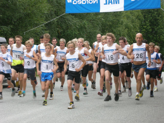
Knubben Rundt
Et 10 km fjelløp som arrangeres hvert år på Ytre Snillfjord den siste helga i juli.
Løypebeskrivelse hentet fra Ysil nettside:
Løypa starter ved Ven skole, nede ved fjorden. Det er 200 høydemeter stigning de første 2 km opp Vennadalen til Setervatnet (205 m.o.h.). Så kommer det et flatt strekke på ca 500m langs Setervatnet før løypa den neste kilometeren stiger ytterligere til løypas høyeste punkt på ca 300 m.o.h.. Høyeste punkt er omtrent midt i det ca 1,5 km lange myrlendte partiet av løypa. Deretter følger løypa en skogsvei i ca 2 km. Denne skogsveien møter hovedveien (40 m.o.h.). Siste del av løypa følger den asfalterte hovedveien retning start/mål i ca 2,5 km. Løypa tar nå av fra hovedveien og følger en gårdsvei over en høyde. Først 500m stigning, deretter ca 1 km flatt-utfor-flatt inn til mål.
English:
Before you head out on the trial Knubben Around I have a few practical information. If you come with a car the best place to park is on Ven School and walk the entire round until you come back to the school. You can drive right up to Knubben Around # 08 but there it stops. If you take the trial opposite direction the road will be very bad. Here I would not recommend driving unless you have tractor. The trip take about 2-3 hours. You may want to use hiking boots when you need to walk a swamp area but it goes with sneakers if you jump a little. Another thing is that you will lose mobile coverage in some places so you may want to save the list of all the caches.
At first post Knubben Around # 01 I have placed a Mystery cache. The cache is not located at the specified coordinates. To find it, you need to find the missing numbers that are in the cache # 07 and cache # 14.
The cache is located at the coordinates: N 63 21.A E 009 16.B
Knubben Around
A 10 km mountain trial held every year on Outer Snillfjord the last weekend of July.
Track Description taken from Ysil website:
The trail starts at Ven school, down by the fjord. It is 200 meters climb the first 2 km up Venna Valley to interior lake (205 meters above sea level). Then comes a flat stretch of about 500m along Seats lake before the trail the next kilometer rises further to the trails highest point of about 300 m.o.h .. The highest point is approximately halfway through the approximately 1.5 km long swampy portion of the trail. Then follow the trail a forest road for about 2 km. This forest road meets the main road (40 meters above sea level). The last part of the trail follows the paved main road towards the start / finish of about 2.5 km. The trail now takes off from the main road and follow a farm road over a hill. First 500m climb, then about 1km flat-downhill-flat to the finish.