You're invited to take a journey through the Maryland's Heart of the Civil War.
The Heart of the Civil War Heritage Area (HCWHA) is an area rich in history, covering portions of Carroll, Frederick and Washington Counties. It is located just below the Mason-Dixon Line, generally viewed as the dividing line between North and South, and above the Potomac River. With one foot in the north, and one foot in the south, the story of the Civil War can be told nowhere better than in this part of Maryland.
No state experienced the Civil War quite like Maryland. Residents of this border state contributed significant resources to both sides of the war effort. Although large portions of the state’s economy relied upon slavery, Maryland lawmakers did not vote to secede from the Union at the outset of the war—though many did not have the opportunity to vote, as they were detained by the federal government because of suspected Confederate sympathies.
Between 1861 and 1865, the Civil War impacted nearly every Maryland resident. Some families faced financial ruin after troops ravaged their land. Thousands of fathers, sons and brothers became casualties of war. For enslaved Marylanders, the conflict ultimately brought about freedom as the new state constitution of November 1864 abolished the practice.
Marylanders witnessed three major military movements during the Civil War: the Maryland (also known as Antietam) Campaign in the fall of 1862, the Gettysburg Campaign in the summer of 1863, and the march to Washington led by Jubal Early in the summer of 1864. Geocachers can visit significant sites from each of these three operations on the Heart of the Civil War GeoTrail.
The mission of the Heart of the Civil War Heritage Area is to promote the stewardship of our historic, cultural, and natural Civil War resources; encourage superior visitor experiences; and stimulate tourism, economic prosperity, and educational development, thereby improving the quality of life in our community for the benefit of both residents and visitors.
The Heart of the Civil War Heritage Area Geotrail launched October 1st, 2016 with 15 geocaches within Maryland's Carroll, Frederick, and Washington Counties. A trackable geocoin will be awarded to the first 200 geocachers, (while supplies last), who find the locations of at least 13 HCWHA caches. To be eligible for the coin, geocachers must download a passport from the Heart of the Civil War website, and record the code word from at least 13 HCWHA geocaches. Geocachers may have their passports validated in person at the Newcomer House at Antietam National Battlefield or at the Visitor Centers in Westminster, Frederick, or Hagerstown. Please refer to the passport for Visitor Center hours and complete validation instructions.
Please note following change. A free prize will still be given to a geocacher who goes to at least 13 HCWHA geocaches and records the code in each of the geocaches on their passport. In addition, geocachers may purchase a trackable Geocoin for $10 at one of the following locations: Frederick Visitor Center, Hagerstown-Washington County Visitor Welcome Center, or Antietam Museum Store. Each of these locations will verify passports by mail and send a coin for a modest handling fee. Call for more information.
Participating in the HCWHA geotrail is fun and we hope that many people join in. However, it is not a requirement for logging your find on this cache once you find the container.
 The dramatic history and landscape of Harpers Ferry have drawn visitors for centuries. Some of Harpers Ferry’s most noteworthy early visitors include Thomas Jefferson in 1783 and George Washington in 1785 and 1794. Washington designated Harpers Ferry as the site of a new federal armory and arsenal, built in 1799. This United States Armory and Arsenal would be the target of radical abolitionist John Brown sixty years later.
In October of 1859, Brown and his followers, which included both free and enslaved men, took control of the Federal Armory in hopes of spurring a slave uprising throughout the South. Brown’s effort did not spark the revolt he sought, though it did draw national attention to the issue that ultimately led to the Civil War. Nearly 160 years later, John Brown’s Raid continues to be debated and discussed by Americans. Brown has been called a martyr or a hero by those who commended his actions as part of the abolitionist movement while others have considered his actions treasonous or terroristic.
Harpers Ferry’s role in the fight for freedom and equality did not end with John Brown’s execution. The Civil War, which ultimately led to universal emancipation, made its mark on the town many times between 1861 and 1865. By war’s end, freedmen and refugees congregated throughout the Shenandoah Valley and near Harpers Ferry. In Harpers Ferry support for them came in the form of a Freewill Baptist primary school, established by Reverend Dr. Nathan Cook Brackett in the Lockwood House on Camp Hill. By 1867 Storer Normal School opened its doors to students of all races, and later would have noted scholar and orator Frederick Douglass serve as a trustee.
The Storer campus would host an early civil rights organization at the beginning of the twentieth century. This group, known as the Niagara Movement (a predecessor of the NAACP), was founded in 1905 by W.E.B. Du Bois and William Monroe Trotter. In 1906, the group’s first meeting on U.S. soil occurred in Harpers Ferry, a place which the Niagara Movement members deemed a symbol of freedom.
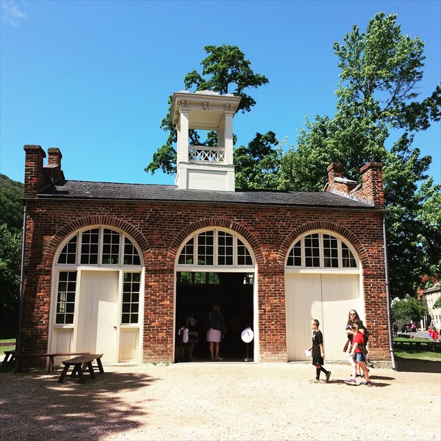
Today, a large portion of Harpers Ferry and its surrounding mountainsides are within the borders of Harpers Ferry National Historical Park. This national park offers visitors of all ages a glimpse into the industrial, transportation, natural, social, and military history of the mid-19th century. With its unique location at the confluence of the Potomac and Shenandoah rivers and at the intersection of Maryland, Virginia, and West Virginia, Harpers Ferry is a destination spot for those traveling from both near and far.
The Geocache
Stage 1: At the given coordinates, [N39 19.439 W077 43.568], you will find a sign titled Lift Lock 33. Use this sign to gather information to find the north coordinates to the geocache.
Stage 1
- A = The number of letters in the first word found in the caption under the picture in the top right hand corner of the sign.
- B = The number of lines of text found in the small paragraph found at the top center of the sign.
- C = The number of sentences found in the first paragraph found at the top left hand corner of the sign, plus 3.
Stage 2: At Reference Point #2, [N39 19.451 W077 43.830], you will find a historical marker titled A Perfect Heap of Ruins. Use this sign to gather information to find the west coordinates to the geocache.
Stage 2
- D = The uniform insignia number located in the display of Civil War-era artifacts that were excavated at this site.
- E = The number of arsenals that U.S Soldiers set fire to.
- F = The second digit in the day of April, in which the fires were set.
The coordinates for the geocache are N39° 19.ABC, W77° 43.DEF. The checksum of ABCDEF is 34. The cache is a clear lock-n-lock container. Please keep the geoacache well-hidden.
Free but very limited parking on the north side of the Potomac River. These two spots may be very full on the weekends.
- Parking 1 Maryland Heights along Harpers Ferry Road: N 39 19.763 W 077 43.911
- Parking 2 Maryland Heights along Harpers Ferry Road: N 39 19.883 W 077 44.124
Parking in Harpers Ferry: All lots are NPS parking lots and a $10 fee per car applies.
- Parking 3 Harpers Ferry MARC Station: N 39 19.464 W 077 43.874
- Parking 4 Harpers Ferry River Access Lot: N 39 19.302 W 077 44.595
- Parking 5 Harpers Ferry Visitor Center: N 39 18.945 W 077 45.376 (Free shuttle service to Lower Town, Harpers Ferry)


Thanks to the following members of the Maryland Geocaching Society in placing the hides for this Geotrail: deepdish23, GeoAPPs, lpyankeefan, Phos4s, and ZombieHNTR.

The Heart of the Civil War Heritage Area extends its thanks to the National Park Service for participating in this Geotrail and for allowing us to partake in its centennial celebrations.Geocaches may only be placed on National Park Property at the direction of National Park Service staff.