
Seria skrytek nominowana w konkursie Polskie Geo-Laury 2018
#001 >> #002 >> #003 >> #004 >> #005
POL – Zadanie jest proste! Przeczytaj krótki tekst historyczny, a następnie odpowiedz na cztery pytania. Trzy odpowiedzi znajdziesz z łatwością w opowieści, jednak czwartej będziesz musiał poszukać samodzielnie!
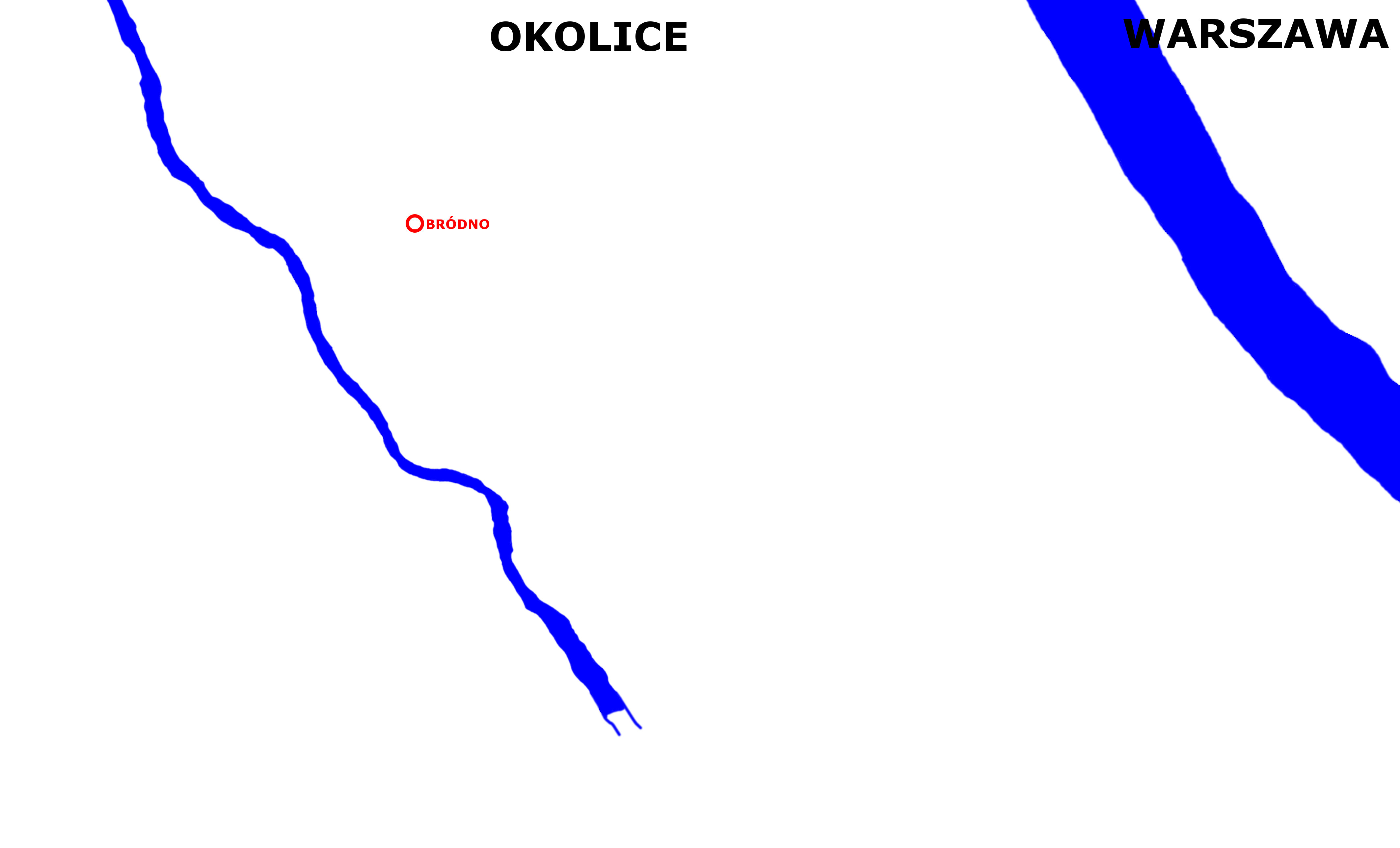
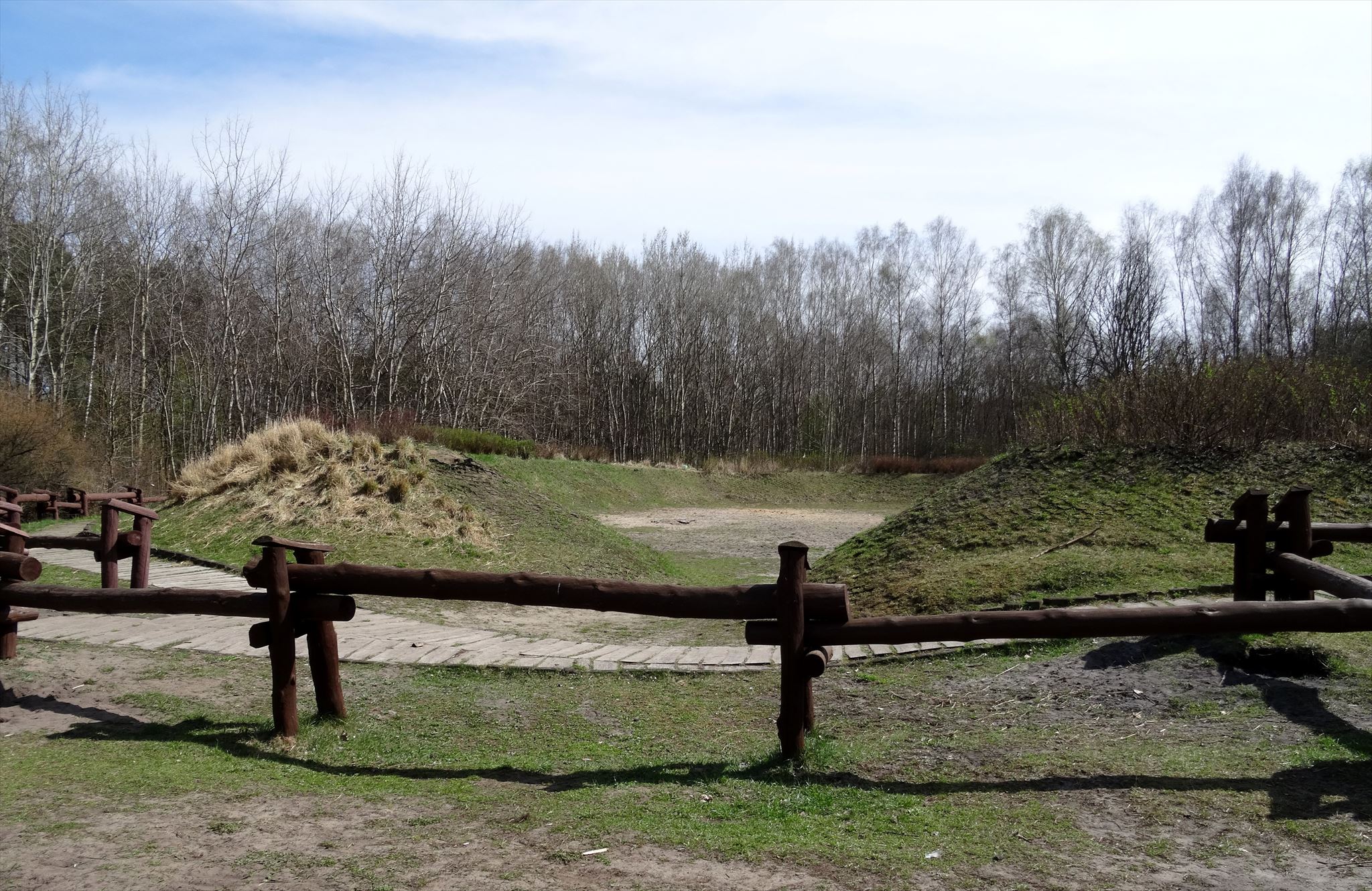
Choć osadnictwo na terenie Warszawy sięgało czasów neolitycznych, to najstarsza osada w nieco bardziej współczesnym kontekście powstała dopiero w IX wieku. Bródno – tak nazywa się powszechnie ten gród – wzniesiono na wydmowym pagórku u nasady tzw. Równiny Praskiej, był otoczony z trzech stron bagnami zasilanymi z wód potoków Brodnia i Długa. Pokonanie ich umożliwiały znajdujące się w pobliżu płycizny, tzw. brody, od których też wzięła się nazwa osady. Gród zajmował obszar o wymiarach 47 na 40 metrów, jego umocnienia składały się z ziemnych okopów wzmocnionych kładzionymi naprzemiennie drewnianymi belkami oraz drewnianymi skrzyniami wypełnionymi gliną i kamieniami, a całość zwieńczono drewnianym ostrokołem. Wejście do niego umożliwiała dwumetrowa drewniana brama. Wewnątrz wałów nie było jednak zabudowań, od strony południowej i zachodniej znajdowało się zaś podgrodzie – zespół 87 domostw ze śladami działalności rolniczej, garncarskiej, tkackiej czy bednarskiej, jak również fragmentami ruskich naczyń, świadczących o prowadzeniu handlu. Szczyt rozwoju osady przypadł na X i XI wiek, czyli okres rozwoju państwa Piastów, była ona zapewne siedzibą jednostek militarnych i chroniła lokalne trakty oraz granice przed najazdami plemion pruskich i litewskich. Gród uległ zniszczeniu w wyniku pożaru lub najazdu w połowie XI wieku, ale jego ślady – zwane przez setki lat Zagórkami – zachowały się do dzisiaj w Parku Leśnym Bródno.
A] Skąd wzięła się nazwa Bródno? >>
>> 2 = od przejścia przez rzekę | 4 = od braku higieny | 6 = od owłosienia na twarzy
B] Z jaką nacją z pewnością handlowali mieszkańcy Bródna? >>
>> 1 = Prusami | 4 = Rusinami | 8 = Litwinami
C] Z jakich materiałów wybudowane były fortyfikacje Bródna? >>
>> 3 = były ziemne | 5 = były ziemno-drewniane | 9 = były drewniano-murowane
D] Który znany historyk przyczynił się do odkrycia grodu na Bródnie? >>
>> 1 = Stanisław Herbst | 3 = Jan Zachwatowicz | 7 = Stanisław Lorentz
Pojemnik finałowy znajduje się pod następującymi współrzędnymi:
N 52°(B+A*C).(B)(A*B)(C+D)
E 021°(B+C).(B-C+D)(B+C)(C-D+B)
Współrzędne możesz sprawdzić w checkerze na samym dole strony
Jeśli masz wątpliwości co do swojego wyniku, wyślij do mnie wiadomość przez wewnętrzny czat i podaj, jaki wyszedł Ci wynik, sprawdzę, czy wszystko dobrze zrobiłeś! Jeżeli w pojemniku cokolwiek wymaga naprawy, daj znać za pomocą wpisu "Wymaga przeglądu" / "Zgłoś problem", wtedy na pewno wykonam serwis!
W pojemniku finałowym, oprócz logbooka, znajdziesz również wskazówkę, która nakieruje Cię na Wielki Pojemnik Finałowy! Ale znajdziesz go dopiero wtedy, gdy poznasz całą historię Warszawy! POWODZENIA!
ENG – The task is simple! Read a brief historical text, and then answer four questions. Three of them respond to the text you have read, but for the fourth answer you will need to look by yourself!
Although the earliest settlements in Warsaw were founded in the Neolithic Age, the oldest one in a bit more modern context was estabilished just in the 9th century. Bródno – this is how the village is called today – was built on a dune hill at the corner of so called Praga Plain, and surrounded on three sides by marshes supplied with water streams Brodnia and Długa. It was possible to cross them using the ford, called in Polish "bród", and the name of the village comes from this object. The settlement – so-called "grod" – was situated in the area measuring 47 to 40 metres, its fortification consisted of ground embankments, wooden beams and boxes filled mostly with ground and stones, and topped with the wooden stockade, the admission was only possible through a wooden gate, which was 2 metres high. However, there were no buildings inside, but the borough was located to the southwest of the grod. It was a group of 87 houses with traces of farming, pottery, weaving or cooperage, and also pieces of vessels from Russia were founded in the borough, what means, the villagers was making trade with another villages. The development peak occured in the 10th and 11th century, which was a period of the Piast's State, and the fortification was probably the seat of different war units, protecting local routes and borders from the Prussian and Lithuanian tribes. The village was destroyed in the mid-11th century, but several remnants survived until today – they were known as Zagórki – and nowadays you can find them in Bródno Forest Park.
A] Where does the name "Bródno" come from? >>
>> 2 = crossing the river | 4 = lack of hygiene | 6 = facial hair
B] With what other nationalities were the villagers of Bródno making trade? >>
>> 1 = Prussians | 4 = Russians | 8 = Lithuanians
C] What materials where the fortifications of Bródno made of? >>
>> 3 = ground | 5 = ground and wood | 9 = wood and stone
D] Which famous historian took part in re-discovering the grod in Bródno? >>
>> 1 = Stanisław Herbst | 3 = Jan Zachwatowicz | 7 = Stanisław Lorentz
The final box is located on these coordinates:
N 52°(B+A*C).(B)(A*B)(C+D)
E 021°(B+C).(B-C+D)(B+C)(C-D+B)
You can test your coordinates in the checker at the bottom of this page
If you have doubts about the counted coordinates, send them by "message this owner" to me, I will try to figure out whether you did it well! If there is anything damaged in the container, please let me know by adding the log "Needs maintenance" or "Log a report" to make sure I will make the maintenance!
In the final box, in addition to the logbook, you will find a hint, which can direct you how to find a Big Final Box! However, you can find it only if you will learn the whole story of Warsaw! GOOD LUCK!
DE – Die Aufgabe ist einfach! Lesen Sie einen kurzen historischen Text und beantworten Sie dann vier Fragen. Drei Antworten kann man leicht in der Erzählung finden, aber nach der letzte Antwort müssen Sie selbstständig suchen!
Die Ansiedlung im Gebiet von Warschau hat schon in Neolithikum begonnen, aber die älteste Siedlung in modernem Kontext wurde erst in 9. Jahrhundert gegründet. Diese Burg ist allgemein bekannt als Bródno und wurde auf einem Dünehügel am Ende der so gennante Praga-Ebene errichtet. Sie wurde von drei Seiten durch die Sümpfe umgegeben, waren sie von den Flüssen Brodnia und Długa verstärkt. Die Flüsse konnte man durch verschiedene Flussübergänge (poln.: bród) überschreiten, sie haben den Namen dem Dorf gegeben. Die Siedlung war 47-Meter-lang und 40-Meter-breit, und war mit Erdgraben, Holzbalken und Lehm- und Stein-erfüllten Holzkasten befestigt. Alles wurde mit einer Holzpalisade gekrönt, man konnte durch ein 2-Meter-Holztor hineintreten. Drinnen der Erdgraben gab es aber keine Gebäude, eine "Vorstadt" befand sich in westlicher und südlicher Seite des Dorfes. Das war eine Siedlung von 87 Häuser mit den Spuren von Landwirtschaft, Töpferei, Weberei und Böttcherhandwerk, man fand auch die Teile der russischen Geschirre, was zeugte von dem Handel mit anderen Dörfern. Ein Entwicklung-Gipfel fiel auf der Wende von 10. und 11. Jahrhundert, das war die Zeit des Piasten-Herzogtum. Die Siedlung war wahrscheinlich ein Sitz von Militäreinheiten, die die Straßen und die Genze von dem preußischen und litauenischen Stämmen schützten. Die Siedlung wurde in der Mitte des 11. Jahrhundert infolge eines Brandes oder eines Überfalls zerstört, aber die Spuren – als Zagórki bekannt – überdauerten bis heute in dem Waldpark Bródno.
A] Woraus stammt der Name Bródno? >>
>> 2 = aus den Flussübergang | 4 = aus der Hygienearmut | 6 = aus der Kopfbehaarung
B] In welcher Richtung handelten die Einwohnern von Bródno? >>
>> 1 = nördlicher | 4 = ostlicher | 8 = westlicher
C] Aus welchen Materialien wurden die Befestigungen von Bródno erbaut? >>
>> 3 = aus Erde | 5 = aus Erde und Holz | 9 = aus Erde und Ziegel
D] Welcher bekannter Historiker leistete einen Beitrag zur Entdeckung der Siedlung Bródno? >>
>> 1 = Stanisław Herbst | 3 = Jan Zachwatowicz | 7 = Stanisław Lorentz
Der Finalcontainer befindet sich an den folgenden Koordinaten:
N 52°(B+A*C).(B)(A*B)(C+D)
E 021°(B+C).(B-C+D)(B+C)(C-D+B)
Sie können Ihre Koordinaten im Checker am Ende dieser Seite prüfen
Wenn Sie Zweifel an Ihrem Ergebnis haben, senden Sie an mir eine Nachricht über das Geocaching-Chat und geben Sie mir Ihr Ergebnis, ich kann das alles kontrollieren. Wenn im Container etwas beschädigt ist, setzen Sie bitte einen "benötigt Wartung" oder "Ein Problem melden" Logeintrag ein, um sicher zu sein, dass ich die Wartungarbeiten machen werde.
Im Finalcontainer finden Sie im Logbuch auch einen Hinweis, der Sie zur Hauptfinalcontainer hinbringt! Aber finden Sie ihn dann, wenn Sie die ganze Geschichte von Warschau kennen lernen! VIEL GLÜCK!
You can validate your puzzle solution with certitude.

If your coordinates are wrong, the certitude can give you a hint.
If there is no hint, you made more than one mistake or you made a mistake in counting.