Meewasin Northeast Swale
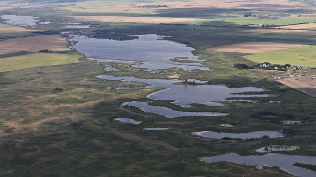
"is an ancient river channel scar approximately 26 kilometres long and 2,800 hectares. It is the result of the post-glacial South Saskatchewan River carving a path through the landscape, evolving over time into a unique geological, hydrological and ecological area.
It is a diverse landscape of rare native prairie, riparian areas and wetlands that provides strong natural connectivity to the river and other adjacent areas."
The posted co-ordinates will bring you to the top of a mound.
In order to claim this Earthcache, please send a private message with answers to the following questions:
-
Describe the terrain as you look North-East and then behind you looking towards the West.
-
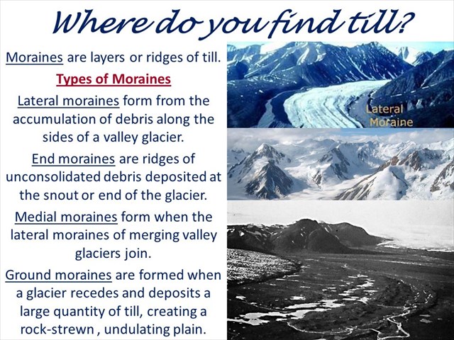
What types of moraines do you observe?
-
In which direction did the glacier recede.
-
Highlight the differences between a braided river and a meandering river.
Please send answers via private message. You are allowed to log immediately after answering the questions and I will confirm your message. If no answers are sent to a "found it" log entry, I will delete it without further notice!
This area is extremely fragile and as such the area is only accessible by foot.
Permission has been given to place this EarthCache.
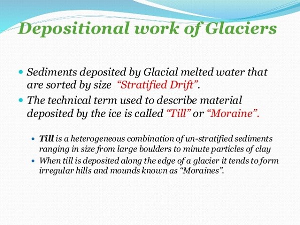
The swale is the result of a braided river valley, the South Saskatchewan River, which drained Glacial Lake Saskatoon into the larger Saskatchewan River Basin. The glacier deposited glacial till is a mixture of all particle sizes from clay to boulders that was further eroded by the meltwater.
To the east, just beyond the recent city developments, is Strawberry Hills. This is a glacial moraine deposit and glacial beach ridge with knob and kettle topography. These hills collect water that eventually ends up into the Forestry Farm aquifer which underlies the entire area including the Northeast swale.
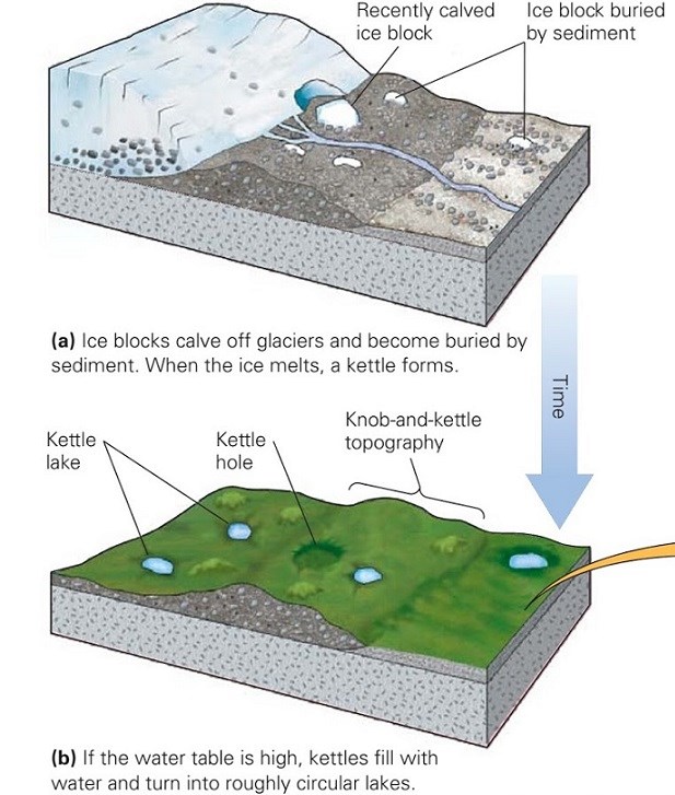
Knob-and-kettle topography: an undulating landscape in which a disordered assemblage of knolls, mounds, or ridges of glacial debris is interspersed with irregular depressions and pits (kettles) that are commonly undrained and may contain swamps or ponds. Hummocky moraine.
The ridges within the Northeast swale are usually comprised of glacial till but may contain sand and gravel. These landforms, particularly the hummocky moraine, are poorly drained and form potholes or sloughs that aid in the control of groundwater levels.
Topsoil erodes from the high areas to the low areas, resulting in very thin, poorly developed soils on the well-drained ridges and deeper topsoil in the depressions.
Consequently, the depressions are very productive and commonly develop lush vegetation such as aspen, sedges, willow and other species that are a valuable habitat and cover for wildlife.
This area supports rich plant and animal life communities. Two examples are the fescue grassland and natural prairie that serve as a habitat for grassland birds. The scar is a wildlife corridor for mammals and a habitat for numerous bird varieties.
If you see any wildlife during your visit, be sure to document the coordinates and share the experience with Meewasin.