 Long before Crystal Mountain was known for skiing and hiking, it was known as the Summit Mining District. Gold was spotted in the Cascades and people swarmed the hills in hopes of striking it rich, dubbing this area across from Crystal Mountain as Gold Hill.
Unfortunately, the claims were small and unprofitable, and mining in the area declined just after World War I. 47 years later, it became Crystal Mountain Winter Sports Area.
Many mine shafts are still visible, and this mine shaft, located next to Elizabeth Creek, is one of the original tunnels built in the late 1800s. You should never explore a mine shaft unless access is granted and you have appropriate gear, so please do not explore this one.
The cache: There are two distinct ways to arrive at the cache. One is steeper, but is easier parking. The other is more direct with a gentle slope, but involves a long gravel road.
- From the Crystal Mountain base area parking lot, head up the slope to the east of the Shop, following the sign for the Silver Creek Trail. Take the first right off the service road, again following the sign toward the Silver Creek Trail. Cross the ski slope, and once you head back into the trees, you’ll be nearly there. This approach is the fastest, but also the steepest: the slope trail up from the base area gets down to business quickly, with a 350-ft gain in a 0.3 mile reach. This trail ultimately leads to Henskin Lake; check the link for more instructions.
- Alternatively, using the waypoints as indicated, turn off of the Crystal Mountain Parkway onto Gold Hill Road. This is a gravel drive, but is smooth and any car should be able to make it. The parking coordinates allow for a couple of cars to park safely just off of the road just before a rugged turn. From here, follow the sign to the Silver Creek Trail and cross the ski slope.
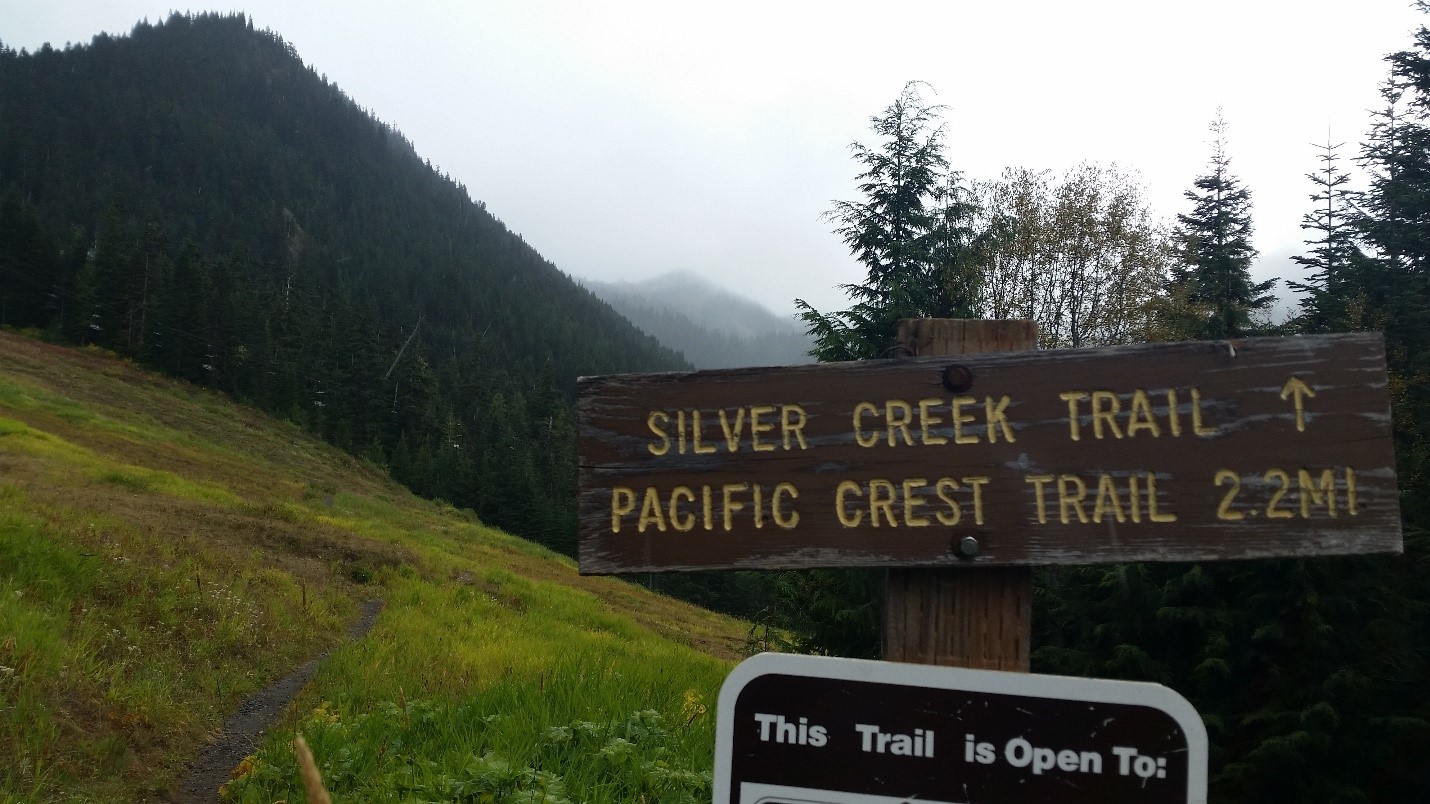
Crossing the ski slope
When you arrive, do not go into the mine shaft! Don’t even think about it! Instead, think about how you’re making safe choices by staying out of there.
Do enjoy the waterfall, the expanse of the base area, and the view of the gondola’s complete route.
Web References:
2016 was the 100th anniversary of the National Park Service, and to celebrate, Visit Rainier and WSGA hosted the Visit Rainier Centennial GeoTour - 100 caches placed in and around Mount Rainier National Park. The geocaches highlighted the rich history, scenic wonders, quaint communities, and hidden gems of the Rainier region. Participants received geocoin and pathtag prizes for finding all the caches.

