Coorumbine Creek begins its journey in Kariong, its major tributaries emerging from huge drainpipes on the edge of the built-up area, so whatever you do, don't drink the water! Also take note that the track down the falls is steep and slippery in places, requiring a fair degree of physical agility. Take particular care at the top of each set of falls as the edge is very slippery and the sudden stop at the bottom unforgiving. This is no park-and-grab cache.
The falls themselves are within the Brisbane Water National Park, so you'll need to visit the virtual waypoints at each of the drops to determine the coordinates of the physical cache hidden elsewhere along the creek.
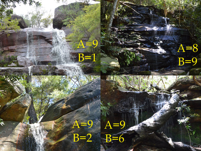
Stage 1: From the trackhead on the Central Coast Highway, follow the narrow path marked with pink ribbons to reach the listed coordinates at the first falls. Choose which of the following four photos best matches what you can see here, giving the digits A and B.
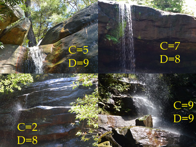
Stage 2: Still following the pink ribbons, descend to the base of the next falls and again identify the correct photo to yield digits C and D.
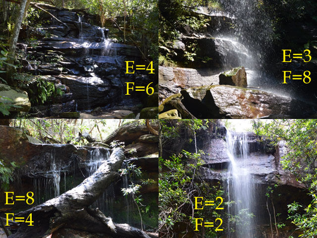
Stage 3: Finally, make your way to the base of the third falls. While there are no ribbons to follow this time, there's an easy way down on the southern side of the water. Find the right photo to determine E and F.
The journey's end, where the water from the falls meets the briny, is at SOUTH 33° 25.ABC EAST 151° 18.DEF.
Now you have a choice. You can continue on foot, following the creek down the gully to GZ, or you can walk back to your car and drive down. The bottom of the creek is heavily overgrown with lantana and other thorny weeds, so in all honesty I wouldn't recommend that option. If driving down, you can take advantage of the U-turn bay a couple of hundred metres further west along the highway. It's not a difficult choice, is it, but if you do decide to walk, head for the end of Nari Road to avoid the worst of the undergrowth.
Since this cache is all about water, look for a container that fits this theme, and please rehide so it's out of sight to stray muggles. While it's a good size, the opening in the base is only about 40mm across so don't try to put anything large in it. Anything bigger than a geocoin or small TB will be hard to get out again.
Congratulations to bella at waggy, the first to complete the journey!