Een einfachen "Drive-in".
Hei stidd Der op der zweit-héckster Platz vam Land, o wann d'Info-Schëld eppes annischt seet.
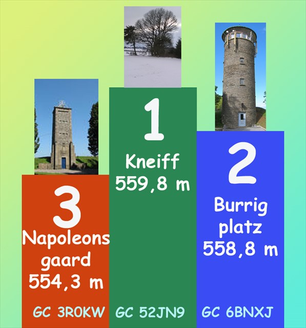
Bis am Joër 1952 ass den Napoléonsgaard bei Randscheld als den héckste Punkt vam Land agesee giänn.
Mat dem mi performanten Fotogrammmetrie-Verfahren gouf 1952 rausfonnt, dass d'Burrigplatz mat 559 Meter deen héckstste Punkt wär.
Zënter dem Joër 1997 gëlt een Hiwwel op der "Kneiff", Sektioun Wilwerdang mat ronn 560 Meter als de Champion.
Fir wégder Informatiounen: http://www.act.public.lu/fr/actualites/2010/01/point-culminant-luxembourg/
A little drive-in; jhust for fun!
Here you are on the second highest peak of our country.
For a long time, the place "Burrigplatz" was considered to be the highest point of Luxembourg (559 m), till 1997, when scientists with their measurement based on GPS system found out, that the highest point is indeed a hill named Kneiff (about 560m).
for further informations : http://www.act.public.lu/fr/actualites/2010/01/point-culminant-luxembourg/
PLEASE ONLY LOGS IN 🇱🇺 LU • 🇩🇪 DE • 🇫🇷 FR • 🇬🇧 ENG