

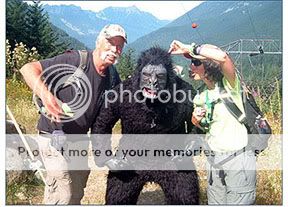
The APE is found in the rugged, snow-capped Cascade Mountains, just a short drive from Seattle, where you can walk through the spooky 2-mile-long Tunnel of Light, find one of the oldest caches in Washington, and visit the APE tribute cache. Plus, we hear that Sasquatch and Fen Dweller have been sighted in the area - so watch out!
If you're new to geocaching, you may be wondering: What the heck is an APE cache? Check it out: Mission 9: Tunnel of Light. Alas, our beloved APE cache was stolen and archived in 2011, but we discovered we didn't need the original cache to have a good time - there's so much else to enjoy! (We're keeping the name for sentimental reasons, and it was Groundspeak's decision to retire the cache and icon, so no, we can't bring it back.)
Time & place: 10:00 am - 2:00 pm on Saturday, August 20, (Please note this is a change to the day of the week from previous years) at the Hyak trailhead in Iron Horse State Park at Snoqualmie Pass (posted coordinates). We'll be in the field at the far end of the parking lot. The park and tunnel are open dawn till dusk, so you can hang out all day if you like. Event map.
We're a low-key mega: no formal activities, no group photo, and no vendors. This is all about a fun day in the beautiful Cascade Mountains with good friends, a spooky tunnel, and some geocaching.
Activities:
- Attend this event, and you'll receive the Mega event icon plus a Souvenir created specifically for this event.
- Socialize and sign the logboard (look for Apezilla wearing it). To help us maintain mega-event status, be sure everyone with a caching name signs the physical log. If you sign a group name, indicate the number in your party in your online Attended log.
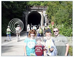
- Hike or bike through the Snoqualmie Tunnel. This 100-year-old railroad tunnel is 2.3 miles long, pitch dark, and a chilly 50F degrees. You'll feel the cold breeze before you even see the tunnel entrance, and occasional water drips add to the spookiness. More about the tunnel.
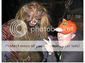
- Find Bloody Fingers, Dirty Diapers inside the tunnel. Watch out for Fen Dweller!
- Find Iron Horse (GC79), 2nd-oldest active cache in Washington, outside the west entrance to the tunnel.
- Find Mission 9: Tunnel of Light Reclaimed, the APE tribute cache. This cache is the same size and in the same location as the original APE cache (the only real difference is the icon), and counts for the APE segment of the Center of the Triad Challenge.
- We again plan on having Lab Caches available for the event. More details will follow as we finalize them. As always the Ape Adventures caches will only be active for one day. Handouts with intel on the Ape Adventures will be available at the Welcome booth.
- If you're doing the Washington State Parks Centennial GeoTour, find the Iron Horse - Hyak cache and stamp your passport. More intel on the GeoTour, including passports, guidelines, and a map, will be available at the WSGA Info table next to the Welcome booth.
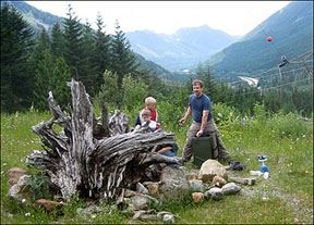
- Stroll or roll the Iron Horse Trail to enjoy the mountain scenery and find other caches. You can continue west beyond the APE tribute cache, or go south from Hyak around Lake Keechelus. Bookmark list of Hyak-Rattlesnake caches.
- Trade your trackables at the Travel Bug Depot (at the Welcome table).
- Get your exclusive APE event coin and shirt, as well as our Washington State geocoins.
Parking & permits: Please route to the posted event coordinates, and our parking staff will direct you to appropriate parking. We have two overflow lots in addition to parking at the main Hyak venue; both overflow lots are a short 5-minute walk from the event site. Parking and Event map
Hyak parking requires a Discover Pass (day or annual); our parking attendants will sell you a $10 day pass if you don't have one, or you can buy one at the on-site kiosk.
The nearby Forest Service lot requires a Northwest Forest Pass (day or annual); we will have passes for sale at this lot and our parking attendants will sell you a $5 day pass if you don't have one.
Hiking: The hike from Hyak to the APE tribute cache is 3 miles (6 miles round trip, including two trips through the tunnel). The Iron Horse Trail is a broad, flat, packed-gravel trail with little elevation change. It's an easy hike. Bookmark list of caches.
If you would like to through-hike, you could leave a car at Annette Lake trailhead (exit 47 off I-90, requires a Northwest Forest Pass to park). The hike is about 5.5 miles, and downhill all the way. The final mile descends 700 feet on the Annette Lake Trail, a typical narrow, uneven forest trail with some roots and rocks to negotiate, a bridge crossing over a waterfall area, and a few caches.
Biking: Bicycles are allowed on the Iron Horse Trail and in the tunnel, so feel free to bring yours. (We don't recommend road tires due to the rockiness of some sections.) If you bike, be sure you have a headlamp and watch for pedestrians, especially in the tunnel. Unfortunately, there are no bike rental places near Hyak, so that's not an option.
If you would like to through-bike, you have several options. One option is to leave a car at Annette Lake; bikes are allowed on the lower portion of the Annette Lake Trail. The most popular option however, is to bicycle 23+ miles down the Iron Horse from Hyak to the Rattlesnake Lake trailhead (exit 32 off I-90), picking up caches along the way. Bookmark list of caches.
Time required: Please plan a half day for this event (or longer, depending on your caching plans). It takes 30-45 minutes each way to drive Seattle to Hyak, and round-trip distance to the APE tribute cache is 6 miles.
Swag:No event is complete without geo-goodies, and we have an APE event coin, T-shirt and SWAG Bag created just for this mega-event. Preorders will close around July 10th depending on demand, so order yours early!; if you purchase a Swag Bag or other items, your bag will be at the Swag Preorders booth on event day.
Pre-Orders are now Closed


This year we have created two versions of our Going Ape event coin, Antique Gold and Antique Silver.
The coin is a 2.5-inch cutout coin of the word APE. The front features the famous ape rendered in black enamel with the western tunnel entrance and Cascades in the background. The reverse side displaying a whimsical map following the ape to where X marks the spot. Designed by NepoKama. Trackable, of course, with a custom icon. Plus, you get a trackable proxy tag (a cachekinz).
The Antique Gold version is a PRE-ORDER EXCLUSIVE and is only available by purchasing one of the 2016 Going Ape SWAG Bags.
The Antique Silver version is the STANDARD version of the 2016 Going APE Geocoin. It will be available for sale at the event and for pre-sales.

The all-new 2016 event shirt will stand out with our dancing ape and map to the treasure in white glow ink on a black shirt.
We will also have the STANDARD 2016 Going APE Geocoin, T-shirt, and other goodies at the Swag Sales booth while supplies last.
Refreshments: If you hike/bike, you should bring sips and snacks. We'll also have a lemonade stand (aka refreshments table) with water, lemonade, fruit, and snack bars. There are picnic tables at both ends of the tunnel, so you can relax and enjoy the scenery while you have lunch.
What to wear: You're hiking 6 miles, so dress accordingly, including footwear. Be sure to check the Weather for Snoqualmie Pass - it could be a cool day or a scorcher, sunny or rainy. The tunnel is quite chilly (50F), so you may want long sleeves or a jacket. Your clothes might get dirty, as the ceiling drips muddy water in places (hats are recommended), and the trail may be wet.
What to bring: You'll need a flashlight or headlamp for the tunnel, plus a day pack with hiking essentials for your party. Depending on your plans, this may include food, water, camera, hat, bug spray, suntan lotion, first aid, camera, emergency whistle, sunglasses, extra batteries, trekking poles, maps, ibuprofen, camera... Also bring your Discover/NWF parking permit or cash to buy one.
First aid: We will have first aid available at the Refreshments tent, so please go there if you need help. The event monitors at each end of the Snoqualmie Tunnel will also have first-aid kits.
More Details
Directions to Hyak: (Hey, not everyone has auto-routing.) From Seattle, drive east on I-90 to exit 54 (Hyak). At the end of the exit ramp, turn right (south), then immediately turn left on a road that parallels I-90 going east. The road makes a sharp right at a gated maintenance yard. Turn right again at the next road, and enter the Hyak parking lot. We will also have APE event signs to guide you, and you can look for the brown Iron Horse State Park signs, as well. (If you end up at Hyak Lodge or Lake Keechelus, you missed the right turn for the Hyak parking lot, but you'll find the Forest Service parking lot.)
Washington's oldest geocache: GCD is also at Snoqualmie Pass, and if you find it and Iron Horse (at this event), you'll have the two oldest caches in Washington! GCD is across the I-90 freeway, accessible from the same exit as this event, and you can auto-route to the trailhead, which is a few miles up forest roads (see GCD's cache page). Be aware this is a moderate hike: two miles each way, with 1,600 feet of elevation gain. How long it takes depends on your hiking speed.
Dogs: Dogs are allowed at Hyak and on the trail, but keep them on a short leash at all times for the courtesy and safety of others. This is especially important in Snoqualmie Tunnel, where visibility is limited; we don't want any bicycle/dog collisions.
Motorized transport: No motorized vehicles are allowed on the Iron Horse Trail, which means no motorcycles, ATVs, golf carts, etc. Motorized scooters or wheelchairs are permitted for users with mobility impairments; park policy requires you to notify the event director (AndrewRJ) and provide your name. You must have a light to enter the tunnel, for safety reasons.
Carpooling: If you'd like to arrange carpooling with other attendees, post a note to find like-minded souls who want to through-hike to Annette Lake trailhead, bike to Rattlesnake Lake, or just pile into a single car for Hyak.
Trail maps: If you use a Garmin GPSr, Northwest Trails is a tremendous (free) resource, as it adds trails to your GPS maps (a transparent overlay, so you see the trails along with other loaded maps).
Services: We'll have plenty of potties at Hyak. Most other services are 22 miles away in North Bend, but Snoqualmie Summit (two miles away at exits 53/52) does have a gas station and small grocery, as well as the Summit Lodge (425-434-6300). ('90s TV trivia: "Twin Peaks" was filmed in North Bend. And "Northern Exposure" was shot in Roslyn, on the east side of the Cascades.)
Accommodations: There are plenty of options in all price ranges in the Seattle metro area. One option is the Hilton Garden Inn in Issaquah, which is on I-90 about halfway between Seattle and Hyak.
Camping: There are several camping areas in the I-90 corridor between Seattle and Hyak. Here are three we recommend: Snoqualmie River RV Park & Campground (exit 22, coords N 47 33.995 W 121 52.540) in Fall City has both tent and RV camping, with restaurants and shops nearby. Tolt MacDonald Park and Campground (exit 22) in Carnation offers yurts for rent as well as tent and RV sites, and the park has several caches along the trails. Denny Creek Campground (exit 47) has a nice wooded location, but you do hear freeway noise.
Hazards: You should not encounter any scary flora or fauna. The well-maintained trails are free of blackberry, stinging nettle, and devil's club (we can't say the same if you bushwhack). We don't have poison oak/ivy/sumac in the mountains this far north. There are no poisonous snakes or spiders in Western Washington or the Cascades (watch out in Eastern WA, though). We do have wasps, especially in August - careful where you put your hands. We also have coyotes, cougars, and bears - oh my! - as well as mountain goats, elk, and deer, but you are not likely to see them during the day, especially with all these people. Watch out for Sasquatch, though!
Questions? Email AndrewRJ, event director.
 This event is sponsored by Washington State Geocaching Association. If you are a geocacher in the state of Washington, please consider joining WSGA. See the WSGA website for details.