This geocache is one of twenty Historical Geo-Passport geocaches within the South Nation Jurisdiction. For more information on this series of geocaches, please visit South_Nation.
In warmer seasons, there is a large parking lot available, and sometimes the indoor restrooms are unlocked. In the off season, the parking lot is closed, and a residential accessway is the ideal way to get to the geocache. This geocache is better hidden than the others in the series, so give yourself a reasonable amount of time to search.
Les cours d'eau fraîche et froide sont généralement alimentés par des eaux souterraines, conservant leur température au dessous de 26 ° C. Un de ces rares ruisseaux, le ruisseau Shields, est situé dans le village de Greely et fait partie du sous-bassin versant de la rivière Castor. La rivière Castor, nommée pour les nombreux castors trouvés dans la région, alimente la rivière Nation Sud.
Depuis le début des années 1990, un effort concerté réunissant les résidents locaux et la CNS implique la restauration de l'habitat, la surveillance, le stockage des truites, et la protection riveraine de cette région. Les travaux qui ont eu lieu dans ce parc de la ville d'Ottawa ont été entrepris uniquement grâce à des bénévoles et des dons de matériels et sont toujours en cours aujourd'hui.
Le Programme de surveillance des cours d'eau de la CNS forme et équipe des volontaires locaux qui travaillent avec le personnel, ceci dans le but de surveiller la santé de la rivière et d'accomplir des projets de restauration de l'habitat. Ces données sont compilées en plus des données sur l'eau, les poissons et autres données forestières dans tout le territoire, et aident à produire des rapports scientifiques afin de mieux comprendre les ressources que nous avons, tout en travaillant avec des partenaires, afin de conserver, restaurer et gérer ces ressources.
********************
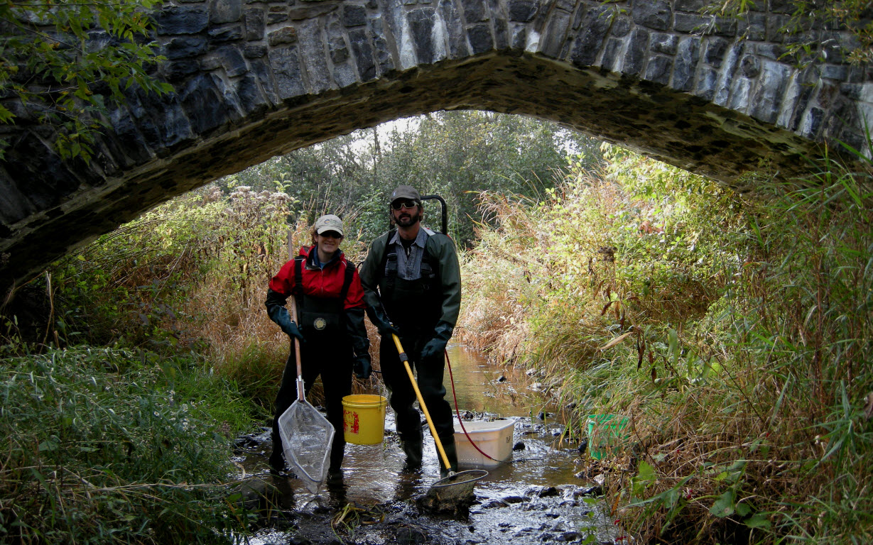
Cool and cold water streams are usually fed by ground water, with an upper temperature limit of 26°C. One of these rare streams, Shields Creek, is located within the village of Greely and is part of the Castor River Subwatershed. The Castor River, named for the many beavers that were found in the area, feeds into the South Nation River.
A team of volunteers and environmental organizations carry out an environmental management plan, involving habitat restoration, monitoring, trout stocking, and riparian protection for this area. The work in this City of Ottawa Park was completed solely by volunteers and donated materials and is still ongoing today.
SNC’s Stream Watch Program trains and equips local volunteers to work with staff to monitor river health and complete habitat restoration projects. This data is compiled with additional water, fisheries and forestry data throughout the jurisdiction, helping to produce science-based reports in order to better understand these resources.