California's Underwater Parks
In December 2012, California became an international leader in ocean protection by completing the United States’ first statewide network of marine protected areas (MPAs). Like the nation’s parks, forests and wilderness areas protect wildlife and habitats on land, MPAs protect and restore unique areas of the ocean. California’s MPAs come in many “flavors”; the size and level of protection, including fishing restrictions, can vary from one area to the next. Also called underwater parks or “Yosemites of the Sea”, they’re designed to protect an entire ecosystem, rather than protecting just a single species and ensure healthy, vibrant ocean life for generations to come.
California’s MPAs safeguard critical ocean habitat, allowing sensitive marine communities such as rocky reefs and seagrass beds to thrive and recover. They also protect biodiversity hotspots and important foraging grounds that support numerous species of fish and invertebrates, as well as seabirds and marine mammals. This in turn benefits a wide range of species including plants like bull kelp, invertebrates like sea stars, and marine mammals such as seals and otters. As safe havens, underwater parks offer a home and refuge for big, old, fat, female fish (BOFFFF) to recover, grow and replenish our ocean.
MPAs are a "network of underwater nurseries"!
The north coast region is the fourth and final coastal region to establish a network of MPAs. Within the region, 20 MPAs and 7 special closure areas were designated from the California/Oregon border in the north to Alder Creek near Point Arena in the south. The north coast additions include spectacular areas along California’s famously beautiful and remote Lost Coast. These MPAs represent approximately 137 square miles (13%) of state waters in the north coast region with approximately 51 square miles (5%) designated as "no take" state marine reserves. These MPAs were approved and adopted in June of 2012 and went into effect in December 2012.
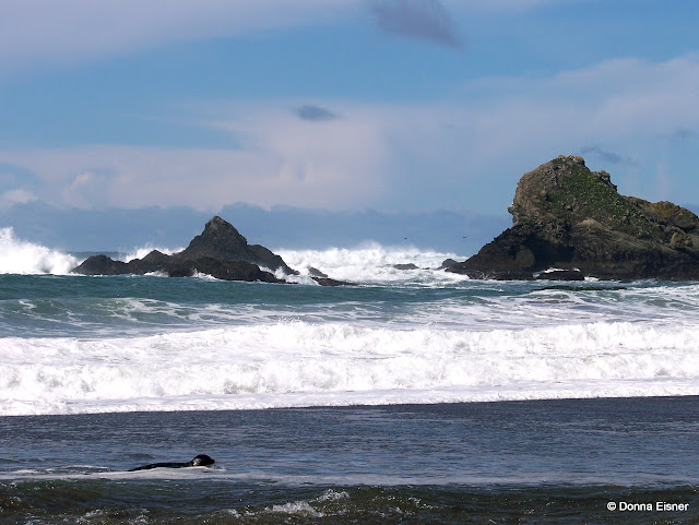
The Navarro River State Marine Conservation Area (SMCA) was designed to protect fish and bird communities associated with areas of diverse estuarine habitat, larval source, enhance reproductive capacity of numerous invertebrate species, as well as spawning and nursery grounds for populations that are found offshore. It also protects shorebird and waterfowl habitat,feeding areas for pinnipeds, as well as a habitat and transportation corridor for river otters.
The mouth of the Navarro River mingles fresh water and salty ocean water to support a great variety of wildlife, including harbor seals, river otters, and California sea lions.
Belted kingfishers, grebes, mergansers, buffleheads, egrets, and herons feed in and along the river, while airnorne raptors such as osprey and red-tailed hawks cirlcle the skies above looking for food.
Explore California's Underwater Parks without getting your feet wet through new online tours!
Based on Google Earth and requires 3D plug in for your browser; follow instructions.