
Seria Wkoło Warszawy powstała w celu zaznaczenia na mapie GC granic Warszawy, przy okazji pokazując ciekawe miejsca.
Zapraszamy do wspólnej zabawy oraz do podjęcia bonusa serii!

The “Wkoło Warszawy” (All Around Warsaw) series was created to mark the Warsaw city limits outline on the geocaching map.
Join the fun and try to get the bonus cache!

Die Rund-Um-Warschau-Serie entstand, um die Grenzen der Stadt auf der GC-Karte ersichtlich zu machen. Selbstverständlich wollten wir damit auch einige interessante Orte weiter empfehlen.
Haut rein, und schnappt euch am Ende auch die Bonus-Dose!
Trudno uwierzyć, że znajdujemy się w Warszawie. To miejsce robi wrażenie - samotna pętla autobusowa, dość porządna, pomiędzy pojedynczymi chałupami. A dookoła las i łąki. A to jest Warszawa od 1976.
Przy pętli kapliczka, obok kury w obejściu, niewiele tu ciekawego, tylko asfaltowa droga porządna, bo mało używana.
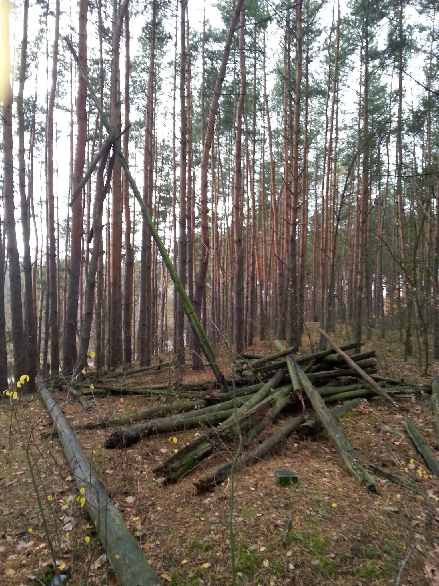
W lesie jest coś, co warto zobaczyć. Jeszcze do niedawna stała tu wieża triangulacyjna, a szukając kesza będzie można zobaczyć co z niej zostało. Wieża ta to drewniana wieża geodezyjna zbudowana w formie dwóch niezależnych, przenikających się piramid, z których wewnętrzna służy do podtrzymywania umieszczonego na jej szczycie znaku (umieszczonego centrycznie nad punktem ziemnym, służącego jako cel przy pomiarze kątów) oraz pomostu dla obserwatora, natomiast zewnętrzna, niższa, podtrzymuje słup na którym podczas pomiarów ustawiany jest instrument geodezyjny (również centrycznie nad punktem ziemnym).
Zmiana technologii pomiaru osnów geodezyjnych dzięki decyzji Billa Clintona o przekazaniu technologii GPS do celów cywilnych skazała takie wieże na wymarcie. Pożegnajmy relikt przedpotopowej technologii... sprzed 15 lat.
Kesz to preforma PET. Zawiera logbook, ołówek i FTF. Odłóż starannie.
It is hard to believe that we are in Warsaw, Poland. This place is impressive - a lonely bus terminus, quite respectable, between individual cottages. And around the forest and meadows. And this is Warsaw since 1976.
A wayside shrine, chickens in the farmyard, nothing interesting here. There is also a decent asphalt road, because little used.
In the forest there is something worth seeing. Until recently, there was a triangulation tower, and searching the cache will be able to see what was left of it. This tower is a wooden tower surveying built in the form of two independent interpenetrating pyramids, the inner of which is used to support placed at the top mark (located centrally on the ground point, serving as a target for measuring angles), and a bridge to the observer, while the outer, lower, maintains pole at which the measurement is set geodetic instrument (also centered on the ground point).
Change of geodetic measurement technology thanks to Bill Clinton's decision to transfer the GPS technology for civilian purposes such towers doomed to extinction. Let us say farewell prehistoric relic of technology... 15 years ago.
The cache is a PET preform. It includes a logbook, pencil and FTF.
Kesz znajduje się w odległości 196 metrów na azymucie 333.9° od współrzędnych startowych.
You will find the cache within 196 metres from the starting point at the angle of 333.9°.
Zachęcamy do podjęcia skrytki bonusowej po ukończeniu serii.