Ever wonder why this area is flat and grassy, while the area on both sides is hilly and full of rock? Well, let me explain. It all started when Bloomington was trying to create a water source for the town. Previous attempts at Leonard Springs and Griffey Lake to provide water to the city were unsuccessful due to the limestone allowing water to escape. So the city turned to the area near Salt Creek to attempt another water source. This area lies in the Norman Upland, which is made of impervious siltstone and shale.
History
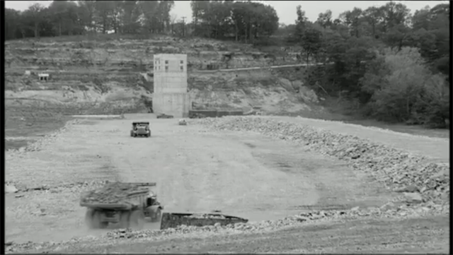
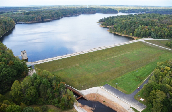
Construction on the lake began in 1960 and was finished in 1965 at a cost of $16.5 million. Salt Creek was dammed south of Bloomington, Indiana and the reservoir fills the valley to the northeast of the dam extending into adjacent Brown County.

It was thought that Elkinsville, a town in southern Brown County, had to be abandoned due to the path of the backwaters. Therefore the town was acquired through the power of eminent domain. Later, this was found not to be necessary; the result of a mistake in elevation estimates. The lake was designed as a primary water source for the City of Bloomington and to prevent flood damage downstream. The lake was created and is still managed by the U.S. Army Corps of Engineers, Louisville District.
In order to build the dam, material was removed from the nearby cutaway.
The spillway was formed by removing the random fill from it to build the dam out of. Part-way through construction, they decided to shore up the up and down-stream slopes of the dam with berms. The downstream berm is the big flat area below the dam.
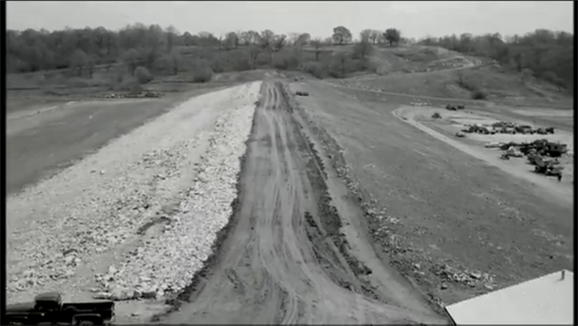
This meant removing more material from the cut spillway, making it twice as large as design intended.
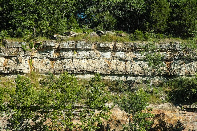
We shall be concentrating on Limestone which is prevalent in this area and quarried locally. Specimens of clay and other stone can also be found in the area. The same limestone composes a great part of the around the lake
So what is Limestone?
Well it is a sedimentary rock - mostly formed of grains of skeletal fragments of marine life. It also contains varying amounts of silica, clay silt and sand which gives limestone its variants of colours. Formed in shallow seas millions of years ago as the grains settled and together with the action of pressure and heat produced the rock that you see today.
Limestone makes up about 10% of the total volume of all sedimentary rocks. Soluble due to its grainy construction, thus forming many erosional landforms that you may have seen, from limestone pavements and pot holes to caves and gorges. Despite this, limestone is more resilient than most other sedimentary rocks. It is therefore usually associated with hills and downland, and occurs in regions with other sedimentary rocks, typically clays.
Being easy to quarry it is a popular building material as well as being the raw material for quick lime - used in cement and mortar. Powdered lime is used to neutralise soil by gardeners before growing vegetables or crushed limestone is used as aggregate. Limestone is particularly suited to sculptors and it also has a variety of other uses, so indeed a versatile rock.
So what is Aggregate?
Aggregate is crushed stone for use in road and railway foundations. Large stones are quarried and put down as a base, followed by smaller stones, then pebbles to create a surface that is easily paved over and stable. These varying size rocks are called "Aggregate" products. Aggregates are used not just for foundations of roads and rails, but for pavement, concrete and other construction products.
You will not be able to see all the aggregrate and material used to construct the dam. Once in place, grass was planted to help with erosion control. However, you can see some of the aggregrate limestone material at the exit of the spillway and along the shores of Salt Creek.
Send me the answers to my account of the following .....
1. How tall is the cut in the spillway cutaway?
2. Take time to look around the rock at its surface texture and list what you see.
3. At the Dam waypoint, what limestone products are used?
4. Does the limestone at the spillway look similar or different to the control tower on the north side of the dam?
5. Post a picture of yourself (face not required) or a personal item at the cutaway or the spillway.