Caminho do Xisto da Benfeita
 |
| Português |
English |
O objetivo é reunir um grupo, para percorrer, no dia 12 de Abril, percurso de xisto da Benfeita.
O evento, será prévio à caminhada, onde na Benfeita juntaremos os participantes para um pequeno convívio e retemperar as forças.
O evento será na localidade da Benfeita (nas coordenadas indicadas), das 8.30 às 9 horas.
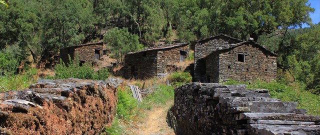
A caminhada, posterior ao evento, terá inicio às 9h, com uma pausa para almoço a meio, que cada um deverá transportar consigo, na Fraga da Pena ou em Pardieiros. Dependendo do andamento, a caminhada poderá terminar pelas 16h.
|
The goal of this event is to gather a group of people, on April 12, to walk in Benfeita and surroundings. .
The event will be prior to the walk, and will take place in Benfeita, to join participants for a small talk and regain strength.
The event will be in village Benfeita (the given coordinates), from 8.30 to 9 o’clock.
The walk, will start at 9 am. We will take a break for lunch at middle, or in Fraga da Pena, or in Pardieiros, so you should take your meal with you (easy to carry). We should be back in Benfeita at around 16 o’clock, ending our event.
|
 |
| A CAMINHADA |
THE JOURNEY |
 |
| Percurso |
Route |
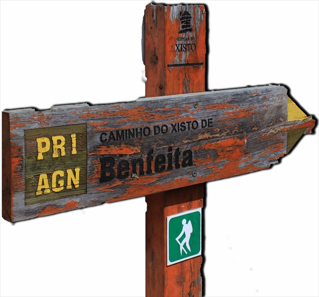
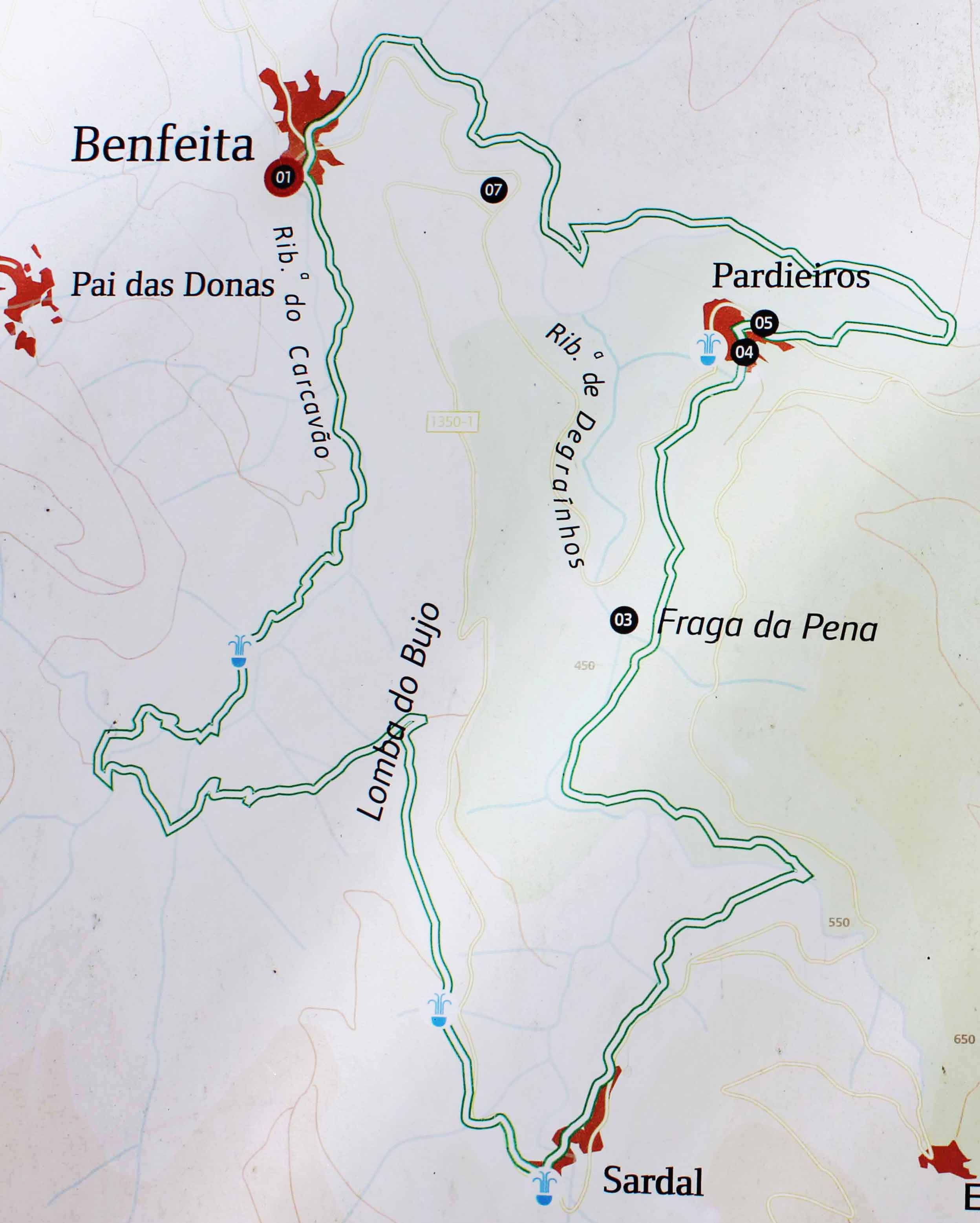
Caminho do Xisto da Benfeita
"No Açor, domínio do xisto, as dobras e fraturas originam um tipo de relevo característico, vigoroso mas de contornos arredondados, sulcado por vales com grandes quedas de nível, linhas de água encaixadas e onde por vezes se encontram curiosos acidentes geológicos, caso das quedas de água da Fraga da Pena." (in site ICN)
Track Wikiloc
Track oficial |
Benfeita Schist Walking Trail
“In Açor, a domain of schist, the cracks and bends make for a characteristical relief, vigorous, but with softened edges, carved by valleys and cliffs, water lines fitted in and where one can sometimes find curious geological formations, such as the Fraga da Pena waterfalls” (in site ICN about the APPSA)
Track Wikiloc
Oficial Track |
| Ficha técnica |
Trail data |
Tipo de Percurso:Pedestre PR (circular)
Ponto de Partida:Largo do Ameal, Benfeita
Ponto de Chegada: Largo do Ameal, Benfeita
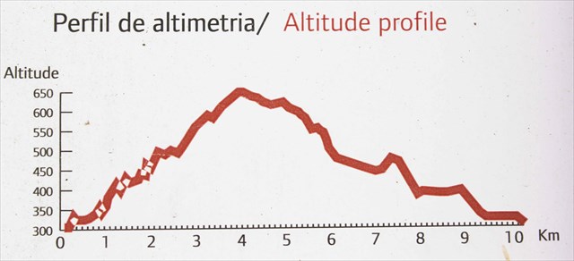
Distância:10 Km
Desníveis:576 m
Altitude Máxima:598 m
Altitude Mínima:299 m
Grau de Dificuldade: 3 - algo difícil
Época: Todo o ano, aconselhando-se alguma precaução no Inverno e em dias de chuva, podendo o piso tornar-se escorregadio. |
Trail type: pedestrian PR (round)
Departure point:Largo do Ameal, Benfeita
Arrival point: Largo do Ameal, Benfeita
Distance:10 Km
Altitude variation: 576 m
Maximum altitude:598 m
Minimum altitude:299 m
Difficulty level (1 to 5): 3 - Average
Advised time of the year: Every time during the year, but with careful during the winter time, especially in the rainy days, once it can be slippery. |
Percurso - Route
 |
Video do percurso / Video from this track
|