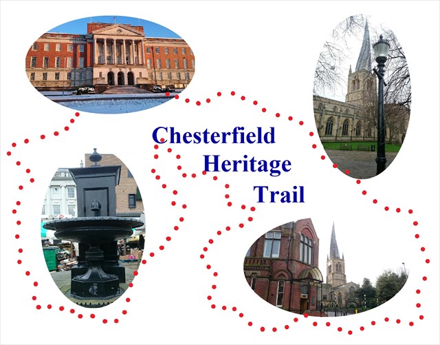
Chesterfield Heritage Trail
This heritage trail is designed to be done in a clockwise loop starting from the front steps of the town hall, however you can choose to tackle it in whatever route you prefer or even visit the waypoints separately a few at a time. The whole loop is 1.5 miles (2.1 km) and should take between 45 and 90 minutes depending on your speed or time taken with photos and information boards. I have walked it in 45 minutes and that included taking photos and coordinates at each waypoint. Be aware that whilst a lot of the route is on pedestrian areas there are some footpaths next to roads and you will be required to cross some roads along the way. Please therefore be mindful not to read directions and clues whilst walking for safety reasons, and take care if there are children with you that they are supervised as necessary at busy areas and crossings. It is designed as a simple route with easy clues so the whole family can get involved with this one. The route should also be accessible for wheelchairs and buggies, the suggested routes use dropped kerbs for crossings and in a couple of places there are alternative routes from one waypoint to the next avoiding steps. Some slopes are more severe than others in places though. Chesterfield naturally does have some historic cobbled pedestrian areas around the centre which may make it harder for walking or for wheels so take care. The final cache is about 30cm off the ground (slightly hidden) so hopefully still reachable from a wheelchair.
It is recommended you take a pen and paper along with you to note down the answers to the clues along the way as these answers will then give you the coordinates of the final cache hidden somewhere close to the loop. There is a printable answer sheet (jpeg image) and also a printable map within the photos attached to this page. The trail should be accessible all year round although any snow on the ground may hinder with the clue on Vicar Lane, or indeed if any blizzards cover clues on the sides of buildings. Some of the paths may be more slippery than others too if icy, e.g. Shentall Gardens below the Town Hall. You may also want to check before you set off that your phone app or gps device does display the full information in this description or alternatively print off this part. This extremely long description does give a detailed suggested route to follow including street names and directions, along with the waypoints to keep you on track and landmarks to look out for. There are then the questions at each waypoint to give you the clues for the final coordinates and the cache. The letters and numbers in red after the answers are highlighted to show you what you need for the coordinates, for example: (Answer = B) or (F = 5) (N.B. this may not show up as a different colour on all mobile apps, or may be an alternate colour to red on some web browsers but the text should stay the same)
There is also some historical information about the buildings or locations which is highlighted in blue to stand out from the general trail directions. (N.B. again this may not show up as a different colour on all mobile apps).
It is recommended not to attempt this trail at night because not only will you miss out on some great historical architecture but you also may not be able to spot the clues at given waypoints, even with a torch (which may look suspicious anyway!) Some of the answers will be a specific number but some are multiple choice and these answers will each have a different number next to them; this number for the correct answer will be the one you need to substitute in the puzzle for the final coordinates. For example if for waypoint E the answers are: 1850 (E = 5), 1855 (E = 7), 1860 (E = 4), 1865 (E = 9) and the answer to that question is 1855 then the number next to that answer (7) is the result for E. In the final coordinates you would substitute 7 in place of E. Please note that the answers A to M are not in any particular order around the trail so make sure you write down the number for the right letter.
The final cache is located at:
N AB° CD.EFG W H° IJ.KLM
There is also a final waypoint whose multiple choice answers will give you clues as to the size, shape and colour of the cache container you are looking for. For all the waypoints and puzzles you can solve them without the need to enter any buildings or climb on any structures you shouldn't. You are also NOT hunting around in public areas to retrieve any physical cache at the waypoints like with a traditional cache, so should be able to get your answers discreetly. You may want to take pictures of some historical items and buildings and then simply look like a tourist!
Although the final cache is located in a slightly quieter place than most of the town centre I cannot guarantee that there won't be anyone around at the moment you finally reach the destination. As long as no one is immediately around you can be fairly discreet in finding, retrieving and signing the cache, but please be patient and try later if any muggles are around. They may be close by, even behind you without you realising.
There is a pencil and logbook within the container, along with a FTF souvenir card for the first to get there. Well done on joint first-to-find by Bee Of Good Cheer & Nikosi, our pioneering trailers.
THE JOURNEY BEGINS AT THE TOWN HALL STEPS ON ROSE HILL.......
N 53° 14.196 W 1° 25.942
The current town hall was built in 1938 on the site of an old Georgian house called Rose Hill, which gives its name to the roads around 3 sides of the town hall. For 50 years before this was built, the council utilised some rooms in what is now the museum.
The first waypoint is now just a few steps away...
Town Hall
N 53° 14.195 W 1° 25.934
To the East of the steps on the smaller noticeboard we can see a map of the town centre, and a good place to start our trail. Take a moment to get your bearings if you’re not sure.
Question: On the town emblem at the top of the board there are 3 animals; how many legs in total have they got placed down on the ground?
Answer = A
Head East from the town hall for 150 metres along Rose Hill and this will take you to the next waypoint. Take care of one road crossing (Rose Hill East) on the way.
Rosehill United Reformed Church
N 53° 14.185 W 1° 25.821
On the north (left) side of the road you will pass the United Reform Church.
This is a grade II listed building originally built by some wealthy Independents and business people of the time. There is a sign above the door (viewable from the pavement) saying “Independent Chapel” along with the date.
Question: What is the last digit of this date? 182?
Answer = I
Continue along the same road, taking care crossing Soresby Street and Glumangate, walking past a number of mock Tudor black & white buildings. Take the next left onto Elder Way but cross over to walk down the opposite side.
Bridge over Elder Way
N 53° 14.226 W 1° 25.665
The first thing you may notice is that there is now NO BRIDGE OVER THE STREET. Sadly this has been pulled down in March 2018 as part of the demolition and refurbishment of the former Cooperative building. The waypoint name remains the same in memory of this fascinating bridge which resembled the famous Bridge Of Sighs in Venice, in the sense that it was high over the street between the buildings with no access from the street over the bridge. There is a new question which replaces the previous question about the bridge.
Half way down the road you can see the old Elder Yard Chapel, built in the late 1600's, although the gates are usually locked to this on most days so it remains somewhat hidden away.
Question:
On the large painted cream sign for the Elder Yard Unitarian Chapel there is a date at the very top of this. What is the last digit of this date? 169?
Answer = D
Carry on to the end of the road and follow the pavement around to the right, down Saltergate on the opposite side of the road to the ‘Donut’ car park, taking care crossing 2 side roads.
The donut used to play host to car boot sales on Sunday mornings and funfairs on bank holiday weekends, although these have now been located elsewhere.
There are a couple of pedestrian crossings then to get you across the end of Cavendish Street. Carry straight on and you’ll see The Winding Wheel theatre on the opposite side of the road.
The Winding Wheel is a listed building, once a picture house, then cinema with ballroom and restaurant, now a theatre and concert hall again.
There are 2 pedestrian crossings to get across the end of Stephenson Place, then just around the corner there is a zebra crossing to take you across the road to the next waypoint.
George Stephenson Memorial Hall
N 53° 14.203 W 1° 25.406
The large building on the right hand side of Corporation Street was originally the George Stephenson Memorial Hall, built to house lecture halls and talks by renowned institutes of mechanics and engineering. They named it after George Stephenson, who came to Chesterfield later in life during his semi-retirement and helped oversee the building of the local railway. He was possibly most famous for designing the ‘Rocket’ steam engine, but designed many other engines before this and even invented a miners safety lamp and worked on other engineering problems. The large lower part of the Hall is now the Pomegranate Theatre, originally the Civic Theatre which opened in 1949, taking the name from the pomegranate tree which appears on the Chesterfield Borough coat of arms. The western part of the building nearest the road has been the Museum since 1994. There was once the public library held within this building, and the Borough council also used the building before the current town hall was built.
If you care to venture into the museum (which is free) you can see the large room at the back originally used by the council, and lots of artefacts and old photos depicting Chesterfield history, including photos of many buildings visited on this Heritage Trail.
Question: On the side of the building there is the stone writing “Stephenson Memorial Hall” along with a year, AD XY7Z. Subtract the 1st digit and 2nd digit away from the 4th digit for answer G, i.e.
Answer G = Z-Y-X
If you have time for a historical detour off the trail then the railway (and Stephenson’s statue) is just down the road and across the foot-bridge over the bypass, passing a building with a blue plaque outside which remains from Chesterfield’s first railway station. There are also some unusual paving stones in front of the building. For now though this trail heads back up from the museum towards town.
Head back towards the churchyard, using the zebra crossing again on the corner. Take the steps up towards the church and follow the path past the war memorial and round the corner of the church into the front churchyard. For those in wheelchairs or unable to manage the steps there is an alternate route going back up Holywell Street slightly then following the pavement round to the left up Stephenson Place. After approximately 100 metres there is a small side road on the left called Church Lane with a pub on the corner, which joins up with the path around the church (follow it to the right when you approach the church).
Churchyard & Rykneld Square
N 53° 14.144 W 1° 25.512
In the churchyard you get a great photo opportunity of the spire.
The crooked spire, aka St Mary and All Saints church, is a famous landmark for Chesterfield, lending its iconic 'twist' to the football team (Spireites) and many other companies and organisations in the area. The church build started in the late 13th Century but not finished until around 1360. The Spire is approximately 70 metres from the ground and leans around 3 metres from its true centre. It is believed that the twisting was caused by a mixture of green timber, heavy lead (over 30 tonnes) and possibly even delayed building during the time of the plague when many skilled builders were in short supply. There are also a number of wilder stories in folklore as to why the spire became bent! Within the churchyard there was until recently Chesterfield’s oldest gas lamp from 1824 which was moved into the churchyard and would have made a good waypoint. Unfortunately this got damaged by a falling tree in 2014 but is hopefully being restored.
For the waypoint here, head out of the churchyard into the middle of Rykneld Square (named after an old Roman road and fort) above the Tourist Information Centre. There is a round plaque on the floor, in the middle of the square, that looks like a grate.
Question: How many letters are in the first word on the 4th line (before "Rykneld Street").
Answer = K
From this waypoint, head towards the town centre on the other side of the visitor centre, watching out for buses coming uphill as you cross over the road on to the pedestrian area of Church Lane. Take the first pedestrian road left down Steeplegate towards Vicar Lane.
Vicar Lane Shopping Area
N 53° 14.102 W 1° 25.540
At the corner of Steeplegate and Vicar Lane it opens up into a wider triangular area with a circular arrangement of paving stones in the middle (sometimes covered by displays or kids rides).
This area, St James Square, commemorates the opening of the Vicar Lane shopping area in 2000. There is also a plaque nearby on the wall. On the floor is an art display called Scramble which is a collection of coins and medals stuck into the paving slabs, all donated from local people.
Take a look at the two rings of stone slabs on the ground around the central circle.
Question: How many light coloured stone slabs make up the inner ring around the circular centre stone? (There are some cracked stones so be careful not to count a cracked one as two. They are all the same size to make it easier to see what should be a single stone).
Alternate Question: As this area is sometimes covered up by a green mat or a merry-go-round then you can also get the answer for F by looking at the plaque on the wall of the building, under the large screen, that commemorates the opening of Vicar Lane. How many letters are in the surname of the O.B.E. Councillor who officially opened this development.
Answer = F
Continue West along Vicar Lane and take the next left onto South Street. Part way down on the right hand side you’ll see an arched opening between the buildings into an old area of town called The Yards.
Falcon Yard
N 53° 14.087 W 1° 25.623
Question: What item is suspended from the wall above this archway?
- Metal church spire (H = 8)
- Chesterfield coat of arms (H = 5)
- Golden pointing hand (H = 1)
- A ferocious dragon (H = 3)
These yards were originally housing, with many small ‘kitchen-industries’ such as weaving and knitting also based here. Some of the old buildings still exist, but combined with new structures to form these small retail outlets which sprung up in the 1980s.
Walk through the archway into Falcon Yard speciality shopping area (passing the Falcon sculpture), carry straight on past this first mini cross junction until it opens up into the next yard, Theatre Yard.
Theatre Yard
N 53° 14.095 W 1° 25.666
As the name suggests, this yard once bordered a theatre which was built in the late 1700s and ran until around 1870. After the theatre closed the building was used to house the electric generators which powered Chesterfield’s first electric street lamps in the 1880s.
There in Theatre Yard is yet another animal sculpture, a large pink plastic one asleep on a plinth.
Question: What animal is this?
- Cat (C = 5)
- Horse (C = 3)
- Mouse (C = 6)
- Dog (C = 1)
If you head back north away from the steps through the narrow path you'll get back onto the cobbled pedestrian street. You will pass some interesting noticeboards with history of the old yards just before the cobbles. Cross over the pedestrian street and into the narrow 'Shambles' lanes opposite. The narrow lane you want for the next waypoint is not the one immediately opposite, it is the next one to the left (west) towards the market place, although there are several interesting lanes here in the Shambles if you have time to explore. Once again there are a couple of notice boards on the walls giving you old photos and historical information.
The Shambles & Old Inn
N 53° 14.126 W 1° 25.672
The Shambles used to be the butchery area in medieval times, with animal carcasses hung up across the narrow passages. Various other trades also took place here over the years, and there are picture boards showing some old images of the lanes. There is an old pub on one corner on Irongate built before the 13th century, and believed to have been used as a rest house for the Knights Templar during the Crusades.
Look for the plaque on the edge of this black and white wooden building.
Question: What year was it first mentioned as an inn?
Answer: 1?22 (L = the 2nd digit of this year)
If you now want to head back out into the main marketplace to look for our next waypoint, passing some information boards on the way.
Market Square Pump
53° 14.138 W 1° 25.734
You are looking for the old pump hidden somewhere between the market stalls.
This is now listed as a grade II structure of special architectural and historic interest, being in place even before the current Market Hall was built, by just a few years.
There are some steps up to the pump on the top side and a commemorative plaque.
Question: According to the plaque, in what year was this pump erected?
Answer: 185? (B = the last digit of this year)
From here you can see the grand tower of the Market Hall on the West side of the market square. Head towards this.
Market Hall
N 53° 14.132 W 1° 25.748
In 1204 king John granted a charter making Chesterfield a Borough, which also allowed the Lord of the land to hold markets on Tuesdays and Saturdays. After 1901 when the cattle market was opened and cattle moved off the streets, the market gradually grew from around 25-30 stalls to over 270 by 1920. This current Market Hall was opened in 1857.
To the right of the doorway on the outside there is a blue information plaque provided by the Chesterfield Historic Society.
Question: How many letter ‘W’ appear in the text on this plaque?
Answer = M
From the market place head south-east back downhill to the opposite bottom corner of the square and towards the library entrance (between the big M and the big chemists).
Living Wall Art
N 53° 14.083 W 1° 25.696
When you get to the library door, turn around and take a look at the wall opposite. You used to be able to see a living display of greenery on the wall, although this has sadly died off and been removed. From this point you can also see the crooked spire in the distance between the buildings and a golden hand pointing to the yards (if you squat down just right you can get the finger on the golden hand to appear to be touching the top of the spire, just for fun!)
This art display was started on St Georges day (23rd April) 2012 and took just under a week to complete, although it was supposed to keep evolving! It complements the other art sculptures in The Yards which were completed over the next 2 months to generate new interest into this area. Be aware this now has been removed so the question below has been slightly amended.
Question: What was the (original) dominant colour in this art display, given than it was originally living grasses and reeds?
- Black (E = 2)
- Green (E = 1)
- Blue (E = 5)
- White (E = 7)
If you now head down through the Pavements Centre, turning right at the supermarket and out on to the market cobbles again. The lower side of the Market Hall is in front of you. Turn left and head West for about 50 metres to the next waypoint.
The Peacock
N 53° 14.120 W 1° 25.811
At the bottom of this smaller market square there is a very old building with a blue plaque on the wall.
It is believed that this was once a Guild Hall, built around 1500AD, although now a coffee shop and before that it was the town visitor centre until the new one was built next to the crooked spire.
Question: On the blue plaque, how many letter ‘L’ appear on the top 4 lines of text (i.e. not including the lettering on the Chesterfield Civic Society badge at the bottom)?
Answer = J
Once you've got this answer it's time to head off to the last waypoint on the trail. Continue West along the pedestrian area and past another old black and white pub/hotel on your left.
This hotel, named after a lord of the manor (the Duke of Portland) was built here in the late 1800s as it was close to the old Market Place Station which is just further on down the road across from the bottom of Shentall Gardens.
The pedestrian area then meets up with the road again on the left. Continue to the pedestrian crossing but don't cross the road, unless you are wanting to take a detour into Queens Park and the Queen's Park Chess'Field cache (For the park head over the road through the gap in the building which was where the Market Place Station originally stood, and across the footbridge into the park). Continuing with the trail, you will now be at the bottom of Shentall Gardens, so head up the path towards the town hall. You’ll be able to see the unusually shaped old magistrates’ court on your left side.
This court served for almost 40 years before the current one on Tapton Lane was opened, and although it has not been used for over a decade it still remains as it is a Grade II listed building.
At the top of the path go up the steps and onto the pavement by the parking bays for the final waypoint. For those with wheelchairs or wanting to avoid steps you can go an alternate route from the last waypoint: head across the smaller market square from The Peacock to the top left (north-west) and follow the path through between the buildings past the borough council Customer Service Centre which will then curve round up to Rose Hill; the next waypoint is opposite the town hall on the side of the road you are on. This route is shorter anyway but the main route takes the scenic way up through the middle of the gardens.
War Memorial
N 53° 14.183 W 1° 25.951
Across from the town hall where the trail started there is the war memorial remembering those locals who were lost in either of the two world wars.
The war memorial was unveiled in May 1954 by the Duke of Devonshire, blending in to the balustrades, terraces and steps which were started in the 1930s. On the front of the central memorial chest tomb is a quote from the bible.
The bible quote is from a book in the old testament. The book name, chapter and verse numbers will give you a clue to the size, shape and colour of the final cache container so you have an idea what you are looking for. You don’t need any biblical knowledge for these answers, they are multiple choice based on the information there to see. It is written in the format “Book Number/Name – Chapter Number – Verse number”.
Question 1: Which book of the bible is it from?
- Genesis (cache width: 1cm)
- Numbers (cache width: 3cm)
- 1 Samuel (cache width: 6cm)
- 2 Kings (cache width: 25cm)
Question 2: Which chapter in this book?
- 11 (cache shape: square/rectangular)
- 25 (cache shape: cylindrical/round)
- 29 (cache shape: conical/cone-shaped)
- 31 (cache shape: spherical/ball-shaped)
Question 3: What verse (v) within this chapter?
- 1 (cache colour: army camouflage greens)
- 5 (cache colour: dark wooden brown)
- 12 (cache colour: white and grey)
- 16 (cache colour: black)
You should now have completed the trail and hopefully answered all the questions to solve the final clue. Take a moment to work out the puzzle and enter them manually into your gps or phone app. The hints in the War Memorial question will give you an idea of the size, shape and colour of the container you are looking for if you have correctly answered that question.
*** There is now a puzzle-checker at the bottom of the page if you want to check your answer before going looking for it. ***
The cache contains a small pencil and log book to record your visit, along with space for maybe just one small and light trackable. Avoid putting anything heavy in though, more than the magnets can support! Please ensure it is quiet around you when retrieving and replacing the final cache, screw the lid back on securely and check that it goes back in exactly the same place and the same way around thanks. Any problems with the clues, landmarks or access then let me know.
”I hope you have enjoyed your heritage trail today and possibly learned a few new facts about our town's history. Thanks to the permission and encouragement from the Chesterfield Borough Council, the help and information from the Chesterfield Museum, and the heritage and blue plaques provided by the Chesterfield Civic Society. Feel free to share any good photos taken along the way on this cache page, although I request that you do not take any photos that will give the location of the final cache away, or spoiler descriptions.
Regards,
Chezcache1”
***New addition - puzzle checker ***
