|
Indroduction:
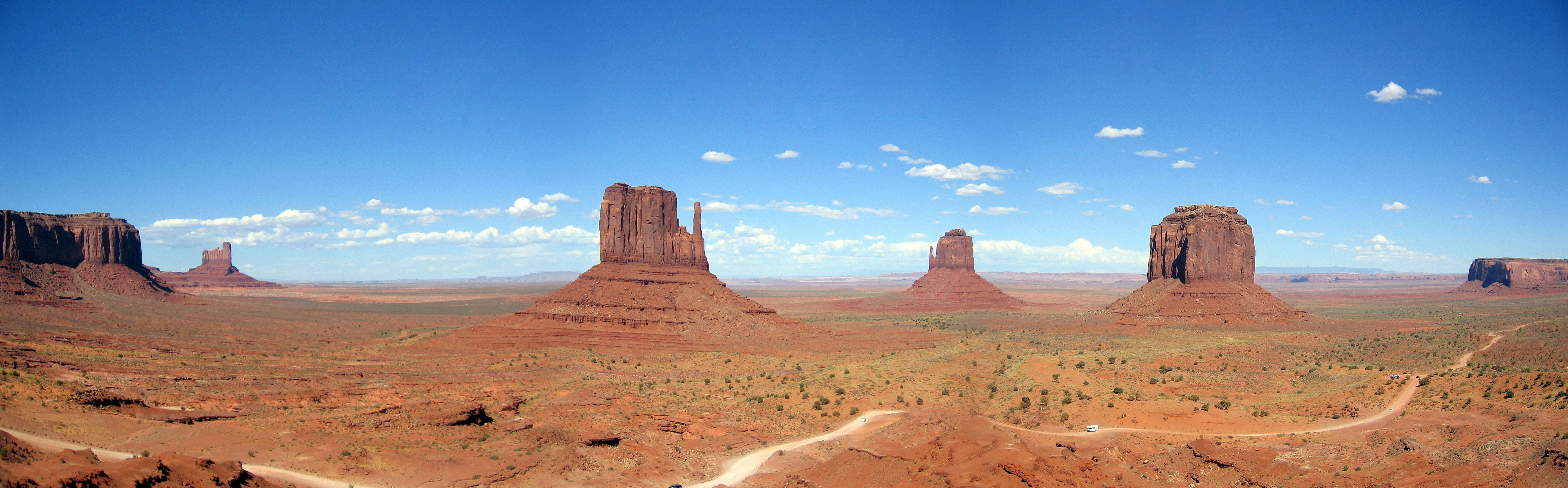
Vosges pink sandstones form the bedrock of the northern part of the Vosges. Their thickness can reach 500 m there. Operated for nearly two thousands years as materials for building castles, churches and monuments, they are the iconic stones of Alsace. For geologists, they represent the archive of a turning point in the history of the Earth, namely the transition from primary to secondary era. Similar sandstones are also found in the US (the Monument Valley, famous western movie landscape), Brazil, Morocco, South Africa, Australia ... All these formations are dated from Permian and Triassic that is to say, a time interval between 275 and 200 million years.
The rounded shapes of the Vosges mountains come from a long geological process.
Large steps alternate from formation of mountains to their erosion, the most recent, occurred 12,000 years ago and have left many traces in the landscape of the massif. Three main geological units compose it, characterized by the predominance of granite and sandstone.
The formation of the Vosges Mountains:
- 350 million years ago, the meeting of two continental plates caused an intense volcanic activity, both aerial and subaquatic. Lava and ashes were deposited on the primary rock. The Rossberg, massif between the valleys of the Thur and Doller, illustrate this event. There, green porphyry and rhyolite can be found.
 · ·
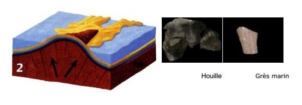
- Then, 300 million years ago, a large mountain range, the Hercynian massif, forms on a part of the current Europe. However, it is eroded in 50 million years. During the Carboniferous, sedimentation of plant debris in large marsh is at the origin of the formation of coal. South of the Vosges Mountains, the Ronchamp coalmines were operated for two centuries. The Hercynian massif, reduced to a peneplain sinks. Then, a sea covers it completely for 100 million years, marine sedimentation gives then sandstones, particularly exposed in the northern Vosges, marl and limestone. The limestone hills in the Rouffach area, are the home of a flora adapted to a warm and dry microclimate.
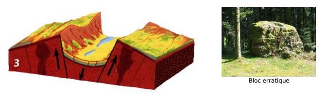
- Ultimately, 50 million years ago, as a result of the formation of the Alps, the old Hercynian massif rises again. It breaks up the middle, collapses into steps to form the Rhine rift. On the western and eastern edges appear the Vosges and the Black Forest. Erosion starts again, strips the socle and sculpt valleys thanks to the faults, the sea invades the Rhine Valley. Glaciers cover the Vosges Mountains during several cooling phases. It carves valleys and refines the relief. The ultimate glacial period dates back to 12,000 years ago. Many cirques and glacial lakes were left as witnesses of this period, as well as the small depressions and glacial erratics of the “Thousand Ponds” plateau.
The three main geological units of the Vosges Mountains:
In the northern Vosges, north of Saverne, the uprising was moderate, altitude is low, the sandstone cover was only slightly eroded.
In middle Vosges, between the Col de Saverne (Saverne Pass) and the Liepvrette Valley, the uprising was stronger. The granite massif of Champ du Feu (Field of Fire) dominates at 1100m.
In the southern Vosges, granite and gneiss were stripped by erosion, except on the Lorraine plateau. The slopes of the Alsatian side are steep and glaciers carved cirques.
The origin of sandstone: indurated sands
The mineralogical composition of Vosges sandstones contains quartz, feldspars, micas. It is close to granites composition. We deduce that the sandstones come from the alteration of granitic rocks. With microscope, it can be seen that the grains are aggregated by a siliceous cement. Sandstones are consolidated sands.
The red colour: the reddening phenomenon

The dominant colour of Vosges sandstones is pink. However, grey levels and light spots are common, especially in younger formations like Voltzia sandstone. Therefore Triassic sandstones are designated by the term Buntsandstein Sandstone or variegated. Microscopic observation revealed that the red pigment, iron oxides, responsible for the colour of the sandstone comes from the alteration of original iron-rich minerals such black mica (biotite) or magnetite. As they decompose, they release their iron that migrates to the neighbouring grains and covers them with a thin pink film. This is the reddening phenomenon, a process that continues during the burial of the sediment. Thus, some sandstone levels are still grey while others have turned pink, and others with variegated tints are reddening.
Reminder about "Earthcaches": There is no container to search for or logbook to sign. Simply visit the place and run the queries from the cache owner with the sending of answers by email for validation. Good Earthcaching!
To validate your visit:
1-. How are these formations called in Lorraine?
2-. What caused the formation of these columns? (Explain it with your words)
3-. On one side of the large mound that maintains this column there is a very curious formation, could you give me the name of this phenomenon?
4-. A picture of you would be welcome. (Optional)
|