Located along Walnut Street in Grafton, Grafton National Cemetery was opened in 1867 to inter veterans of the Civil War. Early burials were of soldiers who were relocated from other temporary cemeteries throughout the region. These early interments included 1,252 Union soliders, 613 of whom were unknown. One of the people buried in this cemetery is T. Bailey Brown, who was believed to have been the first Union Civil War casualty in 1861.
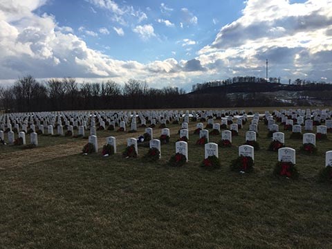
Due to its limited 3-acre size, Grafton National Cemetery began running out of space in the 1960s. A 1975 study determined use of the remaining available space was not cost-effective. A 58-acre site was located nearby adjacent to the West Virginia Industrial Home for Boys at Pruntytown. The new West Virginia National Cemetery, located along U.S. Route 50, opened in 1987.
One notable interment at West Virginia National Cemetery is PFC Lawrence Harris. Harris was killed in 1944 while fighting in France, but due to a bureaucratic error, he was initially buried at the Ardennes American Cemetery in Belgium. Following the discover of an ID bracelet in 2003, DNA analysis was performed which positively identified Harris. His body was relocated to his native West Virginia in 2010.
To determine the coordinates for the final stage:
- How many years passed between T. Bailey Brown's death and the opening of Grafton National Cemetery? This is A.
- In total, how many acres of land are in the two national cemteries in Taylor County? This is B.
- What route number do visitors use to access West Virginia National Cemetery? This is C.
- How many years passed between Lawrence Harris's death and his reinterment at West Virginia National Cemetery? This is D.
- Multiply A by D. This is E.
- Add B to C. This if F.
- As of November 15, 2020, the final is at N 39 20.(E+79) W 080 05.((F*4)-41). Any coordinates prior to this date will need to be updated using this formula.
You can check your answers for this puzzle on GeoChecker.com or using Geocaching.com's built-in checker tool below.
No part of this cache is located on or near national cemetery grounds. You do not need to visit either national cemetery to solve this puzzle.
The final for this cache is on public property at Pruntytown State Farm Wildlife Management Area. Depending on when you go, you may need to climb over a gate for access to the site. Be cautious during hunting season and avoid any livestock that may be grazing in the area, as this is part of a working farm.
Complete the whole geotrail!
This geocache is part of a series of geocaches (see them all) in Taylor County. As of November 2021, seven of the original eleven caches remain. Find at least six to get a special Taylor County Geotrail wooden nickel! Fill out the codeword puzzle to receive your reward.