To claim a find please email your answers to me via the GC.com website (DO NOT POST YOUR ANSWERS IN YOUR LOG). There is no need to wait for confirmation before logging, if there is a problem with your answers I will get back to you.
1) Using the information centre at the entrance (waypoint IC), gather the following information:
A- How high is the Devils Cataract? (info board no8 or at viewpoint no3)
B- What is the average depth of the river in the Batoka Gorge which is below the falls?(info board no5)
C- How many previous sites of the Victoria Falls have there been? (info board no2)
D- How many possible future faults are there that the falls may follow? (info board no2)
Head to GZ and answer the following.
2) The cataract is eroding the basalt to create a new waterfall. In what direction do you think the new waterfall will erode? Use image 4 on the page for inspiration should you need it. Give your answer as N , S , E , S-E etc.
3) (OPTIONAL) Post a picture of yourself or your GPS unit if you are solo with the cataract in the background, and please feel free to add any other pictures from your trip you might want to share.
For Dr David Livingstone, the first European visitor to witness the Falls in 1855, it appeared as if the earth had been torn apart by some great cataclysmic event, and that the river had fallen into this cleft in its bed. However, the history of the Zambezi River and story of the formation of the Victoria Falls is not quite so straight forward.
The original formation of the falls started about 200 million years ago during the Jurassic period when tectonic activity caused a breakup of landmass. Huge cracks and fissures formed in the earth's crust from which erupted huge volumes of molten basalt.

See Earthcache Danger point rocks for more information on basalt.
See Earthcache 'Great River' to learn more about the formation of the Zambezi River.

Birds eye view of the falls and the gorge
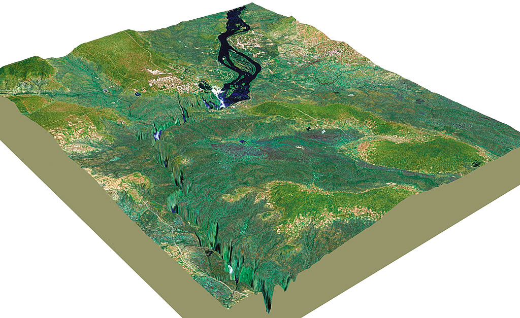
The surrounding terrain
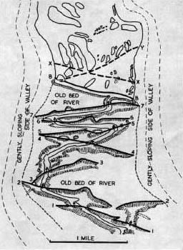
Potential future faults
Devil’s Cataract, which is on the Zimbabwean side of the Falls, is the lowest point of the Falls, It is separated from the rest of the Falls by Boaruka Island/Cataract Island (The name "Devils Cataract" comes from the adjacent island in the river where the local tribes used to perform sacrificial ceremonies. When the missionaries arrived in the area they referred to these ceremonies as “devilish” and hence the name was given to this cataract).
The Devil’s Cataract is the weakest point in the geological composition of this waterfall system. Here, the Zambezi has cut a 10-metre-deep groove in the hard basalt and, as it continues to erode away, more and more water will be channelled through it and away from the rest of the Falls. At some point in the future, which could be sometime in the next 10 000 years, Devil’s Cataract will cut back into one of the joints that are filled with softer material. This may happen slowly over time, or could happen catastrophically if part or all of Boaruka Island/Cataract Island should collapse into the gorge below.

The cataract
These gorges are under threat from a proposal to build a dam to produce hydroelectricity. If the project goes ahead the gorge below the falls will be flooded covering an area of approximately 26 square kilometers. The reservoir will be long and narrow, stretching to just about 1km from the plunge pool of the Victoria Falls. Hopefully this gorge is still around for future generations to enjoy.