PT 2 PICO DO SAPATEIRO
PORTUGUÊS
Este Power Trail é composto por cinco caches tradicionais e tem por objetivo dar a conhecer este bonito trilho municipal (TM02 do Concelho da Ribeira Grande), que foi inaugurado em novembro de 2014.
PICO QUEIMADO/PICO DO SAPATEIRO
O historiador Gaspar Frutuoso, vivo à data deste episódio vulcânico, refere, a propósito deste algar, que dele brotou “...uma ribeira de fogo pela Ribeira Seca abaixo até chegar ao mar, correndo mansamente como metal derretido...".
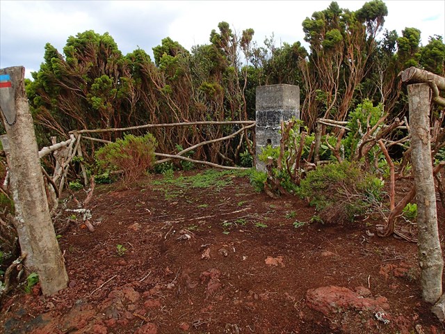
Não foi somente a lava emanada da erupção vulcânica através deste algar que contribuiu para a origem do Pico do Sapateiro. Foi antes formado a partir de uma série de vulcões que se verificaram no sul da freguesia da Ribeira Seca, de que restam ainda algumas crateras. Na parte superior deste pico pode assim observar-se quatro pequenas crateras, uma das quais encima este algar, formado durante a erupção vulcânica de 1563.
O Pico do Sapateiro, assim chamado "... por em outro tempo ser de um oficial deste ofício" (Gaspar Frutuoso) é hoje conhecido por Pico do Queimado.
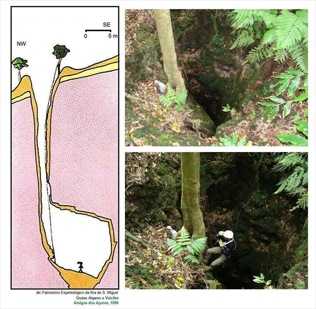
O “algar” do Pico Queimado é uma formação geológica localizada na vertente NW do Pico Queimado e corresponde a uma antiga chaminé vulcânica localizada na freguesia de Santa Bárbara, concelho da Ribeira Grande, nesta Ilha.
Esta cavidade apresenta uma geomorfologia de origem vulcânica em forma de algar, dotado de cone vulcânico, com cratera vulcânica localizada em domo traquítico.
Este acidente geológico apresenta uma respeitosa profundidade de 37 metros e desaconselhamos que tente descer sem ser conduzido por pessoal experimentado e equipamento de escalada adequado. Mesmo para os mais experientes, a sensação de abismo é quase sempre assustadora…
Este “fenómeno geológico” é constituído por uma fenda vulcânica, por um cone vulcânico secundárioe pela cratera principal.
TRILHO TM02
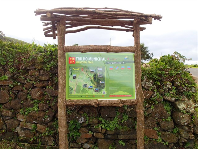
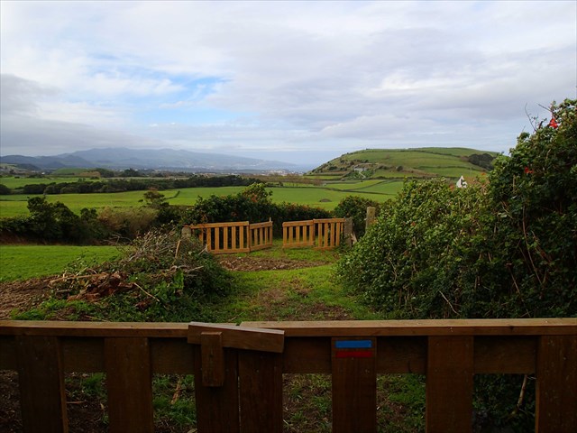
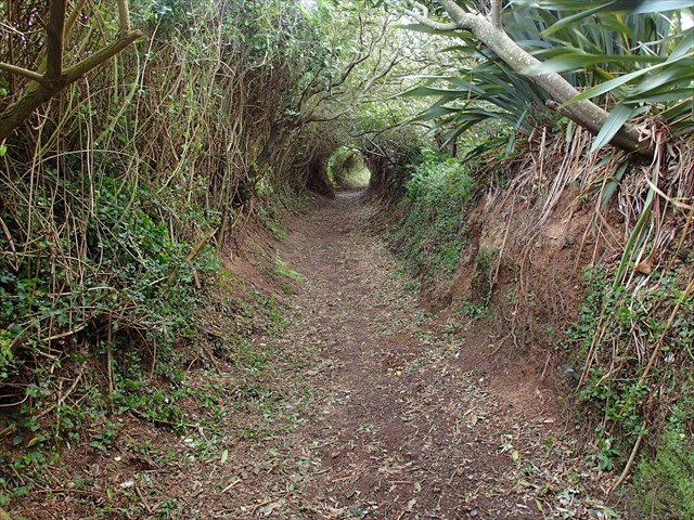
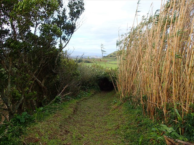
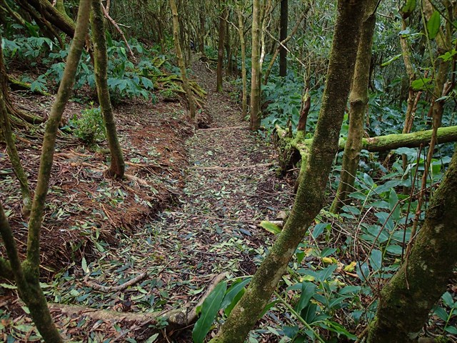
Este trilho municipal foi inaugurado no final de novembro de 2014 e reforça a oferta turística e de lazer a quem gosta de estar em contato com a natureza e manter-se ativo através da caminhada. Inicia-se ao quilómetro três da estrada secundária da Mediana, no sentido norte-sul, Santa Bárbara – Cabouco. É um trilho com cerca de 2,4 quilómetros de distância de valor vulcanológico e paisagístico. O trilho é classificado de dificuldade mediana e demora cerca de duas horas a percorrer. O final do trilho coincide com o seu início.
Os pontos “especiais” deste trilho são:
1) Escoada basáltica da erupção de 1563,
2) Fenda do Pico Queimado,
3) “Algar” do Pico Queimado,
4) Vista panorâmica para o Vulcão do Fogo
5) Complexo vulcânico dos Picos e Vulcão das Sete Cidades,
6) Cratera do Pico Queimado
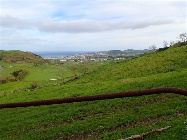
Durante este passeio é possível desfrutar de diversas vistas sobre a costa norte, nomeadamente sobre a cidade da Ribeira Grande, assim como para toda a zona oeste da ilha de São Miguel, desde o vulcão do Fogo até ao vulcão das Sete Cidades.
A CACHE:
A cache tem um formato convencional. Deverá levar consigo, para todo este PT, material de escrita.
AGRADECIMENTOS:
Agradecemos a especial colaboração da Câmara Municipal da Ribeira Grande e dos amigos geocachers: Miguel Cassis e Pedro Silva.
PT 2 - THE SHOEMAKER PICO
ENGLISH

This Power Trail consists of five traditional caches and aims to make this beautiful trail (TM02 the municipality of Ribeira Grande), which opened in November 2014, known.
“PICO QUEIMADO/PICO DO SAPATEIRO”
The historian Gaspar Fructuoso, live the date of this volcanic episode, he says, the purpose of this grotto, which it sprang "... a fiery stream by “Ribeira Seca” below to reach the sea, running quietly as molten metal ...".
Was not only the lava emanating from the volcanic eruption through this grotto that contributed to the origin of the Shoemaker Pico. It was before formed from a series of volcanoes that have occurred in the southern parish of “Ribeira Seca”, that there are still some craters. At the top of this peak can therefore be observed four small craters on top of which this algar formed during the eruption 1563.
The Pico Shoemaker, named "... for another time be an officer of this office" (Gaspar Frutuoso) is now known as Burnt Peak (“Pico Queimado”).
This cache aims to make known the dynamics and traces of volcanic eruption the consequences seen in 1563, which led to the Shoemaker Pico (“Pico do Sapateiro”), now called Burnt Pico (“Pico Queimado”).
The "grotto" of Burnt Peak is a geological formation located in NW part of the Burnt Peak and corresponds to an ancient volcanic chimney located in the town of Santa Barbara, municipality of Ribeira Grande, on this Island.
This cavity has a geomorphology of volcanic origin in the form of grotto, endowed with volcanic cone, with volcanic crater located in traquítico dome.
This geological accident presents a respectful depth of 37 meters and discourage that try down without being led by experienced personnel and proper climbing equipment. Even for the most experienced, the feeling is almost always frightening abyss ...
This "geological phenomenon" consists of a volcanic fissure by a secondary volcanic cone and the main crater.
TRAIL TM02
This city trail opened in late November 2014 and reinforces the tourist and leisure offer for those who enjoy being in touch with nature and keeping active through walking. It starts at kilometer three country road Median, in the north-south direction, Santa Barbara - Cabouco. It is a trail with about 2.4 kilometers away from volcanological and with landscape value. The trail is rated Mid difficulty and takes about two hours to do. The end of the trail coincides with the beginning.
The "special" points of this trail are:
7) basaltic zone from the 1563 eruption,
8) Cleft of the Burnt Peak,
9) "Algar" of the Burnt Peak,
10) Panoramic view of the Volcano of Fire
11) volcanic complex of “Picos” and volcano of “Sete Cidades”,
12) Burned Peak Crater
During this tour you can enjoy various views of the north coast, in particular on the city of Ribeira Grande, as well as to the entire western part of the island of São Miguel, from the “Lagoa do Fogo” up the volcano of the “Sete Cidades”.
THE CACHE
The cache has an conventional shape. You should take to this whole PT, writing material.
THANKS:
We appreciate the special collaboration of the Cityhall of Ribeira Grande and geocacher friends: Miguel Cassis and Pedro Silva.