The Location
The Rutherford County Convention and Visitors Bureau is an all-in-one hospitality stop to help you plan your visit to Rutherford County. The state-of-the-art Visitors Center features maps, brochures, a Civil War timeline, kiosks with details on attractions and touch-screen interactive directories for lodging, dining, attractions and events.
The Area
Rutherford County was created from parts of Davidson, Sumner, Williamson and Wilson Counties in 1803. The county was named in honor of Revolutionary War General Griffith Rutherford and was once hunting grounds for the Cherokee, Chickasaw, Choctaw, Creek and Shawnee nations. The Stones River, a major tributary of the Cumberland River named for explorer Uriah Stone around 1767, provided a transportation route and water source for settlers and power for mills built throughout the county. From 1818 to 1826, our county seat, Murfreesboro, was the capital of Tennessee.
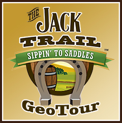
The Jack Trail GeoTour
The Jack Trail GeoTour is a series of geocaches along the backroads and small towns of Middle Tennessee. There is no fixed itinerary, like on a traditional trail, but rather a series of points of interest in a self-guided, goal-oriented plan. We have created a special passport, which you can download here, which lets you track your progress as you hunt specially placed geocaches along the tour. This passport will help you collect “code words” to qualify for special geocoins for completion of the GeoTour.
 Special thanks to Camper John who archived an existing listing to make this cache possible.