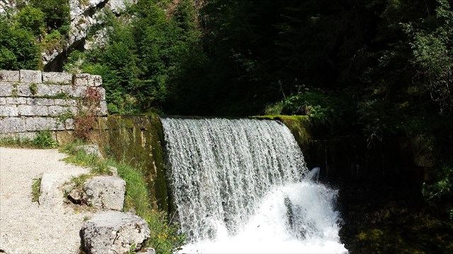
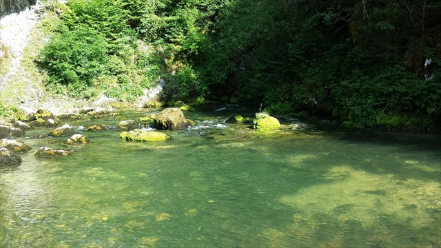
Au fond de cette fracture rocheuse, les eaux du Doubs jaillissent à l’air libre au terme d’un voyage mal connu dans l’épaisseur des calcaires du Noirmont.
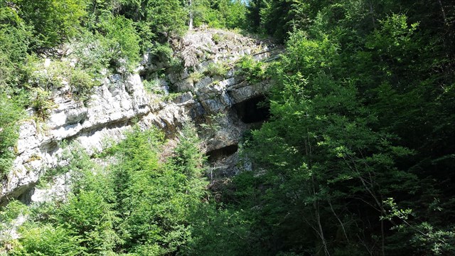
A cet endroit, la roche « recule ». En effet, l’affleurement rocheux est formé d’un empilement de couches de calcaire. Initialement horizontales, repoussées par les Alpes, elles amorcent un mouvement de bascule, c’est le Jura plissé.
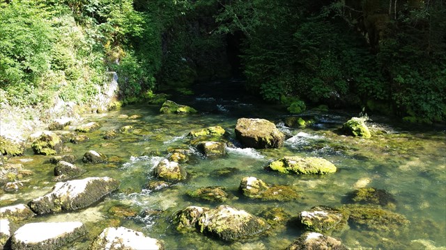
Certaines couches, lorsqu’elles sont gorgées d’eau, éclatent sous l’action du gel et se creusent. Les cailloutis issus de l’érosion par le gel sont évacués par le torrent en période de crue.
Les gros blocs proviennent des couches plus résistantes au gel, se trouvant en surplomb. Ils se sont effondrés sous l’effet de leur propre poids...
Pour valider cette earthcache, vous devez répondre aux questions suivantes :
1. D’où étaient originaires les spéléologues qui ont exploré la source pour la première fois ?
2. En quelle année cette exploration a-t-elle eu lieu ?
3. Quelle est la température à laquelle l’eau est toujours comprise ?
4. L’eau qui jaillit à cet endroit est-elle douce ou salée ?

After passe through the karstic strata of the Noirmont mountain in a fairly unknown course, the Doubs spring water rises to the surface.
At this point, the rock "back." Indeed, its protrusion is formed of a stack of layers of limestone. Initially horizontal, pushed by the Alps, they begin a rocking motion, the Jura folds.
Some layers, where waterlogged burst under the action of frost and dig. The gravel from erosion by gel were evacuated by the river during floods.
Large blocks come more resistant to frost layers lying overhang. They collapsed due to their own weight ...
To validate this earthcache, you must answer the following questions:
1. Whence came from cavers who explored the source for the first time?
2. Which year this exploration does it happen?
3. What is the temperature at which water is always included?
4. The water flowing at this point is it sweet or salty?

An der Unterseite dieser felsigen Graben das Wasser des Doubs Frühjahr im Freien, nachdem eine wenig bekannte in der Dicke der Kalkstein Noirmont Reise.
An diesem Punkt, der Fels "zurück." Tatsächlich ist seine Vorsprung aus einem Stapel von Schichten aus Kalkstein. Zunächst horizontal, von den Alpen geschoben, eine Schaukelbewegung beginnen sie, faltet die Jura.
Einige Schichten, wobei unter der Einwirkung von Frost schlammigen Burst und graben. Der Kies von Erosion durch Gel wurden durch den Fluss bei Hochwasser evakuiert.
Große Blöcke kommen widerstandsfähiger gegen Frost Schichten liegenden Überhang. Sie brach durch ihr Eigengewicht ...
Um diesen Earthcache zu bestätigen, müssen Sie die folgenden Fragen beantworten:
1. Woher kam von Höhlenforschern, die die Quelle zum ersten Mal erkundet?
2. Welchem Jahr diese Erkundung ist es passiert?
3. Was ist die Temperatur, bei der Wasser ist immer enthalten?
4. Das Wasser fließt an dieser Stelle ist es süß oder salzig?
Réponses / Answers / Antworten:
wolverine.earthcache@gmail.com