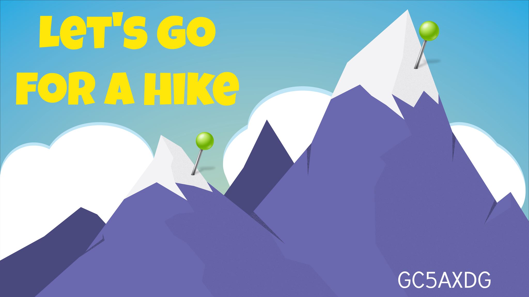
This is a hiking event that will be held at the top of a Colorado 14er Grey's Peak (14,278 ft.). This event is set for the top and is not in the parking lot. Do not attempt this event if you are not able to complete a strenuous hike at high elevations.
This should be a lot of fun - we will hike, talk, and once we get to the summit we will take a break and have some lunch. We start our ascent at 6:00 AM with an intention of being at the summit around 1:00 PM. You can hike with us or make your own way to GZ for the event. We will then take our time enjoying the views as we eat our lunches (BYOL). Around 1:30 PM the event will be over. We will also be going to Torrey's Peak (14,275 ft.) which is outside of the event but all are welcome to join.
Event times:
Start: 1:00 PM
End: 1:30 PM
Where: Grey's Peak Summit
Trailhead:
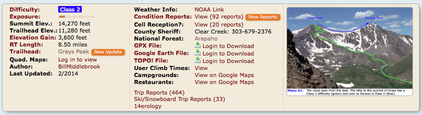
Take I-70 to the Bakerville exit (#221). Leave the highway and drive south over to the dirt parking area near the start of Forest Road 189. This is the winter trailhead and, even if the upper road is open, low-clearance passenger cars should park here. It’s almost 3 miles to the summer trailhead. Reach a junction after one mile - stay straight and follow the sign for the Grays Peak trailhead. Continue another 2 miles to the trailhead at 11,280’. There are restrooms and a few dispersed camping spots near the parking area.
Route Info:
Route: Photo #1 provides a distant view of the route. Start the hike by crossing the large bridge that spans Stevens Gulch and follow the well-defined Grays trail up the hill into Stevens Gulch. Taken near 11,800‘, Photo #2 shows the view of Grays Peak at you hike up the hill on the road-like trail. Continue for 1.5 miles to an information sign where there are excellent views of the two peaks - Photo #3 and Photo #4. Shortly after this point, hike to and across a flat, rocky area - Photo #5. The trail gradually turns left as it climbs behind a small ridge that runs south up to the east side of Grays - Photo #6. As you hike around this area and along a small basin, Torreys Peak is to your right. Continue west and southwest as more of Grays comes into view. Near 12,600‘, the trail turns left and continues south along the small ridge - Photo #7. Continue along the ridge (Photo #8) to 12,800‘ (Photo #9) where the trail again turns up to the left. Hike on easy terrain (Photo #10) to a trail junction above 13,200‘ - Photo #11. Taken from Kelso Ridge on Torreys Peak, Photo #12 is a different view of the area. Stay left on the main trail toward Grays Peak and hike (Photo #13) until you come to a corner with a large overlook of Stevens Gulch (approx. 13,700‘). From the corner, turn right and gradually ascend west across Grays Northeast Slope - Photo #14. Follow the easy trail as it climbs toward the summit - Photo #15. As you climb, Torreys is waiting off to the northwest - Photo #16. After 3,000‘ of elevation gain and over 3.5 miles, gain the Grays summit - Photo #17. This is the time to decide whether or not to proceed to Torreys. If so, your first goal is to hike down Grays‘ North Ridge. It‘s a 575-foot descent on a rough trail and it‘s the most difficult portion of this route. The ridge is rocky but still Class 2. From the summit, drop northwest off Grays (Photo #18) and begin the descent down Gray‘s North Ridge - Photo #19. Shortly after leaving the summit, the trail stays to the right of the ridge slightly before turning left back to the ridge for the remainder of the descent to the Grays-Torreys saddle. Photo #20 and Photo #21 were taken along the ridge and Photo #22 looks back up the ridge from about 13,800‘ above the saddle. Continue down to the broad saddle at 13,700‘. Again, this is a good time to retreat if necessary. On the Grays side of the saddle, there is a trail that descends east back to the main Grays Peak trail. It‘s the trail used for a direct hike of Torreys, without Grays. It‘s also good to identify this trail because it will be used for your final descent after summitting Torreys. Photo #23 shows the remaining, straightforward route from the saddle to the Torreys summit. Hike across the saddle and begin the ascent of Torreys - Photo #24 and Photo #25. After about 100‘ of elevation gain it becomes clear that the trail up Torreys is a bit more loose and rugged than the main Grays trail. Follow the trail up along Torreys‘ Southeast Ridge (Photo #26) all the way to the summit. It‘s about 575 feet of elevation gain from the saddle to the summit, and once you are there, you will have traveled nearly 4.5 miles from the trailhead. Photo #27 looks back at the route and Grays Peak. For your descent, hike back down off of Torreys and locate the trail that drops east from the Grays side of the saddle - Photo #28. The trail (Photo #29) has large cairns that can be seen from a distance. Continue down to reach the Grays trail near 13,200‘ - Photo #30.
All photos can be found here.