Les Strates des falaises de Chassiron EarthCache
Les Strates des falaises de Chassiron
-
Difficulty:
-

-
Terrain:
-

Size:  (other)
Please note Use of geocaching.com services is subject to the terms and conditions
in our disclaimer.
Falaises de Chassiron
Français
Descriptif
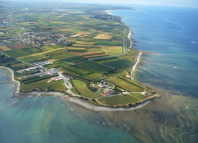
Les coordonnées vous emmènent au nord de l’ile d’Oléron près du phare de Chassiron. Cette partie de l’ile est constituée en grande partie de roches (jurassique et crétacé). Vous pouvez ici observer les roches sédimentaires avec ses couches (ou strates) très marquées par ses lignes parallèles plus ou moins horizontales. Les formes et le contenu des strates permettent de dater et de comprendre leur histoire.
Elles ont été formées à partir de particules d’autres roches, de restes d’êtres vivants transportées par l’eau de l’océan.
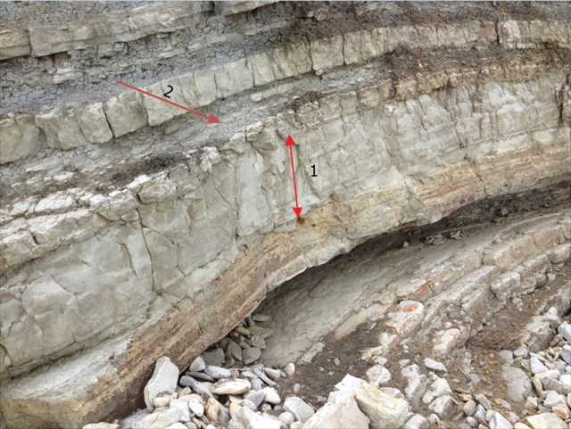
Ici vous trouverez des roches sédimentaires telles que le sable, le grès, l’argile, le calcaire mais aussi les marnes et le poudingue.
Validation de la cache
Pour valider (être autorisé à loguer) cette cache vous devrez m'indiquer pas mail :
- la hauteur de la couche calcaire représentée "1" sur la photo.
- le nom de la strate représentée "2" sur la photo
- Vous pouvez également ajouter à votre log une photo de vous ou de votre gps sur place (ceci n'est pas obligatoire mais pourrait permettre de valider la cache en cas de réponse trop éloignée de la réalité en confirmant votre présence sur les lieux).
Merci de loguer sans attendre une réponse de ma part mais à toutes réponses incorrectes, je supprimerai le log.
english
descriptive
The coordinates take you to the north of the island of Oléron near the lighthouse Chassiron. This part of the island consists largely of rocks (Jurassic and Cretaceous). Here you can observe the sedimentary rocks with layers (strata) heavily influenced by its more or less parallel horizontal lines. Forms and content of strata can be dated and understand their history.
They were formed from particles of other rocks, remains transported by water ocean living beings.
Here you will find sedimentary rocks such as sand, sandstone, clay, limestone, marl and also the pudding.
Validation of the cache
To validate (be allowed to login) that cache you will not tell me this:
- the height of the limestone layer represented "1" Photo
- the name of the stratum represented "2" PhotoYou can also add to your log a photo of you or your GPS on site ( this is not mandatory but could help validate the
- cache in case of too remote from reality response confirming your presence at the scene )
Thank you to log in without waiting for an answer from me but any incorrect answer, I will delete the log.
Additional Hints
(Decrypt)
senaçnvf: Tnerm-ibhf nh cbvag qr fgngvbaarzrag rg qvevtrm-ibhf iref yrf pbbeqbaaérf svanyrf ra cnffnag cne yr cbvag qr cnffntr vaqvdhé.
Ratyvfu: Cnex ng gur cnexvat fcbg naq urnq gb gur svany pbbeqvangrf guebhtu gur pebffvat cbvag vaqvpngrq.