Préparez-vous à découvrir une destination authentique et d’une grande diversité. Des plaines à niaoulis des espaces de l’ouest aux cascades noyées de verdure de la côte est et de la chaîne centrale, en passant par les collines arides du Grand Nord, les îlots et les plages désertes, la terre rouge du pays minier, le Nord calédonien a bien des choses à partager avec vous : une nature magnifique, une histoire riche, une biodiversité exceptionnelle, un lagon inscrit par l’Unesco au patrimoine mondial de l’humanité, une population multicolore au caractère bien trempé...
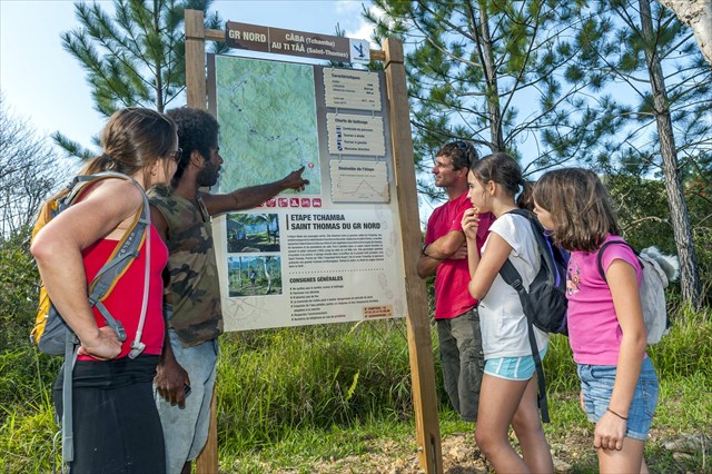
Cache N°6 : GR® Nord Tchamba/Saint-Thomas
Relier les tribus entre elles par un magnifique sentier de randonnée, balisé aux normes de la Fédération Française de Randonnée comme une ligne verte naturelle franchissant des chemins jusqu’ici peu fréquentés, parcourir la province Nord dans ce qu’elle a de plus authentique, de plus inexploré et de plus beau, ses paysages naturels : le premier tronçon du GR® Nord est désormais ouvert au public, longeant des crêtes abruptes, plongeant dans des vallées fertiles connues des seuls initiés et traversant des rivières rafraîchissantes et des forêts secrètes… Cette première partie du sentier vous promet de l’air pur à l’état sauvage sur 70 kilomètres entre les communes de Ponérihouen, Poindimié et Touho.
La première étape Tchamba-St. Thomas est une étape aux paysages variés. Elle chemine entre la paisible vallée de Tchamba et celle d’Amoa. Le sentier serpente d’abord dans la tribu au milieu d’une végétation luxuriante entrecoupée de champs, de bananiers et de plantations de café. Puis il pénètre dans un vaste massif forestier, et dans la touffeur de la grande forêt primaire, vers St. Thomas. Proche de l’IBA (« Important Bird Area ») de la haute Tchamba , le parcours présente une grande richesse ornithologique. Parfois le matin, le chant du cagou résonne dans la forêt…
Prévoyez les indispensables du randonneur (chapeau, chaussures fermées, réserve d’eau, vivres…). La cache est placée dans la première partie du parcours qui emprunte la piste de l’ancienne scierie, et représente une petite balade sans difficulté accessible aux enfants un peu entraînés. Il est possible d’avancer en voiture depuis la case du GR® jusqu’à la limite d’une propriété privée traversée par le GR®. Renseignez-vous à l’étape.
Apportez votre propre crayon.
Avant de repartir, merci de bien re-cacher la boîte, pour le plaisir du prochain géocacheur !
ENGLISH:
Get ready to explore an unusually diverse and authentic destination. From the niaouli plains of the open West Coast to the greenery-shrouded waterfalls of the East Coast and the central mountain chain, from the arid hills of the Far North to the islets, deserted beaches and red earth of the mining country, the North of New Caledonia has much to share with you: a magnificent natural environment, a rich history, exceptional biodiversity, a lagoon listed by UNESCO as part of the World Heritage, a rainbow-coloured population with a sturdy character…
Cache No 6: GR® Nord Tchamba/Saint-Thomas
The tribal villages are connected by a magnificent hiking trail, marked according to the standards of the Fédération Française de Randonnée [French Hiking Federation]. The trail runs like a natural green line crossing paths used relatively little until now, travelling through the most authentic, most unexplored and most beautiful parts of the North Province, its wild landscapes: the first section of the GR® Nord [grande randonnée: registered hiking track] is now open to the public, running along steep ridges, plunging into fertile valleys known only to a privileged few and crossing cool rivers and hidden forests... This first part of the track promises pure, unspoilt air over the 70 kilometres between the districts of Ponérihouen, Poindimié and Touho.
The first stage from Tchamba to St. Thomas has varied scenery. It passes between the peaceful Tchamba valley and the Amoa valley. The track winds first through the tribal area in the midst of lush vegetation intersected by fields, banana trees and coffee plantations. Then it enters a vast forest range and the dense foliage of the great virgin forest near St. Thomas. Near the IBA (Important Bird Area) of the upper Tchamba valley, the route has great ornithological wealth. Sometimes in the morning, the song of the kagu resounds in the forest...
Make sure you take the hiker’s essentials (hat, closed-toe shoes, water supply, food, etc.). The cache is placed in the first part of the route, which follows the old sawmill dirt road. It represents a short walk with no difficulty, accessible for children who are reasonably fit. You can go by car from the GR® hut as far as the boundary of a private property through which the GR® passes. Make enquiries at the GR® hut.
Bring your own pencil.
Before setting off, please hide the box again, so the next geocacher has the fun of finding it!