Due to the people who live and work in the area it is not possible to actually stash away anything. So this became the first virtual geocache. You have to provide at least one convincing photo to prove that you were there.
There is now a sign, as long as nobody takes it away.
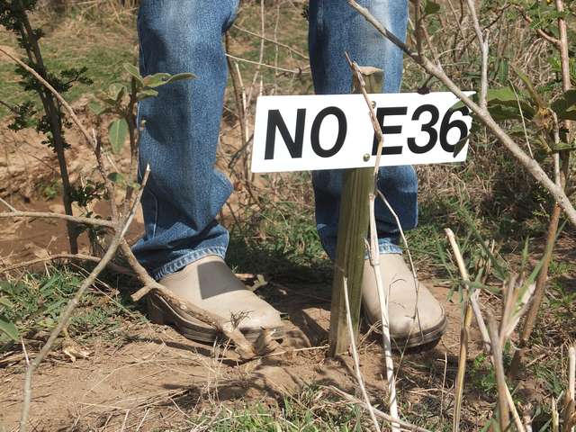
The sign (2019)
Please report whether the sign is still there. If not, I will have to make a new one and take it there.
Because Africa can be tricky and because the place is somewhat remote I will describe the access here in more detail than I would normally provide for a geocache. The idea is that, if somebody has flown thousands of kilometers to reach Kenya and then driven for a day to get close, it would be needlessly frustrating to miss the cache or, worse, to get stuck with the car.
The place is on a large plantation that grows sisal or other crops. The N 0° E 36° spot is exactly on the eastern side of a canal that runs through the plantation in a roughly SE-NW direction. If there is water in the canal, then is just a tad too wide to jump over (unless you are a well-trained jumper), so to reach the place from the main Nakuru-Baringo road you have to cross the canal, which is possible by car over a little bridge NNW of the cache.
There may be people there, asking various questions. My recommendation is to explain it truthfully. Usually the people are just curious and have no business there themselves.
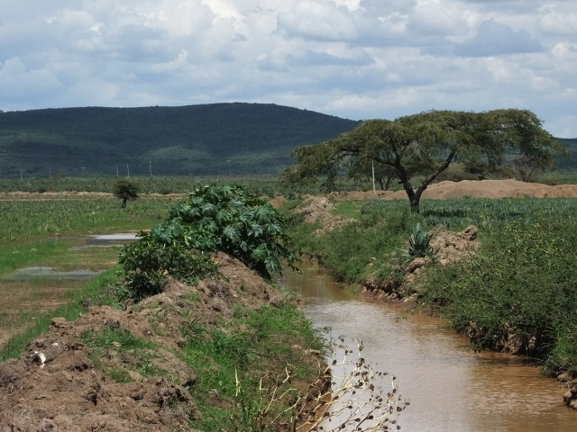
Looking from the cache position southeast along the canal (2015)
Map of the the probably easiest approach | GPX waypoint and track | KML waypoint and track
Whoever sends me an email to hans-georg©michna.com (retype, don't copy!) with a well-recognizable photo of the place will get entered into the virtual logbook for that stash and published on my Web site http://michna.com/gps/#Virtual_Geocache_on_the_Equator and on anybody else's Web site who wants it.
Please send a few extra photos. The place can change rapidly and we want to know what it looks like now.
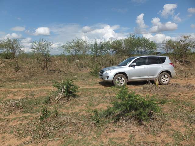
Reaching the cache by car (2019)
Warning: The geocache may become difficult to reach by car when it has rained a lot. You may have to walk the last, possibly muddy bit of the way in suitable boots. Consider skipping this cache during the height of the rainy season, usually around April (the long rains) and, to a lesser degree, around October (the short rains).
There are already quite a few log entries, but not all of the people have found the actual cache. Some only drove by on the main Nakuru-Baringo road. This is still nice, but does not count as a find. Finding the cache is a bit more involved.
Nearby destinations possibly worth visiting
- Lake Naivasha – several hotels, lodges, and other interesting places.
- Lake Nakuru National Park – a lake with flamingos and pelicans. There are a few lodges inside the park.
- Lake Bogoria National Reserve – another lake with flamingos and pelicans. One relatively luxurious lodge.
- Lake Baringo – a lake with over 500 bird species above and around. One small lodge and camp site with a nice restaurant: Roberts' Camp. Other hotels and lodges nearby. Boat rides available.
Hans-Georg