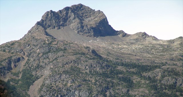
(Crater Mountain from Hwy 20)
With an elevation of 8128'. Crater Mountain is one of the highest peaks in the area. Positioned on the western edge of the Psayton Wilderness, Crater can be easily seen from Ross and Diablo Lakes and Hwy 20.
Crater was actually the home of two fire lookouts. The first one was built on the true summit in 1932. In 1950, the first lookout was abandoned and a second one constructed on a 7054' knob about a mile to the east. Although the lookout was destroyed in 1973, trails still lead to both lookout sites (more lookout info here). This cache will require you to visit the first lookout site on the true summit.
Note: Crater is definitely not an easy summit to reach. The trail is about 15 miles RT and gains 6300' of elevation. At the top there is a class 2-3 rock scramble that is only recommended for experienced climbers.
Access
Start at the Large Canyon Creek Trailhead. You can find it right off of Hwy 20, just past MP 141. Remember to bring your NW Forest Pass!
The trail begins by passing through a nice camping area along Granite Creek. After a bridged crossing of granite, turn left and cross Canyon Creek on a smaller bridge. Once across canyon creek turn right and start up the Jackita Ridge Trail (part of the popular Devil' Dome Loop). After steeply climbing more than 3000', the trail finally levels out at elevation 5000'.
Just over a half mile later, at about 5300' (N48 43.770 W120 53.457), look for an obscure side trail heading off to your left. If you've crossed a small creek, you've gone too far. After about .8 mi of following this trail, reach Crater Lake (ignore the trail that foe to the lower lookout site at (N48 43.990 W120 54.269). While it isn't much of a lake, Crater is one of the few water sources on the trail.
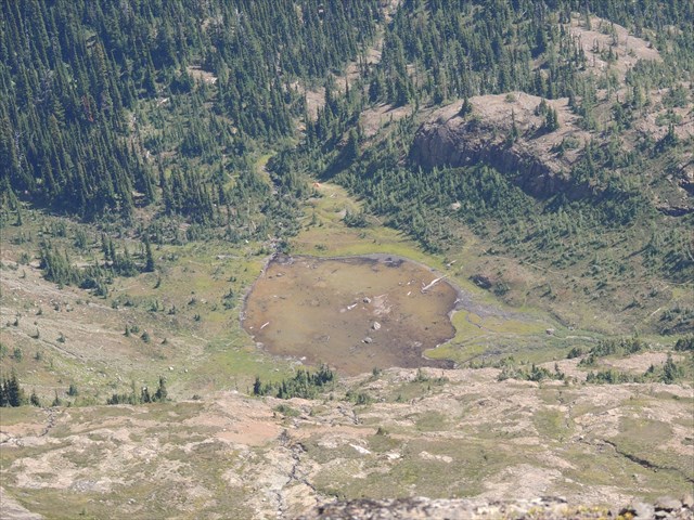
(Crater Lake from above. Notice the trail leading off to the right)
From Crater Lake head west along a stream, going right at any junctions. Soon the trail leave the stream behind and begins climbing a forested shoulder. Come Here in Fall to see the larch trees turn their characteristic orange!
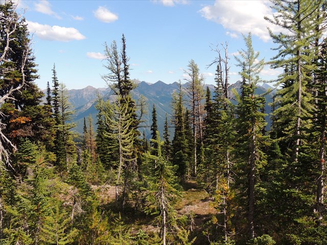
(Mixed forest above Crater Lake)
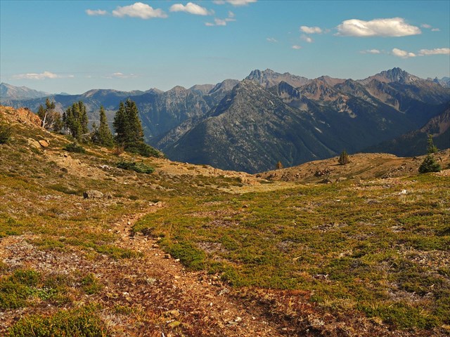
At about 6800' the trail leaves the forest behind and enters a wide, gentle ridge. Excellent views abound!
Soon the ridge narrows and the trail steepens. The trail leaves the top of the ridge and heads over to the SW face. At about 7500' (N 48° 44.179 W 120° 55.341), the trail enters a sandy gully. This is the start of the rock scramble.
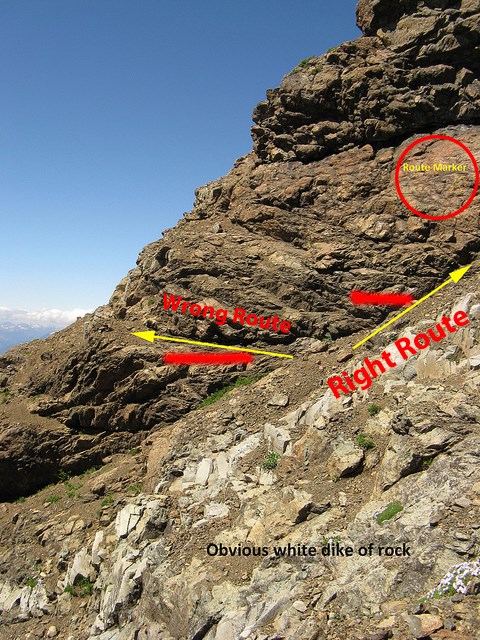
(picture borrowed from http://www.nwhikers.net/forums/viewtopic.php?t=7985624)
The rock scramble should not be very difficult as long as you follow the "trail" of yellow painted route markers. Along the route you can even see the remains of the tram that used to ferry supplies to the lookout. As long as the conditions are not icy, most people should be comfortable without a rope. Follow the link above for a more detailed explanation with pictures.
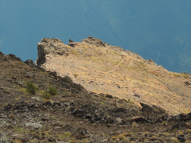
(top of the scramble)
After about 400' of connecting route markers, you top out on a 7900' false summit. From here the trail starts right back up again and heads straight for the 8128' summit.
The Summit and Cache
The view from up top is excellent! Crater's position near the Cascade crest gives it a unique perspective of the two climate zones. To the west you can see the glaciated peaks of N. Cascades National Park.
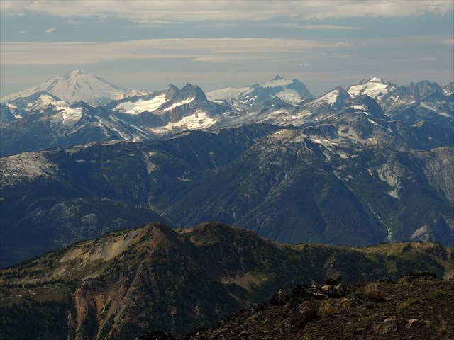
(Sourdough Mountain lookout is visible near the left edge of the photo)
The drier, gentler peaks of the Psayton fill the eastern horizon.
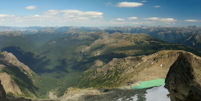
The difference in climates is especially noticeable when looking south towards Rainy Pass.

(Hwy 20 is more than a mile below)
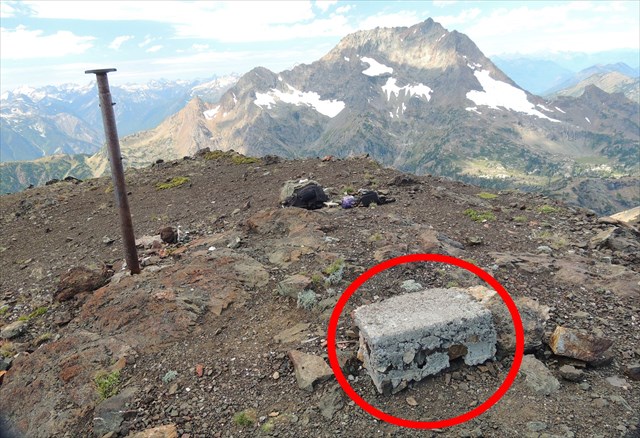
Due to the summit being in the wilderness I have made this cache an easy multi. Not far from the benchmark pole your will see a rectangular concrete block, as shown in the photo below. There is a four digit number carved onto this block.
To get the latitude for the final (48 ??. ???) subtract this number from 44333
To get the longitude for the final (120 ??. ???) subtract this number from 57034
Remember to ignore the decimals or your math will be wrong!
(That's Jack Mountain in the background)
The cache is hidden somewhere between the trailhead and wilderness boundary. It's a medium-sized lock-and-lock than can hold a few small items. There was very poor GPS reception in the area, so remember to check the hints and spoiler pic.
Happy Hunting 