The sedimentary rocks (sandstone and mudstone) of Beaumont Park were laid down in the Upper Carboniferous period, about 310 to 280 million years ago. These rocks were laid down in deltas on the edge of a shallow sea, with mountains to the north and south.
Depending on the direction of the flow of the rivers and sea level at the time the area produced either mudstone or sandstone. This area was situated just north of the equator so the conditions at that time were very similar to present day equatorial rain forests.
Mudstone like Sandstone was formed in a similar way, a deposit being initially laid down in river delta’s and shallow seas. As the sediments formed they were continually being buried by more levels and eventually compressed. As the sea level rose more pressure was created and the sandstone and mudstone were finally created.
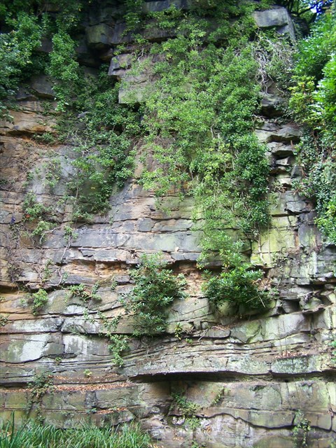
At the published coordinates show on the picture below, you will see a fine example of the sandstone known as the Rough Rock Flags. In conjunction with the notice board you will discover how this sandstone was formed.
.
To log this cache, please send me the answers to the following questions:
1) According to the noticeboard located at the co-ordinates for this cache, it mentions that some of the paths are subsiding. Please describe why in your answer.
2) Again from the notice board. What is the name of the sandstone found at the highest point of the park and what direction was the river flowing in that formed the sandstone.
3) Please estimate the height of the feature in front of you (shown on the cache page)
Although not compulsory, we would love to see a picture of you/your GPS at this location.
Please send your answers through my profile to the set questions before logging your find. All answers will receive a reply.