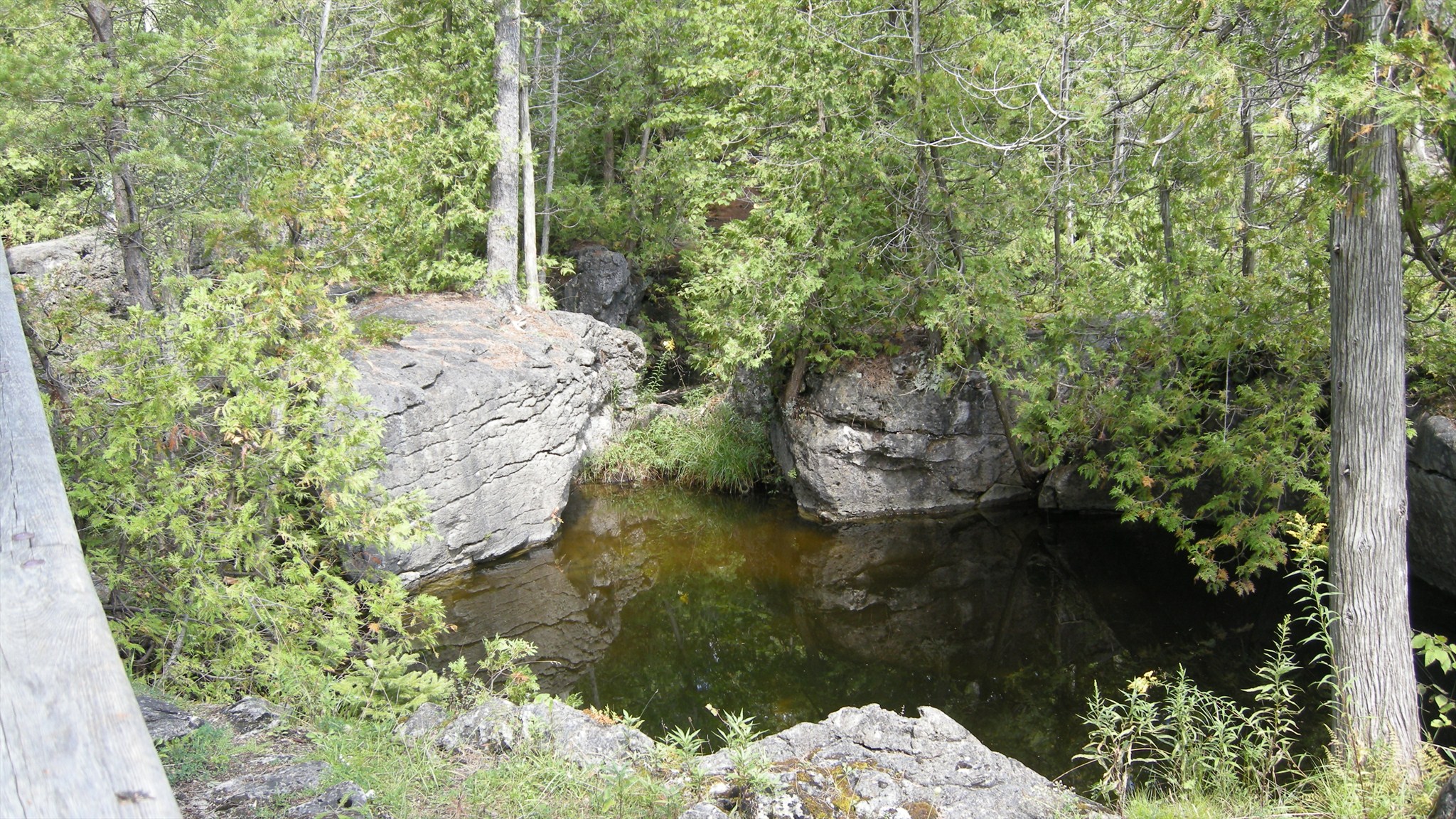
Rockwood Potholes
Rockwood is filled with potholes...about 300 of them. Many of the potholes in Rockwood are just partial ones. They also range in size from the very small up to one of the biggest in North America. At this location you will find a very vast concentration of potholes. Some wide, some tall, many partial ones, some on dry ground, some filled partially with water and there are event some that will be emerged within the water. The water levels very throughout the year as it is a controlled area. When the water levels are low it will reveal some very prominent potholes too. This concentration of potholes is located along The Pothole Trail/Gilbert MacIntyre Memorial Trail. This trail takes you along the north shore of the Eramsa River and through some of the most unique geological features and biologically diverse area in Southern Ontario. These potholes were formed by receding water of the Wisconsin Glacier over 11,000 years ago. From the boardwalk you can spot dozens of potholes and more before and after the boardwalk. Please stay on the trails here.
Pothole Formation at Rockwood
There seems to be general agreement amongst Quaternary workers that the Eramosa Valley is part of a complex series of meltwater channels that drained the ice margins retreating both into the Huron and Ontario Basins. The potholes that are found at Everton and at Rockwood appear to be associated with the floods of meltwater associated with the retreating Wisconsinan ice about 13,000 to 12,000 years ago. Potholes are found at many different elevations within both the Grand River Conservation Authority area (GRCA), and in the adjacent University of Waterloo-owned area. Given the altitude of the tops of the highest potholes they are obviously not associated with modern (or even near-modern) fluvial activity. Even those close to the level of the present day Eramosa River are likely the products of glacial meltwater. It has been suggested that the valley represents the former position of a sequence of coalesced potholes aligned along a master joint system in the bedrock. So, how were the potholes formed? The generally accepted belief is that high volumes of rapidly-flowing water, probably in an ice-marginal, or possibly sub-glacial river enlarged weak points in the bedrock and established the site for a pothole. A number of scholars have indicated that massive bedrock (of virtually any lithology) is more suitable for the creation and retention of pothole forms. In the Rockwood potholes virtually all are formed in the Amabel Formation. Detritus carried in the water as bedload, created the "cutting tools" for a downward attrition of the rock surface. Large boulders that are normally assumed as the principal cutting tool, probably played a lesser role than smaller clasts as cutting tools. In the excavation of a small pothole at Rockwood, highly-rounded and polished Precambrian clasts, that appear to be mostly in the 8 to 18cm range. One thing that several scholars observed, were helical- (spiral-) shaped grooves on the sides of the potholes. These indicate that water circulated in a spiral fashion within the pothole exiting up the centre of the pothole. Such features have not been reported from Rockwood except at the Devil's Well which is the focus of a separate earthcache.
Tasks and Logging Requirements
1) How many potholes do you observe at this location by walking from one end of the boardwalk to the other?
2) Are there any that are still intact or do most have broken sides?
3) Of the potholes you observed here how much bigger is the largest one compared to the smallest one?
4) What percentage of them contain water within them?
5) Based on what you learned about potholes, what factors will contribute to the destruction and erosion of the potholes here?
6) What steps has Rockwood taken and what steps can you take to to protect these potholes?
Email me the answers to the above questions and then go ahead and log this earthcache. Feel free to post pictures too.
** Please note that there is a fee to enter Rockwood Conservation Area. See additional waypoints for entrance location.