Aldeia do Sardal
 |
| Português |
English |
| Aldeia do Sardal |
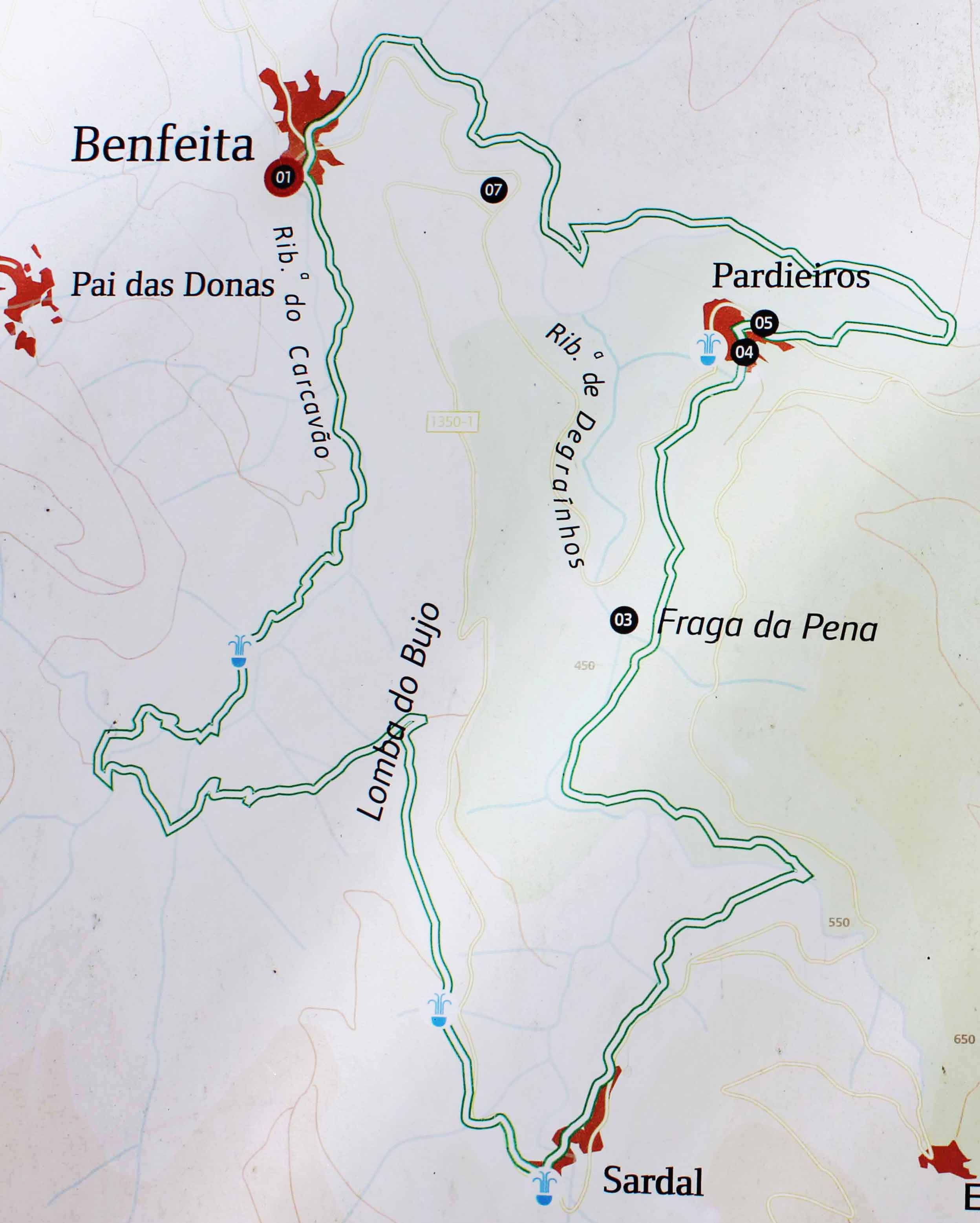
Sardal |
Finalmente um pouco de civilização, mas o nosso percurso ainda está a menos de metade, mas é sempre bom avistar a pequena aldeia do Sardal.
|
Finally a bit of civilization, but our journey is still less than half, but it's always good to sight the small village of Sardal.
|
 |
| A CAMINHADA |
THE JOURNEY |
 |
| Percurso |
Route |
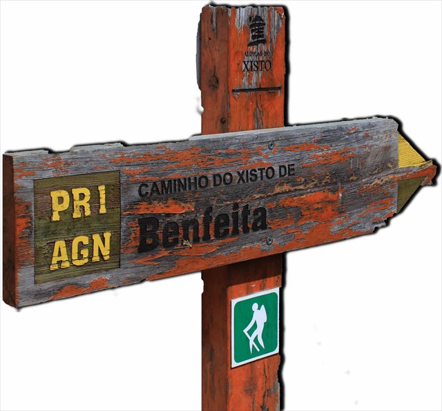
Caminho do Xisto da Benfeita
"No Açor, domínio do xisto, as dobras e fraturas originam um tipo de relevo característico, vigoroso mas de contornos arredondados, sulcado por vales com grandes quedas de nível, linhas de água encaixadas e onde por vezes se encontram curiosos acidentes geológicos, caso das quedas de água da Fraga da Pena." (in site ICN)
Track Wikiloc
Track oficial |
Benfeita Schist Walking Trail
“In Açor, a domain of schist, the cracks and bends make for a characteristical relief, vigorous, but with softened edges, carved by valleys and cliffs, water lines fitted in and where one can sometimes find curious geological formations, such as the Fraga da Pena waterfalls” (in site ICN about the APPSA)
Track Wikiloc
Oficial Track |
| Ficha técnica |
Trail data |
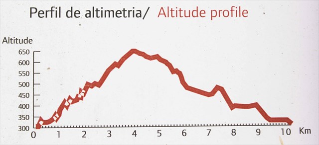
Tipo de Percurso:Pedestre PR (circular)
Ponto de Partida:Largo do Ameal, Benfeita
Ponto de Chegada: Largo do Ameal, Benfeita
Distância:10 Km
Desníveis:576 m
Altitude Máxima:598 m
Altitude Mínima:299 m
Grau de Dificuldade: 3 - algo difícil
Época: Todo o ano, aconselhando-se alguma precaução no Inverno e em dias de chuva, podendo o piso tornar-se escorregadio. |
Trail type: pedestrian PR (round)
Departure point:Largo do Ameal, Benfeita
Arrival point: Largo do Ameal, Benfeita
Distance:10 Km
Altitude variation: 576 m
Maximum altitude:598 m
Minimum altitude:299 m
Difficulty level (1 to 5): 3 - Average
Advised time of the year: Every time during the year, but with careful during the winter time, especially in the rainy days, once it can be slippery. |
Percurso - Route
 |
Video do percurso / Video from this track
|
|
| Informação adicional |
Additional Info |
Para se encontrar esta cache não é obrigatório seguir este percurso, mas é muito mais fácil se esta for a opção.
A cache não se encontra em muros de pedra, ou perto deles, pelo que não vale a pena procurar, mesmo que esse pareça o local mais bonito, não está lá. |
To find this cache is not required to follow this route, but it is much easier if this is the option.
The cache is not in stone walls, or near them, so it is not worth looking for, even if that seems the most beautiful place, is not there. |
|