Cache is not at the posted coordinates; solve the puzzle to find the final. It's a baby bottle with room for small coins.
While much of Omaha’s map is a straightforward grid of numbered streets crossed with named streets in mile-wide squares, a few spots on Omaha’s map are distinctive enough to be recognized even when stripped of identifying labels. Identify where these map slices would be, and then identify the lettered labels for the information needed to solve the puzzle.
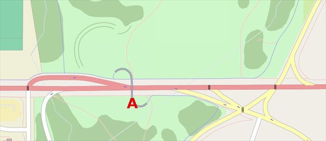


A: The structure labeled “A” was completed in the year _?
B: The two-digit street name at “B” is _?
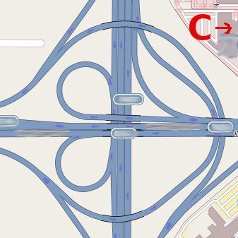
C: In 1969 what was billed as the first movie theater in the world with _? screens/auditoriums opened in a shopping mall near what was then a four-leaf clover shaped interchange. The cloverleaf was not only used as the first logo for what was then the “eighth largest shopping center in the world” but also for the original logo of the bank the mall contained.
D was opened in the year _?
E was opened in the year _?
F: The two-digit street name at “F” is _?
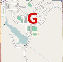
G: The area marked as “g” has its own zip code. The five digits are _?
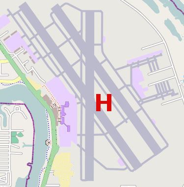
H: The two-digit number for the Metro bus line that services this facility is _?
I opened in the year _?
J: Strangely, this bridge is named after Grenville Dodge, but the street to the west, also known as US highway _? was actually named after Augustus Dodge.
K first opened in 1873 but was rebuilt twice. This current version opened in _?
L: The two-digit interstate highway designation for “L” is _?
To solve the puzzle, enter each answer twice, on both the north and west sides of the double line, in the unshaded squares. Then add the numbers vertically (carrying the tens, as you would normally). Make the last addition and you'll have your coords.


Sources: OpenStreetMap, Wikipedia, Google Transit Maps.
Mapmaking tools: OpenStreetMap, GIMP.
For the truly map-obsessed, there's information about the map sources (and tools used to create the new maps) at the WBs geocaching blog. Use the "Related Web Page" link above.