The Icelandic sagas tell how the giant half-man, half-troll, Bárður Snæfellsás, killed his nephew, Rauðfeldur, by hurling him into this canyon as punishment for pushing Bárður's daughter, Helga, out to sea on an ice floe. Bárður meted out a similar fate to Rauðfeldur's brother, Sölvi, throwing him into the sea from the cliffs of Sölvahmar, near Arnarstapi, after which the giant took himself off away into the glacier, where he remains to this day as the guardian of Snæfell. Helga, you will be pleased to know, was unharmed and eventually drifted as far as Greenland, where she found a lover.
Today, the canyon carries no hint of the violent lives -- or deaths -- of giants, although its very existence says something of the violence of the forces of the earth in these parts. In the spring, when the ledges of its cliffs are crowded with nesting birds, it can echo with ghostly cries, making it an eerie place indeed.
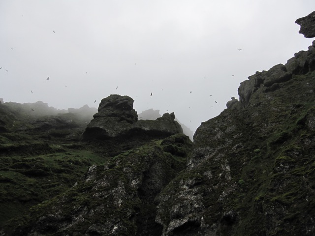
Fulmar in the mists above Rauðfeldsgjár
The Móberg formation
The cliffs of Rauðfeldsgjár are part of the mountain Botnsfjall in western Snæfellsnes. Botnsfjall and its neighbouring hills are part of a class of mountains in Iceland known as the Móberg Formation, all of which were formed during the Upper Pleistocene glacial period which lasted from approximately 70,000 to 10,000 years ago.
During the Pleistocene, the Snæfellsnes peninsula was an active volcanic zone, with frequent eruptions, most of short duration, taking place under the massive ice sheet that covered Iceland at this time. The imposing hyaloclastite cliffs overshadowing the road at Rauðfeldsgjár are the results of such eruptions. The shattered face of these cliffs is largely a result of the stresses placed on the rock as it cooled upon coming into contact the glacial ice around it and the pressures it was subjected to from further magma injections from below. These fractures, which formed early in the life of the mountain, will have provided pathways for water run-off from many different sources over the ages. In addition to providing an escape passage for meltwater produced during eruptive phases of the Botnsfjall vent, these gullies will also have provided routes for the outflow of glacial meltwater during subsequent periods of glacial retreat in later epochs. Today, they continue to drain seasonal snow-melt and routine rainwater runoff from the slopes and mountain tops beyond the cliffs.
Sleggjubeina and gully formation
One of these stress fractures forms an impressive ravine in the cliffs, carrying the mountain stream, Sleggjubeina. It is possible to enter this ravine; a path runs to it up the hillside from a car parking area close to the road. When many people visit, the stream is often little more than a trickle. But is it always so? This earthcache examines the local evidence to seek an answer to that question.
To claim this earthcache you will need to look at both the ravine itself and the stream gully in the hillside below it in order to consider what erosional forces are at work here. You will also need do some detective work in order to speculate about what contribution the water flowing from the rift has made to the formation of the gully.
Erosional processes
Erosion is the general name for the processes that break down rocks and those that carry away the breakdown products. The main agents of erosion are gravity, ice, water and wind. For this earthcache, we are mostly interested in the erosional effects of water and of gravity, and of the two acting together.
On steep slopes, loose soil or broken rock can move downslope under the force of gravity via creep, slides, flows, topples, and falls. These can result from any number of loosening agents, from earthquakes to chemical weathering, from reduction in frictional binding due to the lubricating effects of groundwater percolation, to disturbance by animals, plant growth and so on.
Rivers and streams not only carry water but also sediment. The water, as it flows over the channel bed, is able to mobilise sediment and transport it downstream. The rate of sediment transport depends on the availability of sediment itself and on the river's flow rate, both in terms of the volume of water and its speed of flow, which is itself partly determined by the steepness of the stream or river bed down which it flows. If there is a net removal of sediment in a location, then we see erosional features such as gullies and channels forming. When changes occur to reduce a stream's erosional capacity (such as its flow rate dropping, or the stream reaching a gentler slope) then it will drop some of its sediment load in depositional stream features, such as bars or terraces.
To learn more about the landscape features that are characteristically produced by rivers, you may like to view the "River processes and landforms" slideshow by jacksonthree, which details many of the features present at this location (as well as some that are not!)
The events that lead to erosion may be episodic in nature: while rain may fall pretty often (especially in Iceland), severe storms will be less frequent and the most violent storms of all may be separated by tens or even hundreds of years (even in Iceland!)
In gauging how active an erosional feature may be, an examination of the local vegetation can often provide valuable clues. Features with little or no vegetation are usually being actively eroded (so that vegetation never gets a foothold) or deposited (the deposit is too new to have acquired an vegetation).
Please read the requirements for claiming this cache carefully. It is set at a higher difficulty rating than many earthcaches as you will need to do more than just read the description or look at infoboards to find the answers that are needed to claim the cache. You will need to spend some time at the site, looking around and thinking about the questions. The questions are not difficult but may require some thought to answer; just remember that all of the answers are to be found on the ground at the site, not on the internet!
To claim this cache, you must complete the following tasks:
- Using the clear path that follows the edge of the channel of the river Sleggjubeina, head from the parking area (waypoint CP) towards the published coordinates. On the way, decide where the river channel is at its widest. Describe the channel's shape, size and overall form at this point. What erosional or depositional features do you see here? How established does the vegetation appear to be (newly grown? this season? long-term?) on each of the various parts of the channel here?
- Continue on to the published coordinates (where the path enters the rift). From this point, look back down the river channel. Compare the size, form and appearance of the channel at this point with its appearance at the previous location. How well established is vegetation here? Are there any additional noticeable erosional or depositional features in this general vicinity? How much of a contribution to the form the lower gully do you think the water passing through the rift makes generally? What leads you to this conclusion?
- From your observations of the river channel overall, how actively would you say it has been eroded in recent times? Are you able to speculate (with reasoning) what part (if any) each of the following erosional events has had in contributing to the overall form it has today: ancient jökulhlaupt; glacial retreat meltwater runoff; historical infrequent high intensity storm runoff; seasonal snow-melt; routine rainfall?
The remaining tasks are entirely optional and should only be attempted when conditions allow and if you are well able to do them.
- Continue upstream into the rift as far as you feel comfortable venturing and describe in your log how far you were able to go, and what feature or condition you encountered to make you decide to go no further.
NOTE: The rift can safely be explored, even by young children (with proper supervision!) or inexperienced walkers, on days when there is only a small stream flowing out of it. You must not assume, however, that it is always safe. If you decide to undertake this task, please be alert to the conditions in the rift and consider carefully both your own capability and that of others in your party. Above all, take care and be sensible! Remember that you are a long way from help if you slip and injure yourself. There are no prizes for going further than anyone else; there is no shame in deciding to retreat before you are forced to!
- It would be nice to see included in your log a photograph of the rift in the cliffs, including you and/or your GPSr.
Please mail your answers (in English please!) to the first three tasks to us using the Geocaching.com contact link. Please do not post answers to these questions in your log, or include any views of the down-stream gully section in your photographs. Please send your answers before logging your find. If there is a problem with your answers, we will contact you. You do not need to wait for confirmation that your answers are correct to log a find but all "Found It" logs submitted without a prior emailing will be deleted without comment or warning unless your log explains why you are not able to email and when we can expect your answers.
WARNING: Access to this site may be difficult at some parts of the year. Please use common sense at all times when visiting this cache!
The Quietly Crew have created this cache to celebrate our first trip to Iceland and as a "thank you" to the warm-hearted and generous people of this beautiful island who helped to make our stay so enjoyable and memorable. Wherever you are from, we hope you enjoy visiting this site and learning more about the secrets it holds.