The Map Geek series of geocaches is for all my fellow map nerds in the caching community. All will (hopefully) have fun finding the cache. Those of you who find the map oddities and fun facts appealing, please feel free to discuss that in your cache log, adding comments, corrections and opinions as you wish.
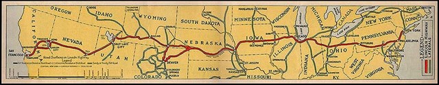
2013 marks the 100th year of the Lincoln Highway, the first paved transcontinental road designed for automobiles and the precursor of the Interstate Highway System. The road spanned 3,380 miles through 13 states. 270 people in 140 (mostly vintage) vehicles will mark the centennial by leaving New York City and San Francisco on June 21-22 and meeting in Kearney, Nebraska on June 30.
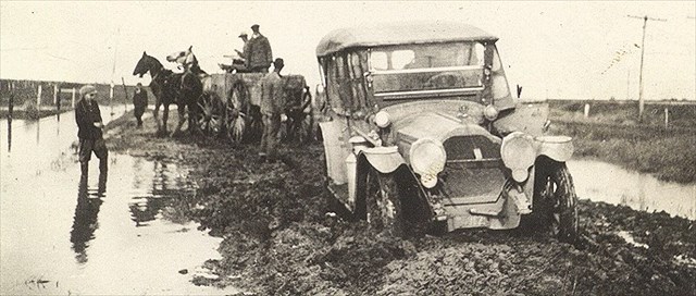
Imagine what travel was like before the Lincoln Highway. This photo from the Nebraska Department of Roads might give you an idea.
The assumption that the Lincoln Highway became Interstate I-80 is incorrect. The Lincoln Highway didn’t go through Lincoln, but ran through Fremont, Schuyler and Columbus. Highway 30 is the closest modern Lincoln Highway we have, and it’s only in the western third of the state where the modern interstate matches the old Lincoln Highway route. The original road and its succeeding generations have been mapped comprehensively here. There's an excellent history of the Lincoln Highway here.
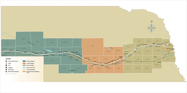
This map is from the Lincoln Highway Nebraska Byway site, which also has this quote about the remnants of the Lincoln Highway still visible today.
Sections of original brick pavers are located to make up a 3.6 mile stretch of road near Elkhorn, three blocks of original bricks in Fremont and two blocks in Shelton. An Avenue of Trees, which flanked the Lincoln Highway, is still visible in Duncan today along with an original Lincoln Highway marker. The Gothenburg berm, a piece of the remaining "stair steps" can still be seen. These famous stair steps can be followed on the road map today.
Historical buildings are flanked along the Lincoln Highway and still operational today. Several locations that can be visited today are the Wheat Growers Hotel in Kimball, Spruce Street Station in Ogallala, Pony Express Station in Gothenburg, Gloe Brothers Service Station in Wood River, Merrick County Country House in Central City and Glur's Tavern in Columbus.
The 3.6 miles of original brick pavers northwest of Village Pointe between Omaha and Elkhorn will be a highlight for those making the trip from the east coast, as it is reputed to be the longest remaining original stretch. From the NE Dept of Roads site, here are photos of the concrete underlayment being completed in the early 1920s.


In 2006 new signage was created to mark the Lincoln Highway’s route through Nebraska. Here is the Nebraska Tourism poster from that effort.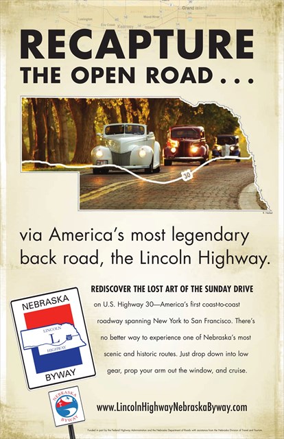
If you want to find all the geocaches within a few miles of the Lincoln Highway before the end of summer, you better get busy. There are a lot of them.
Sources: Nebraska Department of Roads, Nebraska Tourism, Lincoln Highway Association. Tools: GSAK, Google Earth. For the truly map-obsessed, there's information about the map sources (and tools used to create the new maps) at the WBs geocaching blog. Use the "Related Web Page" link above.