Qolla I-Bajda - or - the end of a mountain EarthCache
Qolla I-Bajda - or - the end of a mountain
-
Difficulty:
-

-
Terrain:
-
Size:  (not chosen)
Please note Use of geocaching.com services is subject to the terms and conditions
in our disclaimer.
Qolla I-Bajda - the end of a mountain
Earthcache near Marsalforn about the little hill named "White Jug", Qolla I-Bajda.
Interesting saltpans are just nearby.
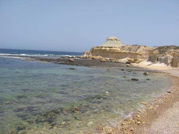
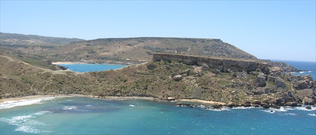
Qolla I-Bajda - view from west
Effects of erosion can be seen everywhere in Malta and Gozo.
Caves are found in limestone (Ghar Dalam view) Caves collapse and leave big sinkholes (Dweijra view) (Maqluba view) or gigantic windows (BlueGrotto view) (Azure Window view)
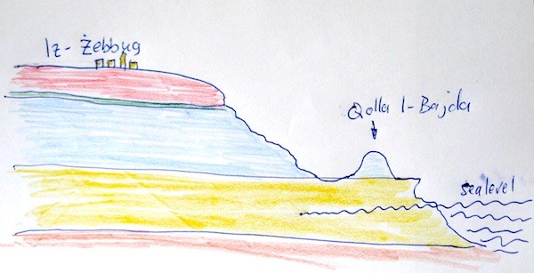
The plateau of the Maltese Islands has the same system of five different stone layers with different hardness and characteristics.
1. Upper Coralline Limestone is a hard rock with cracks and caves and it is the youngest!
2. Green sand is the thinest rock layer.
3. Blue Clay is soft and erodes quickly, stops the water coming down in upper coralline limestone and leads it in sources to the surface.
4. Globigerina Limestone is harder then blue clay, but softer then Upper Coralline Limestone. Most houses in Gozo and Malta are built with this Stone.
5. Lower Coralline Limestone is the oldest and seen at many cliffs
Rainwater and rivers have cut the plateau into parts an have eroded valleys.
In the limestone layers, rainwater has widened cracks an made caves.
Most mountains have still this hard top of Upper Coralline Limestone. When parts of the top fall down the slopes, they build rocky areas called Rdum. If the hard top of Upper Coralline Limestone is taken away, Green Sand and Blue Clay quickly erode down to the surface of Globerina Limestone, like almoust everywhere in the northeast of Malta. If erosion is not stopped by stonewalls, the soil is washed away by the rains in winter, or by the waves of the sea, if it is beside!
So what is the history of the Qolla I-Bajda?
If you want to know, what did happen in the past, until the Qolla looked like now, you can take a look at other maltese or gozitan mountains. There is happening the same today, what has happened here in former times.
-----------------------------------------------------------------------------------------
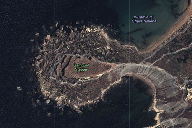
A good example for this process is the Il-Karabba peninsula in the nothwest of Malta, near Ghajn Tuffieha bay.
N 35° 55.600 E 014° 20.400
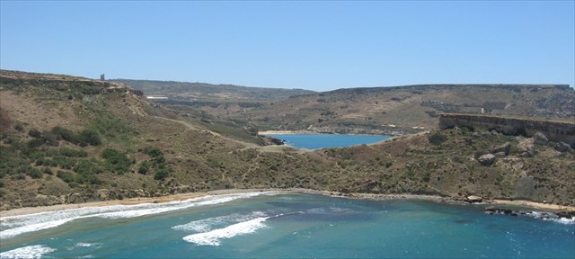
Il-Karraba - view from north
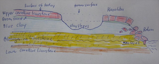
Karraba is one of many tabletop mountains in Malta and Gozo. The sea is eroding it‘s base from all sides. From above you can see the rock parts, that have already broken from the top and rolled down to the sea.
View from above.
Rdum in the west of Karraba.
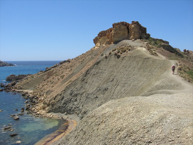
Eroding Blue Clay slopes.
Every landslide of Blue Clay makes the rocks on the top more instabile. Soon the next parts of the top will roll down the clay slopes.
How long will it take, until Karraba looks like Qolla I-Bajda today?
Now to the cache: To log a found, please send me an e-mail and answer the following Questions
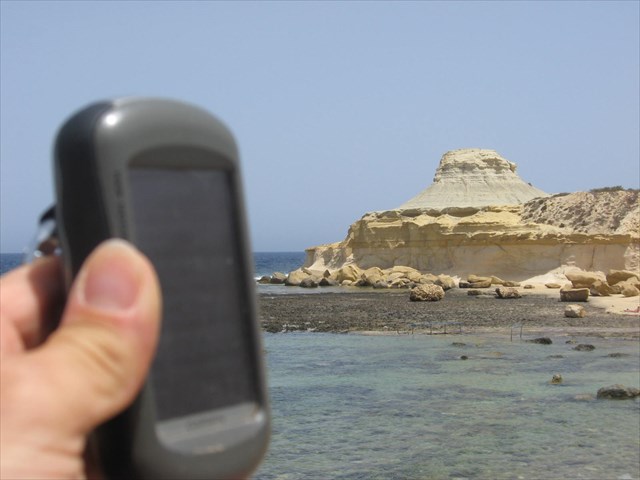
1. Go to point 1, N 36° 04.769 E 014° 14.984 . Make a new track with your GPS and measure the length of the way around the white „hat“ of the hill.
2. Estimate the height of the „hat“ in meters.
3.Describe the color and structure of the stone of the hat. Which of the 5 types is this stone? And what are the reasons for your choice?
4. Describe the color and structure of the basic stone under the hat. What is the name of this stone? Tell me the reasons for your choice!
5. It would be nice, if you make a photo of you or your gps with Quolla I-Badja at the EC-coordinates N 36° 04.704 E 014° 14.883
You can log, after sending your e-mail. I will contact you, if there are problems with your answers.
And don't fall down the cliffs!!!

Additional Hints
(No hints available.)