Harpenden is situated on a dip-slope of the Chiltern Hills. The original village lies between two river valleys running in a north west to south east direction. The westerly valley of the River Ver has been used since Roman times as the route of Watling Street between St Albans and Dunstable; the eastern valley contains the River Lea, which rises north of Luton and flows through Hertfordshire and then to the River Thames.
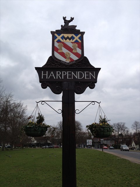
While Harpenden isn't really a village any more the final for this multi is near to another village sign hence the cache name. The sign depicts the town crest, showing a hart at rest which alludes to the County of Hertfordshire; the two gold diagonal crosses represent the Diocese of St Albans, with the black W between them taken from the Wittewronge arms, as are the diagonal stripes in the bottom part of the shield. The three gold sheaves symbolise Harpenden’s connections with wheat growing, including in the past with the straw-plaiting industry.
Now to figure out where the final hide is.....
At the indicated GZ you'll find there is a plaque with 2 dates, use the first date for North and the second for West.
North 2171-Date original sign was presented = ABC
West 2481-Date of renewal of sign = DEF
N51 48.ABC W000 21.DEF
Your looking for a camo’d tube type cache. Happy Caching!
If anybody would like to expand this series please do. I would just ask that you let Smokeypugs know first so they can keep track of the Village Sign numbers and names to avoid duplication.