Tramway @ Watsons Bay Traditional Geocache
-
Difficulty:
-

-
Terrain:
-

Size:  (small)
Please note Use of geocaching.com services is subject to the terms and conditions
in our disclaimer.
This cache is located where the tram way used to run. A little history about transport in the area: South Head road was first constructed in 1812. But the road was always run down and not maintained (sounds similar to now doesn't it?) and believe it or not, bush-rangers were also a regular occurence. For all the overseas visitors, Bush-rangers are basically robbers who would hold up coaches and steal belongings and valuables. Quite different from the scene here today! So a regular ferry that ran twice a day started in 1854. From 1903 the tramline brought visitors as far as the signal station, where the Everitt's Signal Dining Rooms and the Grand Pacific Hotel could be found. From here, it is was quite a long walk down to Watsons Bay until in 1909 the tramway was extended to Military Road just between The Gap and Robertson Park, and the line went straight through Gap Park. In fact the cache is almost on top of where the tams would have run. The trams were discontinued in 1960 and were replaced by buses. What a shame! Trams are much more interesting than buses! For any more information about Watson's Bay visit: http://www.dictionaryofsydney.org/entry/watsons_bay 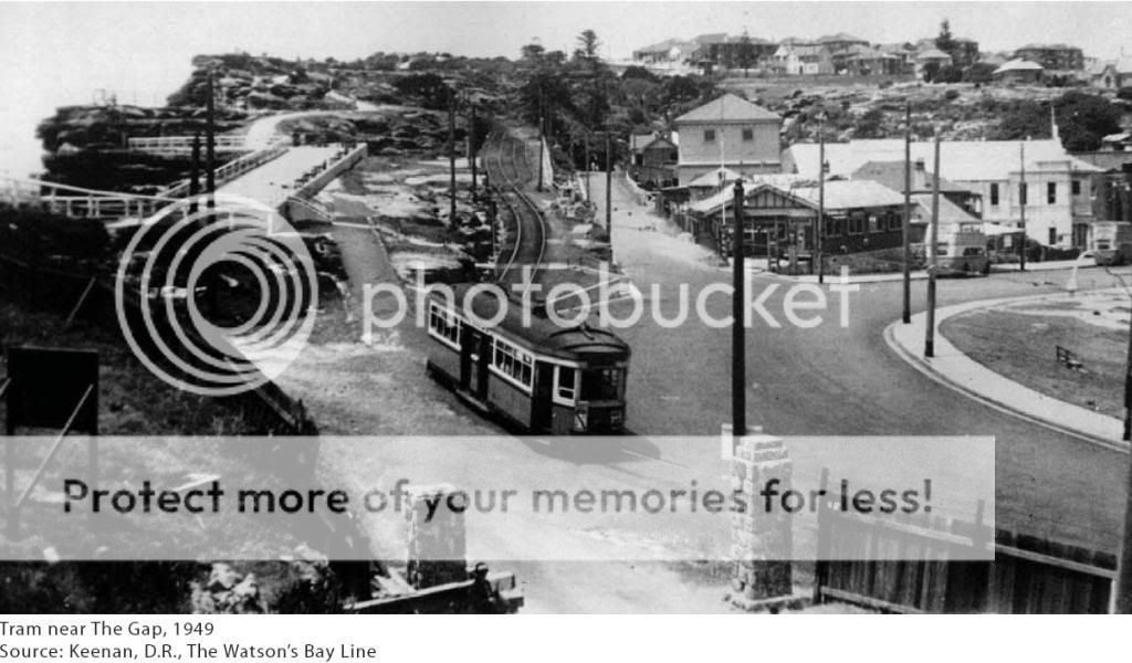 The cache itself is best accessed after a short walk around The Gap national park and also the reserve. My advice is to walk up the steps on the opposite side of the road to the park where the ferry comes to at the Watson Bay wharf. Then once you are at the top of the stairs, turn right and follow the trail. Remember to stop and enjoy the view. Then before you get to the road, turn right down the first concrete path that goes to the right. The fig trees will soon make a beautiful canopy to walk under and a small cliff with be on your right. When you get to the REFERENCE POINT coordinates that I have provided for you, stop. This is where the tramline used to run. Now, turn left onto a small downhill trail until you reach a seat. Follow the coordinates to the final cache and veer off the track a up the small but fairly steep hill to the fig tree. DO NOT try to access the cache from the tramline level as a small but complicated climb is required. Just follow the directions that I have given you. The container is a 400ml sistema which is at ground level. The coordintaes due to the tree cover might be a bit out so feel free to post up with your log the coordinates that your gps thought the cache is at. Once you have found the cache, the easiest way back to civilisation (or the public transport @ watsons bay is to continue along the track. This will take you to a street that goes directly back to the main road. Happy caching!
Additional Hints
(Decrypt)
Jura lbh ner yrnavat ntnvafg gur gerr, jnyx svir cnprf fbhgu naq lbh jvyy svaq zr!