An estimated 30 meter high wave raced across the river, stripping large trees of their branches and completely uprooting smaller ones. A wave also went up and down stream for many miles wiping out wharfs and destroying boats on the Fraser.
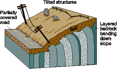
The land mass was unconsolidated material (as opposed to a solid mass such as stone) consisting of layers of silt, gravel and clay as well as combinations of these materials, termed loam. It was found that there was a large thick layer of very greasy clay near the bottom of this slide.
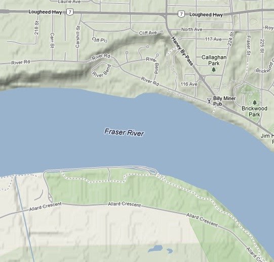
More than half of the river was blocked by all of this material. Although a century and a quarter of erosion has passed since this event, there is still an obvious narrowing of the channel at this point as evidenced from the terrain map below.
Perhaps not readily apparent from the EC location, with all the overgrowth and housing, the slide area is very obvious when viewed on a terrain map.
Landslide Types
Landslides or slope movements can be classified in many ways. There are many attributes used as criteria for identification and classification including:
- Rate of movement: This ranges from very slow creep (millimetres/year) to extremely rapid (metres/second).
- Type of material: Landslides are composed of bedrock, unconsolidated sediment and/or organic debris.
- Nature of movement: The moving debris can slide, slump, flow or fall.
Common landslide types for unconsolidated materials are:
- Creep: the slow downward progression of rock and soil down a low grade slope
- Flow: are downslope, viscous flows of saturated, fine-grained materials, which move at any speed from slow to fast
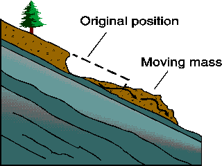
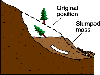
- Slump: occurs when a coherent mass of loosely consolidated materials or rock layers moves a short distance down a slope. Movement is characterized by sliding along a concave-upward or planar surface
I have included an excerpt from the newspapers at the time detailing the event that occured, and can be read by clicking on the various gallery photos below.
In order to log this as a find you must email me the answers to the following questions. Do not post answers with your log please.
Questions to answer:
1: Of the listed landslide types pictured above, what type do you think describes this event best?
2: It is important to differentiate the cause of an event, from the trigger. The cause was likely an unstable mass due to the high clay content. What do you think could have been the trigger for this slope failure?
3: Toss a stone from the river bank into the water. Notice the ripples propagate from such a small object. Try to imagine the ripples that would occur when that whole cliffside slipped into the river. Beside the obvious destruction of homes and loss of life that would occur if this were to happen today, can you identify any infrastructure that would be damaged during such an event today?
Optional task: Post a picture of the area with your log
*Reference: "Vancouver, City on the Edge" by John Clague & Bob Turner ISBN 0-9697601-4-0 (a great book)