The Milton Keynes Boundary Walk is a circular walk approximately 65 miles long around the boundary of the Milton Keynes Unitary Authority; it is waymarked with the Oakleaf symbol.
In 2012 a group a local geocachers divided the walk into sections and set a series of over 300 caches along the boundary.
More information about the walk and caches can be found at the website Caching the Boundary.
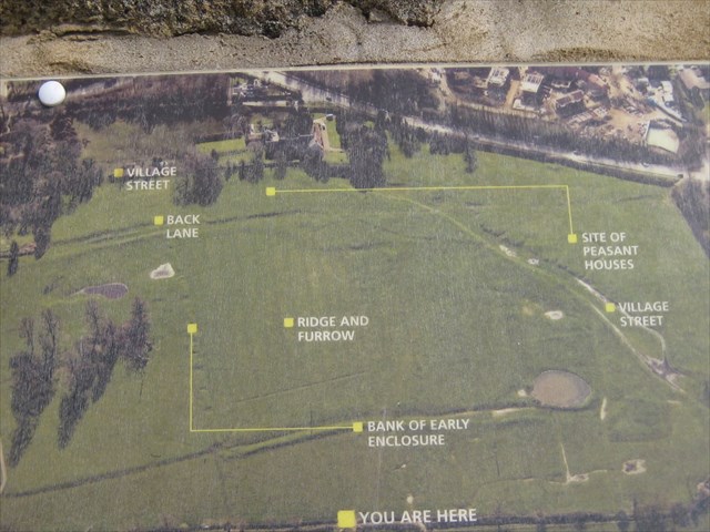
Old Wolverton Medieval Village : The bumps and hollows in the fields at Old Wolverton, on either side of the canal, are all that remains of Wolverton medieval village. The large mound next to Holy Trinity Church marks the site of Wolverton Castle which was built around 1100 by the de Wolverton family who made it the centre of their extensive estates. It consisted of an earth mound (Motte) topped with a timber tower and a courtyard (bailey), defended by a bank topped with a timber palisade.
You are not far from Church Micro 1122 GC278KA and Holy Trinity Panoramic view GC18XZH View