[LAT]
Vietas apraksts:
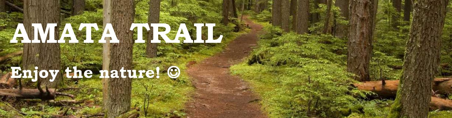
Amatas taka atrodas Gaujas Nacionālajā parkā. Taka aizvijas gar Amatas labo krastu no Vidzemes šosejas tilta pie Melturiem, gar Kārļiem un Zvārtes iezi līdz Amatas tūristu apmetnei pie Kārļu - Līgatnes ceļa Veclauču tilta. Taka aicina iepazīt Amatas upi. Amata tek pa senleju ar stāviem, līdz 45 m augstiem smilšakmens un dolomīta krastiem; tā ir viena no dziļākajām un savdabīgākajām Vidzemes upju ielejām. Amata ir viena no straujākajām, krāčainākajām un tīrākajām Gaujas pietekām. Ne velti lībiešu valodā vārds Amada nozīmē „straujā”. Taka ir brīnišķīga vieta pastaigām un dabas izzināšanai. Amatas takas kopgarums ir aptuveni 16 km, kas ir aptuveni 5 stundu gājiens no Veclauču tilta līdz Melturu tiltam atkarībā no pārvietošanās ātruma.
Sīkāku informācijas par Amatas taku, apskates objektu aprakstu un takas shēmas skatīt ŠEIT.
SVARĪGI:
- Upes ielejā ir diezgan vājš mobilo sakaru pārklājums, un arī internets var nebūt pieejams, tādēļ labāk ir sagatavot offline kartes un slēpņu aprakstus.
- Apvidus reljefa dēļ slēpņa koordinātes var būt nedaudz neprecīzas, tādēļ sekojiet norādēm.
- Lai arī sākotnēji katrā slēpnī tika ievietots arī zīmulis, laika gaitā daudzviet tie ir zuduši, tādēļ noveikti paņemiet līdzi savu rakstāmrīku.
- Velciet pārgājienam piemērotus apavus.
- Ņemiet vērā, ka pavasarī un pēc lietus atsevišķi takas posmi var būt arī nedaudz applūduši vai dubļaini.
- Atsevišķos takas posmos var būt bīstami, īpaši pēc lietus – esiet piesardzīgi un uzmanīgi!
- Velobraucieniem taka nav piemērota!
- Esiet uzmanīgi, mežā ir sastopamas čūskas, ērces, irši, lapsenes u.c. mošķi.
- Savas bildes un piedzīvojumu aprakstu vēlams atstāt pie sērijas pirmā slēpņa ierakstiem, pārējos ierakstos var tik sīki neizplūst (pietiks ar komandas nosaukumu un/vai TFTC/ PPS  ). Ja Jums patika šī slēpņu sērija, un Jūs vēlaties piešķirt favorītpunktu, to arī labāk atstāt pie sērijas pirmā slēpņa.
Dažos sērijas slēpņos uz logbuka titullapas Jūs atradīsiet vērtības, piefiksējiet tās, lai atrastu AMATA TRAIL BONUS slēpni.
Slēpņa apraksts:
Slēpnis ir PET pudeles sagatave, tajā iekšā ir viesu grāmata un zīmulis.
Koordinātes var būt neprecīzas apvidus reljefa dēļ, tāpēc slēpņu atrašanās vieta ir atzīmēta ar sarkanu atstarotāju.
LŪDZAM NOLIKT SLĒPNI ATPAKAĻ TURPAT, KUR TAS TIKA ATRASTS!!!!
Šis slēpnis ir daļa no slēpņu sērijas „AMATA TRAIL”, kas izvietoti gar Amatas upi posmā no Veclauču lilta līdz Melturu tiltam (aptuveni 16 km). Iesakām apmeklēt visus šos slēpņus viena pārgājiena laikā.
[ENG]
The Location:
The Amata trail passes along the right bank of the Amata river from the bridge on the Vidzeme highway (A2) in Melturi, by Kārļi and Zvartes Rock to the tourist stop of Amata near the Veclaucu bridge on the road from Karli to Ligatne. From the trail can be seen the Amata river, which flows through the old valley with steep sandstone and dolomite cliffs up to 45 metres in height; it is one of the deepest and oldest valleys of Vidzeme. Amata is one of the fastest flowing, cleanest influents of the Gauja river and it is full of rapids, the word “amada” in Livonian language means rapid. The trail is a wonderful place for walking and immersing yourself in the nature. The total length of the trail is approximately 16 km, which is approximately 5 hour walk from Veclaucu bridge to Melturu bridge depending on your speed.
IMPORTANT:
- Cellular signal and internet might not be available, therefore it is important to have offline maps and cache descriptions.
- Due to terrain elevations coordinates might be imprecise, therefore follow the description.
- Although each cache initially had a pencil, overtime some of them have gone missing, therefore it is important to have your own pen/pencil.
- Wear comfortable hiking boots.
- Note that during spring and after rain some sections of the trail might be a bit flooded.
- Some sections of the trail might be dangerous, especially after it had rained – please be very careful and watch your step!
- This trail is not recommended for bicycle rides!
- Please be careful - there are snakes, ticks, wasps and other wild things in the forest.
- You can post your pictures and detailed log at the 1st cache but at the others it will suffice with only your team name and/or TFTC :). If you enjoyed this series of caches and wish to leave a Favorite Point, it is also best is you leave it at the 1st cache of the series.
In some of the logbooks (on the front page) you will find values, write them down in order to find AMATA TRAIL BONUS cache.
The Cache:
The cache is a PET bottle that contains logbook and a pencil.
Coordinates might be imprecise due to terrain elevations, therefore the location of each cache is marked with red reflector.
PLEASE PUT THE CACHE BACK EXACTLY AS YOU FOUND IT!!!
This cache is part of „AMATA TRAIL” series. These caches are placed along Amata river from Veclaucu bridge to Melturu bridge (approximately 16 km). We recommend to visit all the caches during one hiking trip.