Brusaknuten Traditional Geocache
-
Difficulty:
-

-
Terrain:
-

Size:  (regular)
Please note Use of geocaching.com services is subject to the terms and conditions
in our disclaimer.
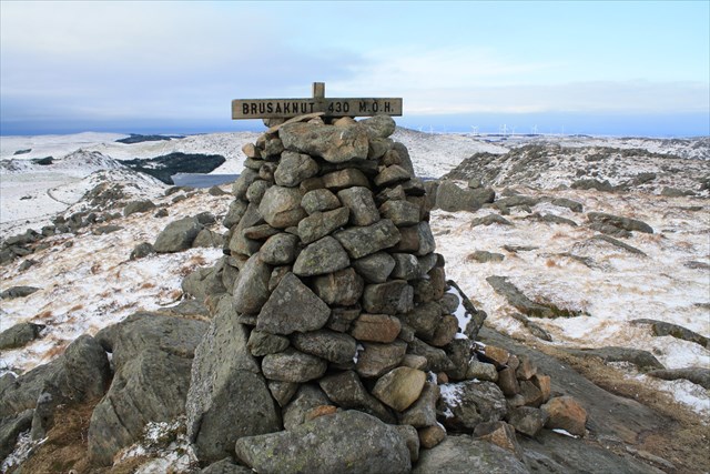
Brusaknuten vert med sine 430 moh rekna for å vera den høgaste toppen på Jæren. På klare dagar er det flott utsikt utover jærlandskapet frå toppen.
Ta av Fv.504 på Mellomstrand ved skilt til Brusaknuten og følg grusvegen oppover til parkering ved skiljeplass for sau.
Frå parkeringsplassen kan du følgja rødmerka løype og skilt (som nå er nymerka og fine) langs traktorveg og etter kvart sti opp mot toppen. Turen opp tek 45-60 minutt i roleg tempo og passar for dei aller fleste
Brusaknuten, with its 430 meters above sea level, is considered to be the highest peak in the Jæren region.
On a clear day you will have great views over the Jæren landscape from the top.
Turn off from Fv.504 at Mellomstrand at the sign to Brusaknuten and follow the gravel road up to the parking area. From the parking area you can follow red trailmarkings and signs along tractor road and footpath to the top.
The trip up takes 45-60 minutes at an easy pace and is suitable for all ages
Additional Hints
(Decrypt)
Haqre ynetr fgbar