Many coastal springs in the Southwest Florida Water Management
District lie in or near the fresh-water /salt-water transition
zone, which is a brackish zone in the Floridan aquifer where
seaward-moving fresh water meets landward-moving salt water. As a
result of their proximity to the coastal transition zone, some
springs discharge brackish water. Homosassa and Chassahowitzka
Springs are good examples of brackish-water springs. Brackish
ground-water discharge indicates that sea water from the Gulf of
Mexico is present in the aquifer gulfward of and below the
springs.

Homosassa Springs Park headquarters
It is estimated that springs in the Southwest Florida Water
Management District (SWFWMD) discharge more than 1,600,000,000
gallons per day of ground water from the Floridan aquifer. Prior to
development, spring flow in the region accounted for 80% of the
ground-water discharge from the Floridan aquifer. However, as
development has occurred this percentage has decreased.
Ground-water discharge from the Floridan aquifer is important to
springs in the region for several reasons: 1) it provides the
springs with adequate ground-water supplies to maintain flow; 2) it
is an important component of many aquatic and terrestrial
ecosystems throughout the region; and 3) it is an ideal barometer
by which to gauge the water quality of the Floridan aquifer over
large areas (tens to hundreds of square miles). Springs throughout
the SWFWMD exhibit seasonality in discharge as rainfall recharges
the Floridan aquifer inland of the springs. This recharge causes
water levels in the aquifer to rise and spring discharge to
increase. Studies by the US Geological Survey have shown that
spring flow along the coast of Citrus and Hernando Counties can
vary considerably during the year. A number of other springs
throughout the SWFWMD exhibit similar variations in discharge as
well, with lowest flows occurring late in the dry season (May/June)
and highest flows occurring late in the wet season (Sept./Oct.)
The Homosassa Springs group lies in western Citrus County
approximately three miles south of King’s Bay and one mile
southwest of the intersection of S.R. 490A and U.S. Hwy 19. The
spring group is composed of the main spring, which includes three
large vents contained within a collapsed-cavern feature, and many
smaller secondary vents spread over an area of nearly four square
miles. The Homosassa River originates at the main springs and
receives additional flow from the spring-fed Southeast Fork of the
Homosassa River and the spring-fed Hall’s River. Springs in
the Homosassa Springs group include Homosassa Main Spring #1, #2,
and #3, Trotter Main, Pumphouse, Hidden River Head, and
Hall’s River Head Spring.
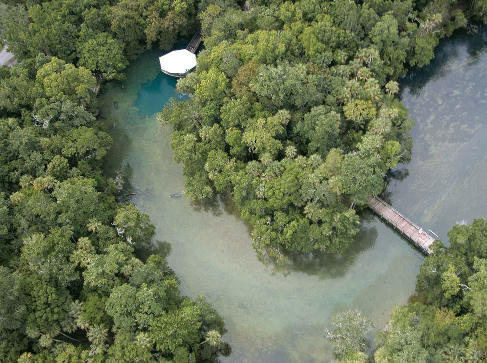
Homosassa Springs group aerial view
The average annual discharge of the springs in the Homosassa
Springs group is approximately 229,000,000 gallons per day. Ground
water discharging the Homosassa Springs group may be fresh or
brackish, depending on tides and water levels in the Floridan
aquifer. At low tide, water quality varies across the spring group
with total dissolved solids (TDS) concentrations increasing from
less than 250 mg/l along the southeastern fork of the Homosassa
River to greater than 1,500 mg/l in springs at the head of
Hall’s River. Chloride concentrations across the group may
range from less than 50 mg/l to greater than 500 mg/l, indicating
that water quality at the spring group is strongly influenced by
the coastal transition zone even at low tide. Nitrate
concentrations at the Homosassa Springs group are typically below
0.7 mg/l. The concentrations vary among the individual springs of
the group, possibly in response to mixing in the coastal transition
zone and variations in nitrate in Floridan aquifer ground water.
Research conducted by the water quality management plan indicates
that the nitrate discharging from the springs is most likely
derived from an inorganic source of nitrate - inorganic fertilizers
applied to residential and golf course turf grass near the
springs.
The Homosassa Main Spring was studied in 1992 by Karst
Environmental Services (KES), a ground-water consulting firm. A
portion of the study involved the mapping of the main-spring cave
system by a team of divers. Their investigation revealed that the
accessible portion of the system is not extensive. Most of the
spring’s cavern system has developed in the Ocala Limestone.
However, the contact between the Ocala Limestone and Avon Park
Formation was observed to occur at a depth of 48 feet below sea
level. The maximum depth reached by the divers in the cave was 70
feet. Although extremely narrow passages continued deeper into the
system, they were judged to be beyond the safe reach of the divers.
The divers also determined that most of the flow in the main spring
emanates from three vents, each of which discharges water that is
chemically distinct from the others. Subsequent samplings of the
main spring were greatly improved by the installation of sampling
tubes into the individual vents. Homosassa Springs is located
within the Homosassa Springs State Wildlife Park. The main spring
lies in a collapsed-cavern feature, and is comprised of three
chemically distinct vents with vent #3 having the least
salinity.

view from the boat dock
In order to log this cache, please submit answers to the
following questions to the cache owner:
1. Homosassa Springs has brackish water. Explain why.
2. What springs comprise the Homosassa Springs group?
3. There is an underwater viewing platform at the main spring.
Either take a photo or describe what you see here. Find out if the
fish are fresh or saltwater species in this brackish water.
4. At the main spring's viewing platform, estimate the depth of
the spring.
Send your answers BEFORE you log the cache or your log will be
deleted without warning. If you have the time to log the cache, you
have the time to comply with its requirements.
There is a charge for entering this park, currently $13.